EngageNY
TASC Transition Curriculum: Workshop 12
How can opinions slant facts? Workshop participants learn how to examine primary and secondary sources and identify the author's point of view. They also examine how visual art impacts the meaning and rhetoric of sources. Full of...
University of Texas at Austin
University of Texas: Perry Castaneda Library: Canada Maps
The University of Texas at Austin provides an extensive collection of maps relating to Canada. Links are given for maps of Canada on many other web sites.
Other
Discover Canada Through National Maps and Facts: Relief
Links to all of Canada's provinces and territories relief maps. Maps can be viewed as a picture or as a .pdf file. Be sure to check out the links to lesson plans as well as the many other types of maps.
C3 Teachers
C3 Teachers: Inquiries: Maps and Geography
A comprehensive learning module on maps that includes three supporting questions accompanied by formative tasks and source materials, followed by a summative performance task. Students learn about map symbols, cardinal directions, and...
National Endowment for the Humanities
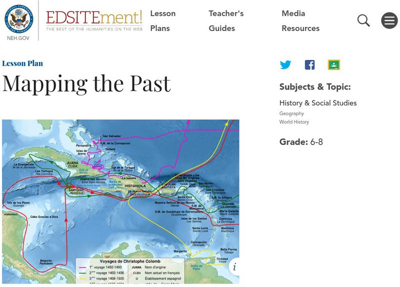
Neh: Edsit Ement: Mapping the Past
This lesson plan requires the students to examine past maps from various cultures in order to learn how the people from that time period interacted and understood their world.
Geographypods
Geographypods: Map Skills
A collection of highly engaging learning modules on various topics within mapping skills. Covers map symbols, how to use four- and six-figure grid references, cardinal directions, distance, contour mapping, and drawing cross-sections....
NASA
Nasa Earth Observatory: Global Maps: Land Surface Temperature
View a global map from NASA's Earth Observatory that shows land surface temperature from February 2000 to November 2008. Learn how land surface temperature is measured and monitored.
National Geographic
National Geographic: Create a Weather Map
Students will learn about symbols that are used to represent weather and then use the day's weather to create a weather map for their state. Includes handouts and website links, as well as links to downloadable coloring books full of...
City University of New York
Virtual Geology: Maps Home Page: Topic and Quiz Menus
This collection of resources cover map topics and includes quizzes for improving map and globe usage skills.
Library of Congress
Loc: Maps of Cities and Towns
Looking for old maps of somewhere in the United States? Check out this huge collection of maps! Search by the name of a city or town, another keyword, subject, title, or geographic location.
Other
Geoscience Australia: Map Reading Guide: How to Use Topographic Maps [Pdf]
A topographic map can be challenging to read. This guide explains how to decipher one and how to use a magnetic compass to orient yourself to the landscape. It also explains how to use GPS coordinates.
Other
The Smithsonian: Lewis & Clark: Mapping the West
The Smithsonian's EdGate project provides this illustrated narrative site that explores the mapping of the American West accomplished by the 1804-06 Lewis and Clark expedition.
The Newberry Library
Newberry: Political and Military History: Map 15: The World at War, 1944
Lesson for K-12 using historical map teaches students about the relationship between perspectives of the world and map projections.
Other
La Rue Literacy Exercises: Reading a Map: Quiz 12
In this quiz, students are given sections of a map with locations like the school, post office, back, etc. They are asked questions about directions from one place to the other.
Annenberg Foundation
Annenberg Learner: Bridging World History: Maps, Time, and World History
Learn how map projections and chronological constructs are used in the study of world history and help us to understand and interpret the past. Part of a larger site on world history, this unit on maps offers complete reading,...
Other
California State University: Topographic Map Symbols
Click on any of the geographical terms on this website to see examples that illustrate the symbols commonly used on maps. Includes boundaries, building symbols, caves, mines, elevation symbols, coastal features, and more.
Other
Bureau of Meteorology: The Weather Map
Explains what a weather map is and how it is prepared. Describes what weather maps show, typical weather patterns in Australia, the use of weather charts, temperature, and wind speed.
University of South Florida
Fcat Express: Story Mapping
Site provides extensive assistance in preparing 4th grade students for Florida Comprehensive Assessment Test. This section focuses on story mapping, which helps students put events of a story in sequential order.
Other
Honolulu Hi 5: Cool Maps With Awesome Weather Data Across 1,219 Us Cities
Explore the weather in states and cities across the United States. Two maps with accompanying graphs are provided. The first indicates the number of comfortably warm summer days a place has and the second shows the temperature and how...
Library of Congress
Loc: Map Collections 1500 2002
This collection provides maps dating back to 1500 up to the present. The collection includes: cities, towns, discovery and exploration, conservation and environment, military battles, cultural landscapes, transportation, communication,...
University of Texas at Austin
The Perry Castaneda Library Map Collection
This collection contains more than 250,000 maps covering all areas of the world, and ranging from political and shaded relief maps to the detailed and the historical. Select from a region of the world or an area of highlighted interest.
University of Texas at Austin
Perry Castaneda Library Map Collection: Afghanistan
Here you will find a collection of maps of Afghanistan from the Perry-Castaneda Collection. There are political maps, relief maps, cultural maps, historical maps, and links to maps on other sites.
Other popular searches
- Mapping Skills
- Semantic Mapping
- Concept Maps
- Story Mapping
- Cell Transport Concept Map
- Mapping Skills First Grade
- Mind Mapping
- Concept Mapping
- Gene Mapping
- Land Use Mapping
- Mapping Rivers
- Forestry and Mapping


