Curated OER
USA: Physical Map
For this United States physical map worksheet, learners investigate the major landforms and bodies of water located throughout the country.
Curated OER
Unit V: Worksheet 2 - Constant Force
Physics learners studying force and acceleration practice solving eight problems with this assignment. They calculate acceleration and deceleration, net force, and distances required for stopping a moving object. Kinematics equations and...
Curated OER
Blank US Map
In this blank outline map activity, students study the physical boundaries of the 50 states that make the United States. This outline map may be used for a variety of geographic activities.
University of Florida
Sailing to St. Augustine
Using a Florida map from 1597, young explorers consider the physical characteristics they would need in a site for a new colony and the resources they would need to survive. After selecting a site, class members research to discover the...
Freecloud Design
Stack the States™
Kids have fun learning US geography and state facts, including capitals, nicknames, major cities, and landmarks. They can choose between the game, or informational flashcards for each state.
Curated OER
Iowa State Map
In this Iowa state map worksheet, students color and label the important cities and physical features. Students also study the background map that shows the location of Iowa in the United States.
Curated OER
Washington State Map
In this Washington map learning exercise, students color and label the major cities and important physical features on the map. Students also study a second map that shows the location of Washington in the United States.
Curated OER
Virginia State Map
For this geography of Virginia worksheet, students color the map and label major cities and physical features. Students also study a second map showing the location of the state of Virginia in the United States.
Curated OER
Georgia State Map
For this geography of Georgia worksheet, students color the map and label major cities and physical features. Students also study a second map showing the location of the state of Georgia in the United States.
Curated OER
Florida State Map
In this geography of Florida worksheet, students color the map and label major cities and physical features. Students also study a second map showing the location of the state of Florida in the United States.
Curated OER
California State Map
In this geography of California activity, students color the map and label major cities and physical features. Students also study a second map showing the location of the state of California in the United States.
Curated OER
Delaware State Map
In this geography of Delaware instructional activity, students color the map and label major cities and physical features. Students also study a second map showing the location of the state of Delaware in the United States.
Curated OER
Zoo-Goers Ready to Greet Baby Panda
The Smithsonian's National Zoo, also known as the Washington Zoo, is one of the oldest zoos in the United States. Youngsters read and discuss a news article about Tai Shan, baby panda that was one of the zoos most famous residents. They...
Curated OER
Written Document Analysis Worksheet
Investigate different types of documents with your middle schoolers. They look at newspapers, letters, maps, reports, etc. and answer a list of questions provided. Introduce them to different primary sources!
Curated OER
Geography Journey
In this geography worksheet, students use a map of Amtrak train routes (not included) to answer 10 short answer questions. Students describe physical features and landmark cities they would see if traveling by train across the country.
Mathematics Assessment Project
Modeling Motion: Rolling Cups
Connect the size of a rolling cup to the size of circle it makes. Pupils view videos of cups of different sizes rolling in a circle. Using the videos and additional data, they attempt to determine a relationship between cup...
Curated OER
Written Document Analysis
In this primary source analysis activity, students examine types of written documents and respond to 6 analysis questions about them.
Curated OER
SOAPS Primary Source "Think" Sheet
Planning on using primary source materials? Introduce your class members to SOAPS, a learning exercise that models how to analyze and reflect on primary source materials. Readers name the document, identify the subject (S), the...
Other
Topo Zone: Free Usgs Topo Maps for the Entire United States
A huge collection of topographic maps for each of the US states. Scroll down to see a map of the United States and click on the state you are interested in. From there, you can search for a particular location, choose a featured map, or...
Houghton Mifflin Harcourt
Harcourt: School Publishers: Types of Land
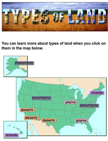
This clickable map of the United States defines different geographic features such as mountains, plains, islands, and deserts.
Library of Congress
Loc: America the Beautiful
A resource page of online map resources, lesson plans, students activities and the transcript of a live chat on the geography of the United States.
Johns Hopkins University
John Hopkins University: Color Landform Atlas of the u.s.
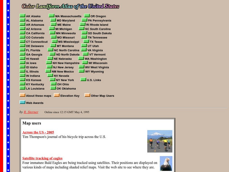
This site from John Hopkins University provides detailed maps of and physical information on each of the 50 states. Maps range from relief maps to satellite images, to historical maps.
Curated OER
Etc: Maps Etc: Physical Features of the United States, 1898
A map from 1898 of the United States showing general elevations, water depths, and terrain features, including the Pacific Slope, Great Basin, Rocky Mountain Plateau, Great Plains, Mississippi Valley, Gulf Plain, Appalachian Highlands,...
Curated OER
Educational Technology Clearinghouse: Maps Etc: The United States, 1899
A map from 1899 of the United States showing the physical features of the area, including mountain systems and highlands, plateaus, basins, plains, lakes, rivers, and coastal features. This map also shows the six conventional state...


