Curated OER
Mapping the United States
In this map of the United States activity, students label mountains, surrounding countries, oceans, and more. Students complete 12 tasks.
Curated OER
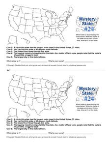
Mystery State # 24
Prepare those brains for a rousing day of learning with a fun geography activity. Your pupils use five different clues to determine the name of mystery state number 24. Where do all those potatoes come from? Idaho!
Curated OER
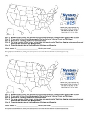
Mystery State #15
Do you know the name of the Badger State? Using five fantastic clues, your super sleuths will determine the name of mystery state number 15. A wonderful way to warm up the class!
Ms. Catsos
Ancient Rome Map Worksheet
It wasn't just the great leaders of ancient Rome that shaped their civilization—the geography of the region played a major role as well. After first identifying major land masses, bodies of water, and city states on a map of Europe,...
Curated OER
School-Home Link: Maps
In this atlas and parent communication form worksheet, students use an atlas to find several things: the capitol city of Japan, the number of countries in Africa, where to buy a newspaper, the names of Presidents of the United States,...
National Wildlife Federation
Hot, Hotter, Hottest: Extreme Weather's Impact on Our Resources
How dry is it? It's so dry, the river only runs twice a week! Through an analysis of maps and discussions, pairs learn about droughts across the United States in the ninth of 12 lessons. They then read about, answer questions, analyze...
Curated OER
Geography and Topography, History and Architecture
For this social studies lesson plan, students answer short answer questions about the geography, topography, history, and architecture of the east part of the United States. Students complete 24 questions.
Curated OER
Mystery State #6
In this mystery state worksheet, students answer five clues to identify the state in question. They then locate that state on a map.
Curated OER
The Oregon Trail
In this Oregon Trail worksheet, learners practice their map skills while they explore the states of Oregon, Missouri, Idaho, Nebraska, and Wyoming. Students us a map of the US to plot six points on the map that show the Oregon Trail.
PBS
Think Like a Historian: A Viewing Guide
Calling all junior detectives! Scholars use the tools of investigation to determine the causes and impacts of the American Civil War. Using viewing guides, videos, group research, and written resources, they discover what it takes to...
Curated OER
Globe Skills Lesson 5
In this map skills learning exercise, students read a text selection about locations during the American Revolution and then respond to 8 fill in the blank questions.
Curated OER
Vermont History True / False
In this Vermont history worksheet, students read two and a half pages of information about Vermont history. After reading, students complete 10 true or false questions about what they read.
Curated OER
Reading Comprehension/history: George Washington
In this George Washington activity worksheet, learners read a one page information sheet about George Washington. Students put 10 events from his life in correct order. Then learners answer 4 critical thinking questions.
Curated OER
Lewis & Clark: The Louisiana Purchase
In this facts about the Louisiana Purchase and the Lewis and Clark expedition online interactive worksheet, students read information and observe a map of the Louisiana Purchase to answer questions showing their comprehension skills....
Indian River State College
Argumentative (Persuasive) Essay Guidelines
Here is a handout that outlines six great steps to structuring an argumentative essay, which can be continually referenced as you teach your class about persuasive writing.
Curated OER
Reading Comprehension: Louisiana
In this reading comprehension worksheet, students read a 2-page article regarding Louisiana and respond to 10 true or false questions regarding the selection about the state.
Curated OER
Geography Journey
In this geography worksheet, students use a map of Amtrak train routes (not included) to answer 10 short answer questions. Students describe physical features and landmark cities they would see if traveling by train across the country.
Curated OER
Preparing for the Lewis and Clark Expedition
Here's a worksheet to help your class envision the Lewis and Clark expedition. Your young historians read a one-page article on the expedition, use context clues and a dictionary to define eight terms from the article and write a...
Curated OER
Right Place, Right Time
In this right place, right time worksheet, students read train timetables and apply the information to answer math word problems. Students solve eight word problems.
Curated OER
Social Studies Review Third Grade
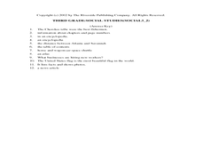
In this review of various skills worksheet, students answer multiple choice questions about Georgia history, references, fiction and nonfiction, and U.S. history. Students answer 12 questions.
Curated OER
Reading Comprehension 5: Level 8
Why is an atlas called an atlas? Because it is named for the Greek Titan, Atlas, of course. Young readers learn all about Atlas and atlases in a short passage used as the basis of a reading comprehension exercise. After responding to...
Curated OER
Westward Expansion
In this westward expansion worksheet, students read and assess comprehension. In this short answer, matching, and timeline worksheet, students write answers to twenty-five questions.
Curated OER
Seventh Grade Social Studies Quiz
In this Georgia social studies assessment activity, 7th graders respond to fifteen multiple choice questions based on seventh grade social studies skills.
Curated OER
Poetry in Motion
In this poetry analysis worksheet, students analyze "From a Railway Carriage" by Robert Louis Stevenson. Students answer 5 questions about the poem.


