Curated OER
Learning to Use Map Legends
Fifth graders comprehend the purpose of and use map legends. They identify and use symbols and lines from legends on a general-purpose map and four topical maps to completely and accurately answer eight questions on a geography worksheet.
Curated OER
Maps with a "Spin"
Students, in groups, research and map the effects of a proposed airport three miles outside of town. They prepare a presentation based on a set of maps they make and explains its different points of view from the viewpoints of the town...
Midwest Institute for Native American Studies
Introduction to Pre-Columbian Lessons
Native peoples established civilizations all over Central and North America. Introduce native civilizations with a unit that promotes discussion, reinforces map skills, enhances reading comprehension, and exposes young historians to the...
NY Learns
Geography of the Fertile Crescent by ECSDM
Using Google Earth, a vocabulary assignment, and map handout, your class members will outline the Fertile Crescent in Mesopotamia and identify the source of the Tigris and Euphrates rivers. They will then complete graphic organizers...
Montana State University
Everest Extremes: Biodiversity
How many animals can live in a climate as cold as Mount Everest's? Find out with a science lesson all about biodiversity. Activities include research, presentations, group work, coloring maps, and a simulation of a food web.
Curated OER
Map Making with Lewis and Clark
Young scholars develop maps based on a virtual internet expedition of The Louisiana Purchase land area. They create the maps based on an actual outdoor expedition of their communities. Student create two maps, one based on the Louisiana...
Columbus City Schools
What is Up Th-air? — Atmosphere
Air, air, everywhere, but what's in it, and what makes Earth's air so unique and special? Journey through the layers above us to uncover our atmosphere's composition and how it works to make life possible below. Pupils conduct research...
Curated OER
CHARTING THE COURSE
Students uses atlases, maps, and Web resources to determine the distance, driving time, and amount of money they need to make the trip (estimates should include hotel/motel stays, meals, and souvenirs).
Curated OER
World Map and Globe-Equator, North Pole, and South Pole
Learners identify the Equator, North Pole, and South Pole on a map. In this geography instructional activity, students use a world map and circle the North and South Pole. Learners locate the Equator on a globe and use a map marker to...
Curated OER
Investigating Our Past: Where Did Humans Come From?
High schoolers brainstorm about evolution and explore the processes of evolution. In this investigative lesson students map out evolution and compare the two theories after researching them.
Curated OER
Summertime Travel
Third graders write about a summer event they participated in. In this paragraph writing instructional activity, the teacher models how to write about a place they have visited. Students then write their own paragraphs. Students will...
Curated OER
Country Capitals
Students locate country capitals on a world map. In this map skills lesson, students review the definition of the word country and discuss what a capital is. Students locate and label capital cities on a world map using a map marker.
Curated OER
Arkansas is Our State: Differentiating Between a State and a Country
An ambitious geography lesson is geared toward kindergartners. They discover what the differences are between states and countries. They look at maps of Arkansas, and learn what the shapes and lines mean. Additionally, they create a...
National History Day
Propaganda Posters of World War I: Analyzing the Methods Behind the Images
The power of a picture. During the events surrounding World War I, propaganda posters were widely distributed in American society to sway the emotions of its citizens. By analyzing World War I propaganda posters in the first installment...
Do2Learn
Homework Chart
Help your learners keep track of their homework and other assignments due with this chart. Kids can note down their assignments for each day of the week, including the weekend. You might fill out the entire month or mark down each class...
United K12
Jan Brett Author Study
Expose young children to the wonderful works of author and illustrator Jan Brett using a few of her stories such as Armadillo Rodeo, The Mitten, or Daisy Comes Home through a unit study.
Mathematics Assessment Project
Smoothie Box
Pupils demonstrate their understanding of nets by designing a net of a box that contains 12 bottles. Given the full size top and side views of the bottle, they determine the dimensions needed for the finished box. The directions do not...
Curated OER
Where in the World Am I?
Students participate in mapping activities to explore an area from different spatial perspectives. In this mapping lesson, students define the terms needed to understand a map. Students use representations such as a balloon and a...
Curated OER
Finding Longitude and Latitude on Pennsylvania Maps
Students draw the lines of longitude and latitude on a map. Students look at a topographical maps to see how topography relates to land use.
Curated OER
Special Places in Our Community
Students compare and contrast cities whether they are large or small, rural or urban. They use digital photography to take pictures of the different types of cities.
Curated OER
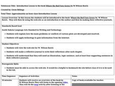
Introduction Lesson to the Book Where the Red Fern Grows
An excellent lesson plan on the classic book, Where the Red Fern Grows. Learners view the W. Wilson Rawls website and engage in a series of activities generated by the website. They write in their reflective journals, watch a video, and...
Curated OER
Quarter Conservation
Here is another in the interesting series of lessons that use the special State Quarters as a learning tool. This one uses the California State Quarter. During this lesson, pupils learn the many ways they can conserve natural resources...
Curated OER
The Five Senses
Study various objects and help kindergarteners use their five senses to classify the objects. They are presented with various objects and then use their five senses to sort and classify the objects. Then they use a Visual Ranking Tool to...
Curated OER
The Branding of America (And Your State)
Students investigate about the origins of some major U.S. brands. They explore local products that stimulate the economy. Students create a map showing where those products originate. Students discover the products that their local area...


