Curated OER
Analyzing the Relationship between Snowpack and River Flow
Learners use the Internet to research current and past snowpack levels and river gauging station readings. They determine the relationship between snowpack and river flow. They predict future river flow.
Curated OER
Scarcity of Water Throughout the World
Students identify the various forms of fresh water on the earth. They observe a demonstration aand read articles that show them the importance of water conservation. They write a journal about their opinion regarding paying for water.
Curated OER
NASA's Mars Gamble Pays Off Part 2
Tenth graders explore the planet of Mars. In this Earth Science instructional activity, 10th graders read articles on the make up of Mars. Students complete a worksheet on their reading.
Curated OER
How's the Weather?
Students explore earth science by researching the Internet. In this weather pattern activity, students utilize the website weather.com to analyze the weather in different geographic locations. Students view charts and graphs based on...
Curated OER
Take a Hike
In this geography skills worksheet, students respond to 9 questions that require them to read topographic maps and interpret them. The topographic maps are not included.
It's About Time
How Do Plate Tectonics and Ocean Currents Affect Global Climate?
What do plate tectonics and ocean currents have to do with global climate? This fourth installment in a six-part series focuses on how plate tectonics and ocean currents affect global climate, both now and in the past, outlines an...
Polar Trec
What Can We Learn from Sediments?
Varve: a deposit of cyclical sediments that help scientists determine historical climates. Individuals analyze the topography of a region and then study varve datasets from the same area. Using this information, they determine the...
Curated OER
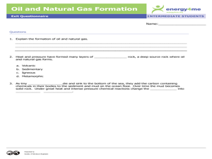
Oil and Natural Gas Formation
Pupils complete a narrative paper and a drawing depicting how the formation of oil and natural gas taken from the Earth's crust were once plants and animals millions of years ago. In this oil and natural gas lesson plan, students read,...
Curated OER
PA Watersheds, Many Ways to the Sea
Students examine the water cycle and the factors that interact with watersheds. In this watersheds instructional activity students describe the purification process, trace the flow of infiltrate water through aquifers, and research the...
Curated OER
Magnetometer Extension Activities
Students observe magnetic fields and locate the position of "ore deposits" patterns using models and maps. In this magnetometer instructional activity students complete a hands on activity and a reading/writing exercise.
Curated OER
Planets
In this planets worksheet, students read about Mercury, Venus, and Earth and then complete 21 multiple choice, 2 true or false, and 1 short answer question.
Curated OER
Circle the Earth - Explore Surface Types on a Journey around Earth
Students use CERES percent coverage surface data with a world map in locating landmasses and bodies of water at Earth's Equator.
Curated OER
Studying Snow and Ice Changes
Students compare the change in snow and ice over a 10 year period. In this environmental science activity, students use the live data on the NASA site to study and compare the monthly snow and ice amounts on a map of the entire Earth. ...
Curated OER
Biodiversity in an Estuary
Students investigate the biodiversity in estuaries. In this estuary lesson plan, students use Google Earth to explore the Rookery Bay National Estuarine Research Reserve. They produce a biodiversity concept map and portray the life of a...
Curated OER
You Can Die Here
Students examine Death Valley including the amount of precipitation and winds that it gets. In this climate based instructional activity students explain the reasons for the amount of precipitation and windward patterns in Death Valley.
Curated OER
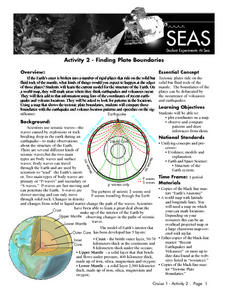
Recent Volcanoes And Earthquakes:
Students investigate the current model for the structure of the Earth. On a world map, they mark areas where they think earthquakes and volcanoes occur and compare those areas with earthquake and volcano location patterns.
Curated OER
Identifying Materials by their Reflectivity
In this reflectivity worksheet, students read about the absorption and reflectivity of light by different materials. Students solve 4 problems and determine the composition of given materials based on the amount of light reflected. They...
Curated OER
Analysis of Atmospheric Conditions for a High Mountain Retreat
Students examine the relationship between altitude, atmospheric pressure, temperature and humidity at a particular location. They practice science and math in real world applications. They write reports detailing their scientific...
University of Colorado
Phases of Charon
Charon, the largest of Pluto's moons, was discovered in 1978. Lesson is a walk through of how to solve for the phases of Charon. It uses two different points on Pluto and takes into account the tilt of the pole, the rotational axis, and...
Curated OER
Tracking Satellites Using Latitude and Longitude
Students, viewing an Internet site, plot the path of several satellites using latitude and longitude over the course of an hour. They learn the four basic types of satellites and their purpose.
Channel Islands Film
Island Rotation: Lesson Plan 1
How do scientists provide evidence to support the theories they put forth? What clues do they put together to create these theories? After watching West of the West's documentary Island Rotation class members engage in a series of...
Curated OER
Continents and Oceans on the Move
Students create an awareness of the vast percentage of water covering the earth. They relate similarities/differences between topographical maps and other maps of various time periods. Students examine how to use a topographical map.
Curated OER
NIGHT AND DAY: DAILY CYCLES IN SOLAR RADIATION
Students examine how Earth's rotation causes daily cycles in solar energy using a microset of satellite data to investigate the Earth's daily radiation budget and locating map locations using latitude and longitude coordinates.
Population Connection
The Human-Made Landscape
Agriculture, deforestation, and urbanization. How have human's changed the planet and how might we mitigate the effects of human activity on the planet? To answer these questions class members research the changes in human land use from...


