Curated OER
Crowley's Ridge: An Upland in the Lowlands
Young geographers examine how Crowley's Ridge was formed. This is one Arkansa's six natural geologic divisions. The history of Crowley's Ridge is important in that the first settlers of the state were attracted to this region, and it...
Curated OER
Nifty Fifty State Trivia
A wonderful game on U.S. States Trivia awaits your class. For this geography lesson, they will play a Jeopardy-style game. All the worksheets with the questions and answers are embedded in this beautifully-designed plan. Your class...
Curated OER
Feudal Powers in Japan
A traditional textbook chapter focuses on feudal powers in Japan, and includes vocabulary, note-taking tips in the sidebar, main ideas, and follow-up assessment questions. It also incorporates opportunities for art analysis and geography...
Polar Trec
Touring the Poles
Would you want to vacation in the Arctic or Antarctic regions? Scholars research both regions and produce a travel brochure trying to convince tourists to visit. The project focuses on the geography, climate, flora, fauna, and indigenous...
Curated OER
Mesopotamia
Sixth graders describe the geography of Mesopotamia, explain the characteristics of Sumerian city-states, and identify the cultural practices of the ancient Sumerians. They then explain how empires formed in Mesopotamia.
Curated OER
How Big is Big?
Geography learners compare and contrast population densities throughout the world. Using maps, they estimate the relative size of the world's regions and populations. They develop analogies to discover the world they live in and...
Tennessee State Museum
An Emancipation Proclamation Map Lesson
Did the Emancipation Proclamation free all slaves during the Civil War? Why was it written, and what were its immediate and long-term effects? After reading primary source materials, constructing political maps representing information...
Environment Agency - Abu Dhabi
Plate Tectonics
Young scholars observe a presentation on plate tectonics, layers of the earth, and plate boundaries. They then use the Internet to research major plates and label them on a world map.
Science Matters
Ring of Fire
Over a period of 35 years, earthquakes and volcanoes combined only accounted for 1.5 percent of the deaths from natural disasters in the United States. The 15th lesson in a 20-part series connects the locations of earthquakes and...
Curated OER
Iraqi Geography
For this word search worksheet, students discover for terms related to the country of Iraq. The terms include important geographical features, cities, countries and people.
Curated OER
The Continents and Oceans of the World
Students explore world mapping skills. In this world geography lesson, students identify and label the continents and oceans on a world map using the Visual Thesaurus. Students generate mnemonic devices to help memorize these terms.
Curated OER
Comparative Geography I
Learners use population density and other statistics to compare countries. They find the population density for the countries listed in the table. Students compare findings with a partner, and then share with the class.
Curated OER
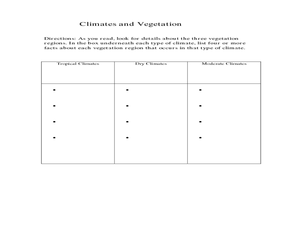
Physical Geography- Climate
Sixth graders explore different climates. In this compare and contrast lesson, 6th graders look at the differences in climates of America and Europe. Students use KWL charts and graphic organizers to record information about different...
Curated OER
Geography of the Study of the Spanish-speaking People of Texas
Young scholars identify the physical features, demographic characteristics, and history of the four Texas towns featured in Russell Lee's photo essay, "The Spanish-Speaking People of Texas." They conduct Internet research, and create a...
Curated OER
Geography and Culture in South Carolina
Students explore South Carolina. In this cultural heritage lesson, students investigate the topography of South Carolina using maps. Students are engaged in identifying the different regions of the state and examine the cultural heritage...
Curated OER
Geographic Landforms
Each slide is a simple notebook page with one landform in blue and its definition in red. There are 26 vocabulary terms in all, some you may want to use, and others easily hidden. It is recommended that you add photos or other graphic...
Curated OER
Connections Between World Events, Geography and the Human Quest for Knowledge
Young scholars examine the relationship between innovations in geography and world events. Using maps, they report different information from a spatial perspective. They develop hypothesis about how man's quest for knowledge has...
Curated OER
Getting Comfortable with the Internet & Geography
Students are introduced to the basic characteristics of Geography. Using maps, they practice identifying locations and other landmarks. They use the internet to explore websites with are geographically oriented.
Curated OER
The Sands of Arabia
Sixth graders apply geographic information to the study of World History. For this Geography lesson, 6th graders create a political/physical map of the Middle East, develop questions and answers about the culture of the Middle East, and...
Curated OER
Stack #94414 Word Search Puzzle
In this language arts worksheet, learners study the 20 terms in a word bank which seem to pertain to earth science or environment. Students locate the words in a word search puzzle.
Curated OER
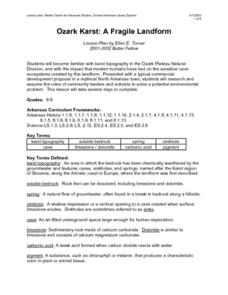
Ozark Karst: A Fragile Landform
Young geologists become familiar with the Karst Topography in the Ozark Mountains. They study how human activity has affected the cave ecosystem. They conduct a simulation in which a large development is proposed in the area, and they...
Curated OER
Map Quiz 1
In this map quiz 1 worksheet, students answer questions relating to geography, not interactively, then scroll down to see the answers.
Curated OER
Geo-portrait of the Caribbean: 1492 -1992
Students compare and contrast the Caribbean region in 1492 with the same region today , and use five themes of geography as avenues of comparison.
Curated OER
Explore Surface Types on a Journey Around Earth
Students explore satellite data. In this technology cross-curriculum math and world geography lesson plan, students locate specific map areas using a microset of satellite data. Students use technology and math skills to determine...
Other popular searches
- Geography Terms Smartboard
- Basic Geography Terms
- Geography Terms Smart Board
- Esl Geography Terms
- Basic Geography Terms Lesson
- Sixth Grade Geography Terms
- H2o Geography Terms
- Geography Terms Lesson
- Geography Terms Flashcards
- Geography Terms Lesson Plans


