Map Skills Teacher Resources
Find Map Skills lesson plans and worksheets
Showing 1,163 resources
Curated OER
U.S. Political Map
Students explore the symbols found in a map legend. In this map skills lesson, students locate the legend on a political map and explain what each of the symbols mean. Students locate and identify several symbols on the map.
Curated OER
Roman Empire: Physical Framework - Location, Borders, Dimensions
Students relate the classical world to the modern world. In this map skills lesson, students turn a blank map into a colorful complete map by following step-by-step directions. This lesson allows students to connect our current geography...
Curated OER
Mapping the Family
Students research the locations where their fathers have lived. In this map skills lesson, students identify the locations their fathers have lived in the world as they create charts and maps that note the information.
Curated OER
Lesson Design Archaeology- USGS Maps
Learners research USGS maps and identify the major features. In this map skills lesson, students identify low and high elevations on a USGS map and practice finding latitude and longitude.
Curated OER
Song Mapping
Students explore locations on the United States map. In this map skills lesson, students recite the song This Land Is Your Land and locate various places listed in the song on the map.
Curated OER
World Projections
Students identify map projections and examine polar maps. In this map skills activity, students use a flat world map to identify various projections and calculate the distances between locations by using a map scale.
Curated OER
Political Legends and Map Symbols
Students identify the legend and map symbols. In this map skills lesson, students use a world map to find various locations using a map key.
Curated OER
Colonial Vacation Planner
Students plan a family vacation to states that were among the original 13 colonies. The groups determine which state they visit, map their route, calculate the mileage, and determine how much money they spend on gasoline.
Curated OER
The Gold Rush
Students identify the routes involved in the Gold Rush on a map. In this map skills lesson, students use a United States map to locate the routes used to travel to California during the Gold Rush. Students demonstrate how to use the map...
Curated OER
The Oregon Trail
In this Oregon Trail worksheet, students practice their map skills while they explore the states of Oregon, Missouri, Idaho, Nebraska, and Wyoming. Students us a map of the US to plot six points on the map that show the Oregon Trail.
Curated OER
African Safari Adventure
Students conduct Internet research on the different safaris available. They locate and label safari sites on the continent of Africa. They create a PowerPoint presentation for the class to persuade the class why they should vote for...
Curated OER
Bunyans Lesson Plan
Students practice their map skills. In this early childhood lesson plan, students use a map of the United States and identify the location of several natural wonders included in the book The Bunyans by Audrey Wood.
Curated OER
Lesson Design Archaeology- World Map
Students practice locating positions on the world map. In this map skills lesson, students explore the world map and items such as the compass rose, Equator, mountains, cities, etc. The students practice locating positions on the world...
Curated OER
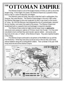
The Ottoman Empire
In this Ottoman Empire worksheet, students read a 1-page selection about the empire and examine a map. Students then respond to 5 short answer questions about the reading selection and the map.
Curated OER
You Too Can Haiku
Students explore the country of Japan. In this international studies instructional activity, students utilize their geography skills to locate Japan on a map. Students explore some Japanese customs and communities. Students use...
Curated OER
An Early American Culture
Students identify the locations of the Hopewell culture. In this map skills lesson plan, students use a globe to mark several locations of the Hopewell culture.
Curated OER
Media Center Map Skills
Student demonstrates the ability to locate, retrieve, and handle media and equipment by utilizing the library media center floor plan, symbols, and guides. They then use systems of classification to identify, locate, and retrieve materials.
Curated OER
Introduction to the United States Map
Students identify a map of the United States. In this United States map lesson, students study a map of the United States and find various locations on the map. Students then locate and list the state that touches their state.
Curated OER
Map Skills
Learners construct a road map using map pieces precut by the teacher. They apply geometric terms such as rotation and turns. Students apply the use of ordinal directions. They apply a variety of map keys.
Curated OER
Map Skills
In this history activity, learners use a map and legend to answer nine comprehension questions. Students check their answers when done.
Curated OER
What You Can Learn From a Map
Students discover how to interpret maps. For this geography skills lesson, students explore geographic themes as they complete worksheet activities regarding road maps, shaded relief maps, and topographic maps.
Curated OER
Mapping the Halifax Explosion
Students research the Halifax Explosion using historical maps.
Curated OER
What Do Maps Show?
Students discover the uses for various types of maps. In this geography skills lesson, students discuss the type of maps that exist and what their individual features are. Students then practice using different types of maps.
Curated OER
Historical Indian Treaties and Aboriginal Population
Sixth graders navigate an online atlas of Canada and compare the land area of of historical Aboriginal peoples in Manitoba to present-day figures.
Other popular searches
- Map Skills Lesson Plans
- Map Skills Worksheets
- Elementary Map Skills
- Geography Map Skills
- Basic Map Skills
- Social Studies Map Skills
- Globe and Map Skills
- Beginning Map Skills
- United States Map Skills
- Map Skills, Continents
- Early Explorers Map Skills
- Free Map Skills Worksheets


