Lake Victoria Teacher Resources
Find Lake Victoria lesson plans and worksheets
Showing 35 resources
Curated OER
"Using Cichlids To Demonstrate the Effects of Human Activity On Ecosystems"
Students explore the freshwater ecosystem of Africa's Lake Victoria by creating a freshwater aquarium. They investigate factors affecting the aquarium's ecosystem and conduct lab activities.
Curated OER
Definite Article or Zero Article-Geography
Here is a grammar and geography worksheet! Learners choose the correct sentence or answer for sixteen questions dealing with articles in connection with geography.
Pulitzer Center
Exploring Downstream: Water Resources
The lack of clean water is a life-threatening plight for millions of people around the world. Through an extensive WebQuest, young environment or social studies classes compare our water availability to that of the cxitizens of Ethiopia,...
Curated OER
Famous Lakes Quiz
In this online interactive geography quiz worksheet, students examine the chart that includes details about 15 famous world lakes. Students identify the names of the lakes in 3 minutes.
Curated OER
Test Your General Knowledge
In this ESL worksheet, students answer 10 multiple-choice questions about a variety of topics. For example, "What is the highest mountain in the world?"
Curated OER
Africa: Its People And Places
Students plan a pretend trip to the African continent choosing from several prominent places such as the Nile Delta, Mount Kilimanjaro or the Sahara Desert . In small groups, they form transportation, accommodation, packing, itinerary...
Curated OER
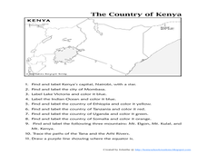
The Country of Kenya
In this map completion worksheet, students observe a map and map scale of Kenya to find and label bodies of water, cities, countries, and the equator. Students answer 11 questions.
Curated OER
Physical Geography of Africa
Fifth graders investigate the topography of Africa. In this physical geography lesson, 5th graders research the six regions of Africa and complete a physical map. Students locate various landforms in Africa. Students...
Curated OER
World Lakes Map Quiz
In this online interactive geography quiz instructional activity, students respond to 15 identification questions regarding major world lakes.
Curated OER
Cities Near Water Quiz
For this online interactive geography quiz worksheet, students respond to 18 identification questions about world cities located near water. Students have 4 minutes to complete the quiz.
Curated OER
World Records
For this world records worksheet, students fill in the blanks to sentences about different world records with nouns from a word bank. Students complete 10 sentences.
Curated OER
Geography A to Z - The Letter L
In this geography worksheet, students answer clues about geographical place names that all begin with the letter L.
Curated OER
Mapping Tanzania
In this Tanzania activity, students label countries, cities, landmarks, rivers, and more that make up Tanzania. Students label 10 items.
Curated OER
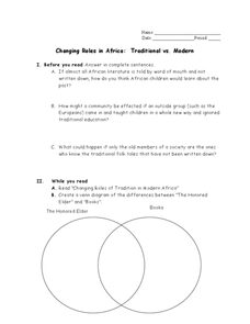
Changing Roles in Africa: Traditional vs. Modern
In this African culture worksheet, students read a selection about the role of tradition on modern Africa and then respond to 7 short answer questions. Students also complete a Venn diagram.
Curated OER
Nature of Science and Ecology
Students identify the different biotic and abiotic components of an ecosystem. In this ecology lesson, students perform a case study on current environmental problems. They write a position statement about their chosen topic and share it...
Curated OER
In the Freshwater Aquarium-Triva Quiz
In this online quiz worksheet, students answer a set of questions about freshwater aquarium fish. Answers may be submitted for review by clicking a link at the bottom of the page.
Curated OER
World Geography Quiz
In this world geography worksheet, students answer several questions based on world geography and landmarks. Students answer 10 multiple choice questions.
Curated OER
Endangered Animals Report
Fifth graders research an endangered animal and create a written and technological report. Students present their slide show report to the class. The class completes a rubric for each student presentation.
Curated OER
Educational Technology Clearinghouse: Maps Etc: The Lake Victoria Region, 1920
A map of the region around Lake Victoria, or Victoria Nyanza, in 1920, showing the northern portion of German East Africa, the eastern portion of Belgian Congo, and all of British East Africa including the Uganda Protectorate. The map...
United Nations
United Nations: Cartographic Section: Great Lakes Region (Map 2) [Pdf]
This map of the Great Lakes region in Africa from the United Nations shows the large lakes, the countries the lakes touch, and rivers that flow into and out of the lakes.
United Nations
United Nations: Cartographic Section: Great Lakes Region (Map 1) [Pdf]
The United Nations offers this very clear map of part of the Great Lakes region in eastern Africa. The lakes, of course, are labeled, as are the rivers, major cities, and countries.
Curated OER
University of Texas: Uganda: Relief Map
A relief map of Uganda showing the terrain of the country, but particularly showing the rivers that crisscross the country and drain into the lakes bordering the country. From the Perry Castaneda Collection.
Curated OER
University of Texas: Tanzania: Relief Map
A relief map of Tanzania showing its many lakes, rivers, and Mount Kilimanjaro. From the Perry-Castaneda Collection.
Curated OER
University of Texas: Central Africa: Relief Map
A good relief map of the countries of Central Africa showing mountains, lakes, and valleys. Clicking on the map will enlarge it. From the Perry Castaneda Collection.


