Formation of Continents Teacher Resources
Find Formation of Continents lesson plans and worksheets
Showing 138 resources
Curated OER
How Islands Form
Students how islands form, rising water levels, growth of coral, and volcanoes. They complete Island Investigation worksheets after researching island formation on various Internet websites.
Curated OER
Landforms By Hand: Geography, Map Skills
Learners experiment with landform vocabulary by using their own hands and a bar of soap as media.
Curated OER
Underwater Mountains & Trenches
Students determine Earth's deepest trench, outline continents, major ocean mountains, and trenches on color-key map using Crayola Erasable Colored Pencils, identify oceans' geographic features, locate significant oceanic features around...
Curated OER
Comparison of Juan Bautista de Anza and George Washington
Fifth graders discover that Anza and Washington lived at the same time but on opposite sides of the American Continent. They identify differences and similarities in their lives. They present the data in an illustrated time line
Curated OER
"What If The Earth Were Made Of Sand
Pupils examine the most common characteristics of clay and sand, and to understand how the properties of these materials affect the erosion of the landscape and the formation of the many landforms. They explore clay and sand through...
Curated OER
Science Review for Grade 5 (5.2)
In this science review for grade 5 (5.2) worksheet, 5th graders answer 25 earth science questions in a standardized test format, including reading maps and diagrams.
Curated OER
Mini Biography of Queen Victoria
Queen Victoria ruled Great Britain until her death in 1901. Here are four slides describing the life and times of Queen Victoria in a bulleted format. The last slide sums up the information as a timeline of her life.
Curated OER
Earthquakes and Volcanoes
In this geology worksheet, 10th graders locate thirty-six terms about earthquakes and volcanoes in a word search. Answers to the word search are available in various formats.
Curated OER
World Landforms
In this blank outline map worksheet, students note the major landforms of the 7 continents of the world on a Robinson projection map.
Curated OER
Americas: Physical Map
In this Americas physical map activity, students make note of the major landforms and bodies of water located on the North American and South American continents.
Curated OER
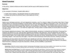
Island formation
Students explain what an island is, and distinguish islands from similar landforms. They compare and contrast the different ways in which islands are formed.
Compton Unified School District
How Can We Locate Places?
How can we locate places? Maps, of course! Expose second graders to the tools available in maps and discuss how these tools can help people find locations. Students also look at communities, including what makes a community and the...
American Museum of Natural History
Fossils
Sixteen slides showcase an average day on the job for a paleontologist, Ross MacPhee. Engaging images include world maps and real-world photographs from an archeological dig in Antarctica. A brief description accompanies each slide.
PBS
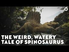
The Weird, Watery Tale of Spinosaurus
While scientists have know about dinosaurs that flew in the air, lived on land, and swam in the water, a episode from the PBS Eons series reveals recent discoveries of a dinosaur that was semi-aquatic—the first known semi-aquatic...
TED-Ed
History vs. Genghis Khan
What place should Genghis Khan hold in history: vicious thirteenth century warlord, or cultural unifier who set the stage for the modern world? TED-Ed illuminates viewers with arguments behind both historical perspectives and...
Curated OER
Sedimentary Rocks
In this sedimentary rock worksheet, learners answer 9 fill-in-the-blank questions and 8 matching questions regarding sedimentary rocks and their formation.
Curated OER
Civilizations of the Americas
Study and compare multiple aspects of both Aztec and Inca civilizations. Young historians explain how each of the empires came to be, and how they were both defeated by the Spanish. The resource starts out as a good lesson, but is...
Curated OER
Building a Better Sentence
Sentence construction is both a science and an art. This bare bones lesson ties an analysis of earth's geology to sentence formation. Although referenced as a major part of the activity, there are no links to the technology or resources...
Curated OER
The 50 States and its Holidays
Though the format of this ELL instructional activity is confusing (the standards listed are for plate tectonics, yet the objectives are for American geography and holidays), a teacher could glean some ideas from the main idea. Here,...
Curated OER
Landforms All Around
Students create a "Landform Dictionary". They develop an overlay map and participate in hands-on activities to identify the key characteristics of landforms. They discuss the plant and animal life of these areas. Handouts for the lessons...
Curated OER
Regions of South America
Students explore facts about South America in the four lessons of this unit. Booklets are created from the materials produced as the class delves into the topic.
Curated OER
Great Questions
Fourth graders research and create questions about a famous person. They create questions in a game format, create a computer generated brochure, and develop rubrics for their finished projects.
Curated OER
A Bight is Born
Students sequence and model the events leading to the formation of the southeastern coast of the United States, including the formation of the South Atlantic Bight.
Curated OER
Learning About Maps
Students investigate the many uses and features of maps and globes and locate where they live on both. In this map lesson, student play a travel game and create their own maps to explore states, continents, countries, and islands.


