Curated OER
Where is the Trail? The Journey of Lewis and Clark
Students explore the trail followed by Lewis and Clark on their journey across the United States. In this United States History lesson, students complete several activities to establish the Lewis and Clark Expedition, including a class...
Curated OER
Travel Plan Project
You can use a travel plan project in the classroom to learn about budgets, maps, time management, and more.
Curated OER
Fossils Footprints Across Time
Students examine fossils to understand how they are formed and how they give information about geological history. In this fossil lesson, students research and write about fossils and make models of different fossil types.The PDF...
Curated OER
Biomimicry, Nature: Architecture of the Future
Students explore the relationship between nature and architecture. For this cross curriculum history, culture, and architecture lesson, students observe and discuss structures visible in nature. Students view websites in which Native...
Curated OER
Spelling Instant Activity
Sixth graders understand the usage of capital letters for mapping skills. In this capitalization lesson, 6th graders correct sentences to insert appropriate capital letters. Students select cities from the sentences and make a word puzzle.
Curated OER
'European Exploration, Conquest, and Trade
Fifth graders examine the motives, progress and results of the European exploration and conquest of Asia, Africa and the West Indies from the 15th to the 17th centuries. They use maps to trace spice routes and research the role of spices...
Curated OER
Global Symposium
Ninth graders work together to develop a sysnopis on the Earth. Using the Internet and print sources, they focus on one country to research and determine its condition. They offer possible solutions to the problem and share their...
Curated OER
Lost at Sea: The Search for Longitude
Middle schoolers research and chart the shortest course to circumnavigate the globe.
Curated OER
Cultural Exchange (Salem)
Students view the photo of the The Tea Trade Painting and discuss what they see. They will then discuss what went into the beginning of a major sea voyage. Next they explore routes traveled by the New England traders. They study sailing...
Curated OER
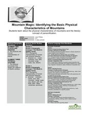
Mountain Magic: Identifying the Basic Physical Characteristics of Mountains
Students read about and identify on maps the physical characteristics of mountains. For this mountains lesson plan, students also write about the characteristics using personification.
Curated OER
Paint My Counties: Map Coloring the Counties of Arizona
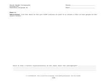
Fourth graders identify the counties of Arizona. In this social studies lesson, 4th graders color a county map of Arizona using the fewest number of colors possible. Students write a persuasive paragraph.
Curated OER
Lights On ! Lights Off! Exploring Human Settlement Patterns
Third graders write informational paragraphs based on the settlement patterns of the United States. In this settlement lesson plan, 3rd graders read about population and how it affects where people settle next.
Curated OER
Welcome to New York State
Students choose one region of New York state, and create a travel brochure that includes information such as geographical features, tourist attractions, accesibility, economic features, and historical events that occured in that region.
Curated OER
Population and Population Density
Students read and interpret graphs. In this population activity, students explore population and population density as they read several data graphs and respond to questions.
Curated OER
Rwanda: You Go, Girls
Students examine the genocide that took place in Rwanda in 1994 and focus the post-genocide success of women. They study websites to examine how women are challenging their traditional roles in Rwandan society.
Curated OER
When Am I Ever Going to Use this?
Young scholars solve problems using equations and properties of integers. In this algebra lesson, students solve problems using ratio and proportion and graph their answers on a coordinate plane. They solve word problems using geometry.
Curated OER
Trouble in the Troposphere
Students create graphs using NASA data, compare ozone levels of several U.S. cities, analyze and evaluate the data and predict trends based on the data, and discuss and describe how human activities have modified Earth's air quality.
Curated OER
How Can We Organize Study of a Given Place?
Seventh graders embark in discovery of basic facts about an assigned continent and are asked to organize their information into categories. The Five Themes model is taught and students reshuffle their information appropriately.
Curated OER
So -- What's Happening Here, On This Old Christmas Tree Farm?
Students review their prior knowledge on biomes and ecosystems. At a local Christmas tree farm, they work together in groups to identify the changes occuring in the area. They participate in solving a mystery in which they determine the...
Curated OER
The Desert Alphabet Book
Students use a book to discover an interesting fact from the desert using each letter of the alphabet. Using a United States map, they identify the meanings of symbols and locate deserts within the U.S. In groups, they participate in...
Curated OER
Trouble in the Troposphere
Students Use data sets from MY NASA DATA to produce graphs comparing monthly and yearly ozone averages of several U.S. cities. They analyze and evaluate the data and predict trends based on the data. In addition, they discuss and...
Curated OER
social studies: Life in Colonial America
Students explore the trials and tribulations early colonial life and note its successes. Through literature, Internet research, and interactive software, they engage in various activities to evaluate early social and cultural development.
Curated OER
Scavenger Hunt for Ancient Egypt
Seventh graders do a scavenger hunt in order to investigate Ancient Egypt.
Curated OER
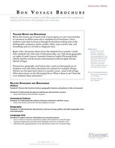
Language Arts: Mississippi River Brochure
Learners create brochures about recreational activities along the Mississippi River. Focusing on points of interest, they research attractions and create maps of the surrounding area. Once students write descriptions of their...


