Curated OER
World Map and Globe - Lesson 15 (K-3)
Students discover mountain ranges and their locations in the world. In this physical map activity, students locate and identify major mountain ranges of the world on a large physical map.
Curated OER
Getting to the Core of World and State Geography
Students create topography relief maps. In this geography skills lesson, students review geography core knowledge skills, design and make a state relief map, and compile a student atlas.
Curated OER
Mountain Range Project
This is an outline for a geography project which requires learners to research, compare, and construct a book about various mountain environments around the world. Even though this is a simple outline, it contains some useful ideas and...
Curated OER
Map a World of Facts
Learners mark ten places on a world map while they follow fun facts on the included printable sheet. They research using a variety of resources to determine the location of the ten places.
Curated OER
Where in The World Am I?
Students explore the concept of absolution location. In this geography skills lesson plan, students discuss how to identify and locate latitude and longitude. Students play a game to reinforce the skills.
Curated OER
World Continents
Students identify the continents of the world. In groups, students create a three-dimensional clay representation of their assigned continent. Using KidPix software, they draw and color their continent. Students research their continent...
Curated OER
Identifying Biomes
For this biomes worksheet, students will use an atlas to find the location of 12 cities listed on a graph onto their world map. Then students will use the cities' annual precipitation to figure out what biomes that city is found.
Curated OER
What a Relief Map
Students create a map using cookie dough. In this geography instructional activity, students research the physical features of a country, draw a diagram and design and create a map out of cookie dough.
Curated OER
Mesopotamia
Middle schoolers map Mesopotamia. For this Geography lesson, students are introduced to Ancient Mesopotamia. Middle schoolers use an atlas to label the defining features and areas of Mesopotamia on a map.
Curated OER
Mapping the News
Students explore cartography. In this map skills and map making lesson, Students work in groups to create wall size world maps including legends, compass roses, latitude and longitude, and physical features. Students collect current...
Richmond Community Schools
Map Skills
Young geographers will need to use a variety of map skills to complete the tasks required on this learning exercise. Examples of activities include using references to label a map of Mexico, identify Canadian territories and European...
Curated OER
Around the World in 5 Days
Learners explore continents, draw map, discuss cultures, use research to learn geography, and investigate cultures.
Curated OER
Coral Reef Geography
In this coral reef geography worksheet, learners find locations of reefs on a globe or map. There are 10 instructions to follow. There is no map provided--an atlas, globe or map is needed.
Curated OER
Where in the World Is ...?
Students move themselves around a "world" map on the classroom floor, using lines of latitude and longitude to locate specific spots. They determine the locations of 11 countries where Peace Corps Volunteers are serving and identify in...
Curated OER
Geography Booklet
Sixth graders explore geography terms. Students use resources to find real examples of landforms in the world. They create a map showing the landform. students label the surrounding features, countries and states. Students use each...
Curated OER
Off to See the World!
Second graders use games that use the atlas and the globe. Students take a ride (journey). Students place their chairs as if they are riding in a car. The Teacher is the driver. As the students travel along they point out different sites...
Curated OER
Where in the World War? Mapping WWII in the Pacific
Students study the geography of the Pacific theater of World War II. They study maps to examine the geography and features of the land.
Curated OER
Using Old Maps as Tools to Explore Our World
Learners explore historical maps. In this primary source analysis instructional activity, students uncover the meanings in selected historical maps as they use them to enhance lessons on historical events. Samples for classroom use are...
Cornell University
Too Much of a Good Thing?
Continuing their study of beneficial insects, young entomologists discover where in the world some of these bugs are. By labeling, coloring, and using the scale on a map, pupils explore the territories and arrival of the Asian lady...
Curated OER
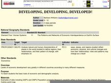
Developing, Developing, Developed!
Students differentiate among and explain various levels of economic development around the world. They see that levels of economic development vary greatly in different countries according to many different measures.
Curated OER
Climate Characteristics of Canadian Localities
Tenth graders match the climate data to a Canadian city. They justify their choice, referring to factors that affect climate. They use the Atlas of Canada's Advanced Search to locate specific communities.
Curated OER
Historical Indian Treaties and Aboriginal Population
Sixth graders navigate an online atlas of Canada and compare the land area of of historical Aboriginal peoples in Manitoba to present-day figures.
Living Rainforest
Finding the Rainforests
From Brazil to Indonesia, young scientists investigate the geography and climate of the world's tropical rain forests with this collection of worksheets.
Curated OER
A world of oil
High schoolers practice in analyzing spatial data in maps and graphic presentations while studying the distribution of fossil fuel resources. They study, analyze, and map the distribution of fossil fuels on blank maps. Students discuss...


