Curated OER
Make Your Own "Weather" Map
Learners create their own "weather" map using data from x-ray sources. They analyze and discuss why it is important to organize data in a fashion in which is easy to read. They compare and contrast different x-ray sources using a stellar...
Curated OER
Will There Be a White Christmas This Year?
Young scholars examine historical weather data, and create map and color key that illustrates the likelihood of a white Christmas in different locations across the United States.
Curated OER
Cloudy With A Chance of Meatballs
Second graders explore weather. In this weather lesson, 2nd graders read Cloudy With A Chance of Meatballs and participate in four supplemental science activities. Students participate in Internet research, create weather maps,...
Curated OER
Waterdrops
In this science worksheet, students learn about water cycle, weather, clouds, storms and water resources by completing 8 pages of this full color newsletter. Students read a story, study weather maps, learn to make a rain gauge, learn...
Curated OER
Weather
Second graders study the basic components of weather. They construct a thermometer and anemometer to measure temperatures, precipitation, and wind speed. In addition, 2nd graders discover how to find these components on weather maps.
Curated OER
Mapping China
Students identify cities in China on a map. In this map skills instructional activity, students locate the continent of Asia and the country of China. Students use a blank map to label China and bordering countries.
Curated OER
EarthTrek Gravestone Project
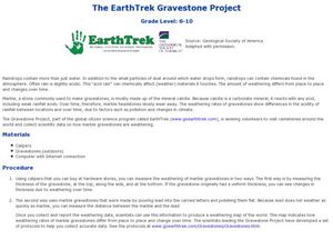
Students explore the effects of acid rain. In this acid rain lesson, students investigate the effects of the weathering from acid rain in different places. Students visit cemetaries to collect data about the effects of acid rain on the...
Curated OER
Weather
Fourth graders study a map and locate cities, read information and create a chart. In this weather lesson students place appropriate weather information on a map and write a script using their information to relay the weather to...
Curated OER
Clouds and Your Weather
Seventh graders identify clouds and the weather associated with them. They use informational articles and personal weather observations to learn about the relationships between weather fronts and clouds.
Curated OER
Weather Patterns
Students collect weather data over a thirty day period to gain an increased understanding of the weather patterns in their area. Once the data is collected, students post their finding online using a web tool. Finally, students attempt...
Curated OER
CLASSROOM MAPS
Pupils do a blind tour of their school by responding to verbal commands. They look and discuss various maps in the classroom. They locate the direction of the sunrise and discuss the compass directions of North, South, East, and West.
Curated OER
Song Mapping
Young scholars explore locations on the United States map. In this map skills lesson, students recite the song This Land Is Your Land and locate various places listed in the song on the map.
Curated OER
Comparing the Effects of El Nino and La Nina
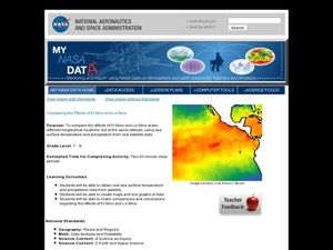
Students examine the differences between an El Nino and La Nina year. In this investigative lesson plan students create maps and graphs of the data they obtained.
Curated OER
Is Portland, Oregon Experiencing Global Warming?
Students use data to determine if the climate in Portland has changed over the years. In this weather lesson plan students complete line graphs and study long wave radiation.
Curated OER
A Question of Rivers
Interactive PowerPoints are terrific tools for self quizzing before an exam. This particular presentation is about the action and physical features of rivers. There are nine boxes to click on, each leading to a picture or map. When you...
Curated OER
A Comparison Study of Water Vapor Data to Precipitation over North America
Learners use NASA satellite data to compare water vapor over the United States. For this data analysis lesson students use an Excel spreadsheet to map their data.
NASA
Hurricanes and Hot Towers with TRMM
Take cover because a wild presentation on hurricanes is about to make landfall in your classroom! An outstanding PowerPoint presentation is the centerpiece of this lesson. Not only does it provide information and photographs, but several...
Curated OER
Weather Watchers
Learners conduct Internet research of their community's weather and compare it to the weather in another location. After conducting research, students become weather reporters by reporting their findings to the class by using a...
Curated OER
Understanding Canadian Weather Extremes
Students research and analyze the causes and sources of Canada's extreme weather conditions. They conduct an experiment, complete a worksheet and predict the most likely locations for extreme weather conditions.
Curated OER
Weather and Climate Around the World
Students explain the difference between climate and weather. They gain concepts of currents and discuss how the currents have an affect on climate and weather. Students gain knowledge of the instruments that meteorologists use to predict...
Curated OER
Let's Forecast the Weather!
Students discuss weather and how it is forcast on the news. They set up a "news room" and create their own sentences with a forecast and advice for those watching based on the forecast. These sentences are used as students role play weather
Curated OER
Exploring Weather Websites
Students research and locate their own weather data using a weather website. They examine how to locate valid information on the www.weather.com website, and explore the website. Next, they select a city they want to visit, and compare...
Curated OER
Severe Weather
Ninth graders investigate the cause and effect of severe weather. In this Earth Science instructional activity, 9th graders use a learning contract and a rubric to develop a presentation about severe weather.
Curated OER
Quiz: Weather Prediction
In this science worksheet, 3rd graders will focus on the weather. Students will respond to ten fill in the blank questions regarding weather prediction.
Other popular searches
- Reading Weather Maps
- Interpreting Weather Maps
- Interpret Weather Maps
- Surface Weather Maps
- Creating Weather Maps
- Weather Maps With Fronts
- Pressure and Weather Maps
- Analyzing Weather Maps
- Construct Weather Maps
- Winds and Weather Maps
- Interactive Weather Maps
- Just Interpret Weather Maps


