Curated OER
Science: Reading a Compass
Students demonstrate how to take bearings using a compass. In pairs, they select objects in the classroom then write down its first initial and bearing. They exchange papers and try to disciver their partner's object.
Curated OER
Trends of Snow Cover and Temperature in Alaska
Students compare NASA satellite data observations with student surface measurements of snow cover and temperature. They practice data collection, data correlations, and making scientific predictions.
Curated OER
Podcasting Crusader's Style
Students work as a group of scientists studying a specific biome of their choice. In this biome lesson, students research a biome and develop a podcast where factual information is read about a biome and the events of...
Curated OER
Polar Bears
Students read books, color pages, and make crafts having to do with polar bears. In this polar bears lesson plan, students link to different sites for these activities.
Curated OER
Leave No Trace
Students explore what is needed, when preparing for an outdoor trip. In this leave no trace lesson, students examine the equipment required for a camping trip, discuss the hierarchy of needs, and review the seven principles of leave...
Curated OER
Watercolor Ways
Students investigate the concept of being part of a global community. In this global community lesson, students learning the definition of stewardship as it relates to taking care of the Earth. They listen to the lyrics of the song,...
Curated OER
Solar Box Cooker
Students explore solar power. In this solar power instructional activity, students build simple solar cookers after they study convection, conduction, and radiation. Students transfer their knowledge of how the solar cooker works to...
Curated OER
Exploring the Hudson in 1609
For this geography worksheet, 5th graders study about the exploration of the Hudson River. Students respond to 7 multiple choice questions about the presented facts.
Curated OER
Natural Disaster Blooms Taxonomy
Students complete activities that lead to greater understanding of the variety of natural disasters that occur all over the world.
Curated OER
An Adventure to the New World
Fifth graders role play the position of an explorer traveling to the new world. They research the explorers journey and create their own explorer's notebook. They complete different activities and then present their evidence to the class.
Curated OER
Life in Sahara
Students explore the geography of the Sahara region of Africa and identify characteristics of a desert habitat. They explore the culture of the people living there and how it has adapted to desert life.
Curated OER
Turin, Geography, Culture And Sports
Students study why certain locations are suitable to host the Winter Olympics. They research the characteristics of Turin, Italy, plan a trip and create a multimedia scrapbook of the trip.
Curated OER
Cave Men to Cave Painting
Students explore the Ice Age. In this geology and social studies lesson, students read the book Eyewitness Books Early Humans and create a KWL chart about the Ice Age. Students locate Asia and North America on the World Map and...
Curated OER
Population and Population Density
Students read and interpret graphs. In this population activity, students explore population and population density as they read several data graphs and respond to questions.
Curated OER
Native American Indians
Fourth graders identify Native-American groups in Texas before European exploration and describe the regions in which they lived. They list Native American Indian tribes from Texas, describe them, and evaluate how the environment...
Curated OER
Planning a Trip from Vancouver BC
Students plan a weekend car trip to Seattle Washington. They leave Friday afternoon and arrive back Sunday afternoon.
Curated OER
Reasons for the Seasons
Students discover how the Earth's axis of rotation affects the angle of sunlight and the length of day. They take a survey and give the survey out to family members and friends. They tally their findings and then determine the correct...
Curated OER
Country: Caribbean Islands
Students explore the countries in the Caribbean. They examine island information, language, climate, culture, currency, places of interest, resort information, and flight information.
Curated OER
Trouble in the Troposphere
Students create graphs using NASA data, compare ozone levels of several U.S. cities, analyze and evaluate the data and predict trends based on the data, and discuss and describe how human activities have modified Earth's air quality.
Curated OER
The Twelve Months: A Slavic Cinderella Variant
Students locate Slavic countries and identify a few characteristics of those countries. They read and/or listen to the Slavic tale, "The Twelve Months," and compare this version with another Cinderella story.
Curated OER
Erosion: On the Move...Defending the Coast Against Wave Attack
Students study how people have tried to save beaches from wave erosion. They examine what has occurred to Cape Hatteras as a result of beach erosion and the efforts to reduce the erosion.
Curated OER
Reasons for the Seasons
Sixth graders conduct and analyze a survey that explores public perceptions about the reasons for seasonal change. They measure the changing length of days, observe shadows and discuss how the Earth's axis of rotation affects the seasons.
Curated OER
The Selling of the Taj Mahal or Osaka Castle
Seventh graders work in groups and act as a real estate company who is trying to sell a billionaire a historical landmark to house his art collection and must make a presentation convincing him to buy their historical site.
Curated OER
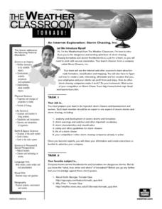
Storm Chasing, Inc.
Students use the internet to research storm chasing. They develop their own lesson plan and present it to the class. They create a visual for their lesson as well.
Other popular searches
- Reading Weather Maps
- Interpreting Weather Maps
- Interpret Weather Maps
- Surface Weather Maps
- Creating Weather Maps
- Weather Maps With Fronts
- Pressure and Weather Maps
- Analyzing Weather Maps
- Construct Weather Maps
- Winds and Weather Maps
- Interactive Weather Maps
- Just Interpret Weather Maps


