Curated OER
Barnegat Bay Watershed
Students design a model watershed. In this watershed lesson plan, students learn the needed parts of a watershed and how they work. Students evaluate how watersheds effect communities.
Curated OER
Arizona
Learners engage in a series of lessons about Arizona. They perform experiments and participate in activities across the curriculum. They perform research on websites imbedded in this plan to complete a variety of tasks.
Curated OER
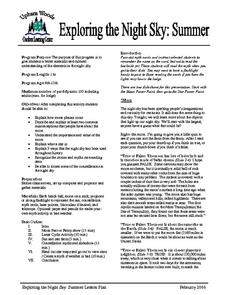
Exploring the Night Sky: Summer
Students explain how moon phases occur. They describe and explain at least two common misconceptions that people have about the moon. Students explain what a star is. They explain 3 ways that the night sky has been used throughout history.
Curated OER
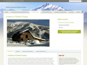
Evidence of Climate Change
Sixth graders examine climate change in the state of Colorado. In this climate lesson, 6th graders watch 2 video clips regarding the topic and research the subtopics- snow pack, precipitation, temperature, forest fires, river flow,...
Curated OER
Aquifers and Groundwater
Students understand the purpose of an aquifer. In this aquifer and groundwater lesson, students build a model aquifer find its relationship to water usage. Students record observations as they build the layers of the aquifer.
Curated OER
Food Webs in the Barnegat Bay
Students investigate the food webs in the Barnegat Bay. In this organisms instructional activity, students use a graphic organizer to illustrate the types of consumers in the bay. Students use reference books to continue to research the...
Curated OER
Alaska Virtual Field Trip
Young scholars participate in an on-line virtual field trip to the state of Alaska. In this U.S. Geography lesson, students research several Internet sites dealing with travel to Alaska and activities to participate in. Young scholars...
Curated OER
Housing: Types of Shelters
Students experiment with the construction of shelters and the various types of architectural designs. In this shelters lesson, students draw the building they live in. Students compare and contrast buildings made today and...
Curated OER
Ecosystem In A Bottle
Ecosystem activities show how everyone and everything is interconnected. The smallest change can make a big impact.
Curated OER
Great Lakes Ecology
Eighth graders identify the Great Lakes, and describe the habitat of life of a loon. They are able to point to and explain one of the major river systems that enters the Great Lakes with a focus on the Clinton River and the food webs...
Curated OER
Microclimates of Our School
Students read the story "Weslandia" by Paul Fleischman, define the term microclimate, gather and record data in various places on school grounds to establish the presence of difference microclimates, analyze and compare microclimates,...
Curated OER
Scientist Tracking Network
Students correlate surface radiation with mean surface temperature of several geographic regions. They observe how these parameters change with latitude and construct an understanding of the relationship of solar radiation to seasonal...
Curated OER
Water Cycle
Students explore the water cycle. In this water cycle lesson, students examine water as a resource as they create a water cycle poster and create a water cycle model. Water cycle game instructions are included as well.
Curated OER
Scatter Plots
Seventh graders investigate how to make and set up a scatter plot. In this statistics lesson, 7th graders collect data and plot it. They analyze their data and discuss their results.
Curated OER
Climate Change in Canada
In this Canada worksheet, students read a 6 page detailed informational text about climate change in Canada. Students then complete 10 essay/short answer questions.
Curated OER
Introduction to Drawing Isopleths
Students draw isopleths based on how many pieces of "confetti snow" land in their cup.
Curated OER
Wind
Fourth graders are read a story and answer the comprehension questions about sound and wind. In groups, they make their own wind vane and how to determine the direction of the wind. To end the lesson, they make their own Anemometer to...
Curated OER
Holocaust Pictures Exhibition
Students write reactions to selected pictures of the Holocaust. They view selected online pictures about the Holocaust and write their reactions. They use their knowledge about the Holocaust to write reactions to pictures about this period.
Curated OER
50 States: New England States
Students discover where certain states are located and what the look like. They look for their information on a web site. Each student is assigned a state which they must research then present to the entire class.
Curated OER
The Iditarod Adventure
High schoolers use the internet to follow the Alaskan Iditarod race as well as perform research. This project-based activity will result in students creating many desktop publishing documents.
Curated OER
The Trail of Tears; Its Grief and Loss
Fifth graders trace the development and expansion of the US while studying the Trail of Tears. They examine the political factors and analyze the impact the Indian Removal Act had upon a society. They present a case for or against the...
Curated OER
Lesson 1: The Creek War - Return to Nativism or International Pawn? Religious War or International Conflict?
Students investigate the countries and peoples involved in the Creek Indian War. They study the complex relationships between American and European settlers and the native Alabamians in the early 19th Century.
Curated OER
Teaching The Personality Profile
Students write a comprehensive personality profile feature that demonstrates knowledge of the Wall Street Journal formula of feature writing and the concept of show, don't tell. They experience a press conference interview situation.
Curated OER
The Oregon Trail
Fourth graders discover the significance of the Oregon Trail in Idaho history. In addition, 4th graders conceptualize the Oregon Trail in relation to their own lives. They engage in a wide variety of curricular activities, culminating in...
Other popular searches
- Reading Weather Maps
- Interpreting Weather Maps
- Interpret Weather Maps
- Surface Weather Maps
- Creating Weather Maps
- Weather Maps With Fronts
- Pressure and Weather Maps
- Analyzing Weather Maps
- Construct Weather Maps
- Winds and Weather Maps
- Interactive Weather Maps
- Just Interpret Weather Maps


