Curated OER
The Weather Page-Comparing Data
Students examine weather patterns in the United States. For this weather lesson, students use a United States map to identify high and low temperatures in two states. Students compare the data and record their findings onto a chart.
Curated OER
Weather Reporter
Fourth graders generate an oral presentation on the weather. In this weather lesson plan, 4th graders watch the weather for a week and record the data on a chart. Students give a weather report at the end of the week.
Curated OER
Weather's Outer Limits
Students make educated guesses and explain their reasoning and compile, graph, and map weather data. They then study environmental weather extremes on earth and discover that many variables determine climate.
Curated OER
Creating a Thematic Map
Students create and analyze a weather-related data table and a thematic map based upon information provided.
Curated OER
Weather, Data, Graphs and Maps
Students collect data on the weather, graph and analyze it. In this algebra lesson, students interpret maps and are able to better plan their days based on the weather reading. They make predictions based on the type of clouds they see.
Curated OER
Learning Lesson: Analyzing a Weather Map
Students use weather maps to locate warm and cold fronts. They discover the different types of weather associated with these fronts. They also observe the weather in their local area.
Curated OER
Cold, Clouds, and Snowflakes
Students explore satellite data and graphing. For this weather data analysis math and science lesson, students analyze NASA satellite data to draw conclusions about geographical areas where precipitation might have happened. Students...
Curated OER
The Weather Page: Comparing Data
Students analyze data from maps. In this comparing data lesson, students use comparative and superlative statements to draw comparisons among the weather in different American cities based on USA Today weather maps.
Curated OER
Isolines on a Weather Map
Ninth graders explore weather by analyzing maps. In this temperature lesson, 9th graders view black and white weather maps of locations in which the weather changes often. Students identify the isolines used on the maps and utilize the...
Curated OER
Waldseemüller’s Map: World 1507
Students take a closer look at historical maps. In this primary source analysis lesson, students examine the first world map produced by Martin Waldseemuller. Students complete the included map analysis worksheet and then write letters...
Curated OER
Great Lakes Snow Analysis Collaborative Network
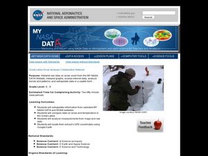
Students interpret data on snow cover and analyze trend patterns. In this snow lesson students compare data and locate their school's GPS coordinates.
Teach Engineering
Air Under Pressure
Introduce your class to air masses and how they affect the weather with a lesson that focuses on the differences between high and low air pressure systems. The class explores actual weather data using archived weather data.
Gfletchy
Deep Freeze
Warm up to the idea of subtracting integers. After watching a video where the contents of a cup instantly freeze when tossed into the air, pupils estimate the air temperature of Duluth, Minnesota (where the video was made). They then use...
Curated OER
Weather Maps
Pupils explain the collection of weather data as presented in different formats. They use appropriate terminology related to weather maps and use the Internet to capture weather data from a city of choice and present a TV style weather...
Curated OER
Reading A Weather Map
Ninth graders construct a weather map. In this meteorology lesson, 9th graders construct a weather map using contour lines and temperature.
Curated OER
Hands-On Weather Data Collecting
Fifth graders study weather in their community, in the United States, and around the world. They use thermometers, the beaufort wind scale, and simple weather symbols to measure and record the weather outside their school. They also look...
Curated OER
What Do Maps Show?: Lesson 1 Introduction to Maps
Students brainstorm a list of the different types of maps they have seen or used. Using the activity sheet, they look through a social studies book to find all the maps and to determine what they are used for. Using a poster, they review...
Curated OER
Weather Observations
Students record the weather using an outdoor thermometer. In this weather instructional activity, students compare their recordings to that on the weather map online. Students explain the differences of each weather reading. Students...
National Wildlife Federation
Get Your Techno On
Desert regions are hotter for multiple reasons; the lack of vegetation causes the sun's heat to go straight into the surface and the lack of moisture means none of the heat is being transferred into evaporation. This concept, and other...
Curated OER
Deep Convective Clouds
Students observe clouds. In this deep convective clouds lesson, students analyze cloud data recorded over one month and draw conclusions based on results. Students predict "Thunderstorm Season" and prepare to defend their decision using...
Curated OER
Understanding Weather and Climate Patterns
Students research the climate patterns of various locations and make predictions based on their findings. They determine the importance of latitude and longitude in weather and climate. Students create graphs displaying their collected...
Kenan Fellows
Sensors, Sensors…..Everywhere! Middle School Meteorologist Create Weather Bots!
My forecast is that you'll want to use the resource. Pupils design and create a weather bot as part of a project-based unit. These bots should be able to measure temperature, humidity, barometric pressure, wind speed and direction, and...
American Institute of Physics
The Tuskegee Weathermen: African-American Meteorologists during World War II
Chances are good that young scholars have heard of the Tuskegee Airmen but few would predict that these pilots had their own support in the form of the Tuskegee Weathermen. These Black meteorologists were recruited and trained to provide...
Curated OER
A Comparison Study of Water Vapor Data to Precipitation over North America
Students use NASA satellite data to compare water vapor over the United States. In this data analysis lesson students use an Excel spreadsheet to map their data.


