Curated OER
Map the Mystery!
Seventh graders read the novel, "The House of Dies Drear", and create a story map to analyze the plot and recall events.
Curated OER
Technology Integration
Third graders describe and locate the five geographical regions of the state of Virginia. Using that information, they organize the descriptions in a database they created. They are graded based on accuracy and spelling all noted on a...
Curated OER
Bronx Zoo
Students prepare for a field trip to the Bronx Zoo. They use maps and descriptions of animal exhibits to give and interpret directions on how to navigate the zoo. They play games, participate in pairwork and whole class discussion.
Curated OER
Do You Know Your 50 States?
Learners use the names and abbreviations of the 50 states to label a blank map of the United States.
Curated OER
Finding Their New World
First graders place stickers on maps indicating their understanding of the cardinal directions. They locate Jamestown, England, the Atlantic, and Virginia.
Curated OER
The Settlement of the Chesapeake
Focusing on the Virginia and Maryland settlements in the 1600's, this presentation is a complete and thorough resource during a unit on Colonial America. It includes pictures, maps, and interesting discussion points for you to address...
Curated OER
A More Perfect Union: The Story of Our Constitution
Sit back, relax, and transport to 1787! This lesson on the Constitution begins with guided imagery of the Constitutional Convention. The class reads A More Perfect Union: The Story of Our Constitution in an interactive read-aloud...
Power Show
Colonial North America
This 54-slide PowerPoint outlines the significant events in the history of Colonial North America, beginning in 1603 with the ascendance of James I to the throne of England. Designed to accompany a lecture on this time period, the...
Curated OER
Virginia's Five Geographic Regions
Tenth graders study the products and industries of five major geographic regions in Virginia. They use web based resources to examine maps of Virginia and to make a large classroom map which they label with the products and industries....
Curated OER
Virginia State Map
In this geography of Virginia worksheet, students color the map and label major cities and physical features. Students also study a second map showing the location of the state of Virginia in the United States.
Curated OER
Virginia in the Civil War
Students examine the role of Virginia during the Civil War. In groups, they brainstorm ideas about why they believe so many battles took place in Virginia. Using a map, they locate the major battles on land and in the ocean. To end...
West Virginia Department of Education
History Scene Investigators - John Brown's Raid
An informative resource covers the event of John Brown's Raid, an event that became an important part of West Virginia history. It serves as a standalone and covers the event and John Brown's life in depth using group work, online...
American Battlefield Trust
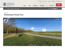
Gettysburg Virtual Tour
Step into one of the most iconic battlefields of the American Civil War with an educational interactive resource. Young historians learn about key moments, locations, soldiers, and turning points in the battle with a clickable map and...
Smithsonian Institution
We Have a Story to Tell: Native Peoples of the Chesapeake Region
How did colonial settlement and the establishment of the United States affect Native Americans in the Chesapeake region? Your young historians will analyze contemporary and historical maps, read informational texts, and work in groups to...
US Mint
Desert Dwellers
What can a quarter possibly teach young learners about desert ecosystems? More than you might think. After displaying and discussing the included picture of the Arizona state quarter, the class participates in a series of shared reading...
Curated OER
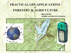
Practical GPS Applications in Forestry & Agriculture
An explanation of the Global Positioning System (GPS) and the Geographic Information System (GIS) is given in this presentation. Uses and applications are considered. How it works and sources of error are also touched upon. A large...
Curated OER
National Marine Sanctuaries Shipwrecks
Junior oceanographers access the Channel Islands National Marine Sanctuary Shipwreck Database and plot the locations of several shipwrecks. Shipwrecks are always an enthralling subject and this activity allows your learners to act as...
Curated OER
A to Z Observations
Eighth graders examine the cultural conflicts that occurred when Europeans moved into the land the Native Americans lived on that would become West Virginia. In this West Virginia history lesson, 8th graders visit the state history...
Curated OER
Creating Station Models
Students work in groups to interpret weather maps. They use latitude and longitude readings to complete a worksheet together and turn in the worksheet along with the maps and a rubric.
Curated OER
Reference Materials
After a class discussion where kids share how they find answers to their questions, learners explore the world of reference materials such as, an atlas, an almanac, and an encyclopedia. The Internet is also discussed as a way to access...
Virginia Department of Education
The Writing Process for Persuasive Writing
Get your junior high writers stimulated with the strategies and ideas available in this activity. Learners discuss and debate controversial subjects, and outline their reasons with an online graphic organizer (link included) that creates...
Curated OER
Plan a Trip
Students plan for a trip. They use map quest and / or road maps to decide on an address for their trip. They determine the mileage, lodging, gasoline to be used, shortest distance and fastest distance.
Curated OER
The Pilgrims
Students use distance measuring tools to follow directions and chart the path the pilgrims made from Plymouth, England to Boston, Massachusetts. In this Pilgrim voyage lesson plan, students use a map to chart the distance traveled by the...
Curated OER
Label the Southern States
During your study of the United States, challenge your class to label the seventeen Southern states. Can they do it without the key? The answer sheet is included.


