Hi, what do you want to do?
Curated OER
Creating a National Park
Students explore how national parks are created, operate and benefit society by creating a new national park for their state.
Curated OER
Oceanography
Fifth graders study the topography of the ocean floor. They determine its ever changing nature as they examine currents and trade winds. They write paragraph describing how the winds might affect land formations after the discussion of...
Curated OER
The Big O
Students investigate the characteristics of a community. They investigate the characteristics of the Omaha community through internet research and discussion. Students create books about their community.
Curated OER
Travels Of A Florida Migrant Child
Young scholars discuss the story Amelia's Road by Vickie Leigh Krudwig in this cross-curricular Math lesson for the middle-level classroom. Elements of the social sciences are addressed. Cooperative learning groups are suggested for...
Curated OER
Give Me The C and D Canal!!!
Students estimate the distance from Baltimore to Philadelphia via the water route before the Chesapeake and Delaware Canal was built. Students study canals and how transportation and economic necessities dictate the building of a canal.
Curated OER
Social Studies: The Connecticut Hill Community
Pupils discover the reasons for the settlement of the Connecticut Hill Community. Through an examination of the climate, occupations of the inhabitants, and demographics, they discuss reasons people choose locations for settlement. ...
Curated OER
Translating Traditions
Students analyze art reflective of traditions and cultural heritage. In this art analysis lesson, students complete image based discussion.
Curated OER
Gonna Take a Sedimentary Journey
Students collect water samples from a local source, test it, filter it and identify the materials suspended in it. Students disucss the possible sources of sediment in their watershed.
Curated OER
Species and Spaces - At Risk at Home
Eleventh graders explore and compare Canadian biomes and investigate species at risk. They describe population growth and eco-regions in terms of climate and geography. They research and create presentations about the natural history and...
Curated OER
It Takes All Kinds!
Students view video clips and observe similarities and differences between animals. They sort animals into groups for a zoo. They make a graph of their observations and review scientific classifications.
Curated OER
Who We Are: To Know the Characteristics of a Population Within Certain Domains
Students, through research, discover the characteristics of the population of Quebec and compare them to those of Canada as a whole. They create a class presentation about information they found.
Curated OER
Acids and Alkalis
Students determine and explain the characteristics of alkalis and acids. With their list of characteristics student groups conduct an investigation into whether various household substances are alkali or acid. Their lab findings are...
Curated OER
Alaska's Physical Systems and History
Students read about Alaska's physical systems and determine how Alaska's physical makeup has impacted its history. They create timelines of their particular physical system.
Curated OER
Hurricanes-Disasters In the Making
Sixth graders discover the proper methods for plotting hurricanes while developing their understanding of hurricanes by researching and gathering tracking data from technological sources. Students develop a newsletter about hurricanes,...
Curated OER
Castles and Forts of Wales and Oregon
Learners compare a castle in Wales to a fort in Oregon and design and build a castle or fort. In this structure study activity, students complete activities to study castles in Wales to forts in England. Learners then design their own...
Curated OER
Date a Rock!
High schoolers figure the number of half-lives since the sample solidified, and therefore the "age" of the sample rocks.
TeachEngineering
Teach Engineering: Scaling the Map
Students learn how to determine map distances and areas using the map scale. They get a feel for how much an area represents on the map in relation to the size they are suggesting for their underground caverns to shelter the Alabraska...
BBC
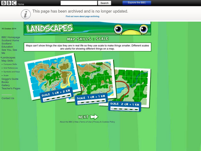
Bbc: Landscapes: Scotland: Map Skills: Scale
Lesson for elementary students on map skills uses a map of Scotland to teach about the concept of scale.
TeachEngineering
Teach Engineering: Topo Map Mania!
Maps are designed to allow people to travel to a new location without a guide to show the way. They tell us information about areas to which we may or may not have ever been. There are many types of maps available for both recreational...
Illustrative Mathematics
Illustrative Mathematics: 7.g Map Distance
This lesson plan has students solve problems using scale drawings on a map.
E-learning for Kids
E Learning for Kids: Math: Tea Store: Position on a Map
Help Gina locate items in the tea store using coordinates, a compass, and a ruler in this series of leveled exercises.
University of Oregon
University of Oregon: Interactive Nolli Map of Rome: 1748 Map of Rome
Interactive Nolli Map introduces students to Rome and the structure of its urban form based on the work of eighteenth-century Italian architect Giambattista Nolli. Using the map engine, navigate through the city at a variety of scales,...
National Association of Geoscience Teachers
Nagt: Bringing the Geologic Time Scale Down to Earth in the Students' Backyard
This activity is specifically designed for a field trip to Drayton Hall, which is a historic plantation near Charleston, South Carolina. It does provide a model of how a similar activity could be designed for a local area, and there are...
Curated OER
Educational Technology Clearinghouse: Maps Etc: Drawing Asia, 1872
A chart from 1872 illustrating instructions for drawing Asia. "General instructions for drawing the continents. Make a scale by marking on a slip of paper or pasteboard the measures 1,2,3, etc., as on the sides of this map. Every measure...


