Curated OER
Tracing Highs and Lows in San Francisco
On a topographic map, students identify the scale bar, north arrow, and contour interval. They then locate a hill on the map and make note of the contour lines. Students then locate other places with similar contour line patterns....
Curated OER
Rivers Run Through It
Using a relief map of New York State, learners answer questions about the distance between different cities, identify bodies of water, and more. First, they discuss vocabulary related to the Hudson River area. Then, they complete a...
Curated OER
Exploring the Hudson in 1609
While this lesson focuses on a study of the Hudson River, it could be used as a template for a discussion of map skills, converting measurements, and plotting a route. The lesson includes vocabulary and other resources to make it a...
Curated OER
What do Maps Show?
Eighth graders practice the skill of reading maps. In this geography lesson plan, 8th graders participate in a classroom lecture on how to read a map.
Curated OER
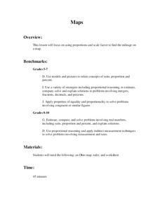
Maps
Students figure out the mileage from one state to another using a map. In this map lesson, students look at the scale factor and turn it into a fraction. They measure the distance between two cities and use the proportion to find the...
Curated OER
Introduction To Topographic Map Activities
Students discuss different types of maps, their similarities and differences. Using a Topographical Maps CD-rom program students create their own map.
Curated OER
Map It With Pixie
Fourth graders use the computer program 'Pixie' to create a topographic, detailed map for the state they live in. In this mapping skills lesson, 4th graders use Pixie to make a map of their state that includes topographic features, state...
Curated OER
You Are Here
Learners map local places and learn to use scale and distance. In this mapping lesson, students map their school and a favorite place. Learners recreate their maps showing distance and scale sizes. Students locate their location on a...
Curated OER
Plotting A Hurricane Using latitude and Longitude
Students explore map and plotting skills by tracing the movement s of hurricanes through the Earth's systems. a hurricane map is developed from daily media reports.
Curated OER
Globe Skills Lesson 7 The Transcontinental Railroad
Young scholars explore the Transcontinental Railroad. In this geography skills lesson, students use map skills in order to locate legs of the Transcontinental Railroad on globes.
Curated OER
The Underground Railroad
Students explore the Underground Railroad routes. In this map skills and Civil War instructional activity, students use map and globe reading vocabulary and skills to track the routes the slaves followed from the Bahamas to the United...
Curated OER
Understanding Geography
Students create a map of their own neighborhood to show the relationships between the geography of the neighborhood and its economy and culture. They view and discuss an introductory video on how geographers study an area then go out...
Curated OER
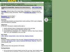
Shipping in the United States in 1835
Young scholars use transportation routes existing in 1835 to plot a shipping route from Boston to Cincinnati. They use the map scale to measure distances and plot a trip.
Curated OER
Generate an Accurate Landscape Profile from a Topographic Map
Learners enerate an accurate landscape profile from a topographic map. They determine the correct interval needed to accurately graph the change in elevation on a single piece of graph paper.
Curated OER
An Early American Culture
Students identify the locations of the Hopewell culture. In this map skills instructional activity, students use a globe to mark several locations of the Hopewell culture.
Curated OER
The Landscape of a Novel
Students, after reading a novel, utilize geographic skills to map out the places described in the novel. They collect data, envision spatial features and then design a map to work off of to complete their assignment. Each student also...
Curated OER
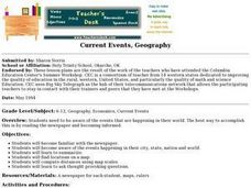
Current Events, Geography
Students read the newspaper to become aware of what is happening in their city, state, nation, and world. They summarize, find locations on a map and ask thought-provoking questions.
Curated OER
Johnny Appleseed Walkabout
Second graders calculate mileage for a journey. In this place value and measurement instructional activity, 2nd graders read Johnny Appleseed, work in groups to locate his birthplace on a map, locate the other states he stopped in, and...
Curated OER
Me on the Map Lesson 2
Students analyze and interpret maps, globes and geographic information systems to define and identify cities, counties, states, countries and continents to create a booklet called me on the map. They also determine and calculate the...
Curated OER
Maps, Charts, and Graphs
Students define key geographic terms and track a hurricane on a map. They examine various types of maps and find locations on them,including rivers, cities and mountains.
Curated OER
US City Quality of Life Analysis and Comparison
Young scholars analyze US census data and criteria to compare and measure the quality of life in the country's fifty largest cities. After accessing the 2005 quality of life world report online, students conduct their study to compare...
Curated OER
Using Venn Diagrams to Compare Two Ecosystems
Students explore the distribution of two ecosystems on a global scale; and map the distribution of tropical and temperate rain forests throughout the world. They use a Venn Diagram to describe these ecosystems and the differences between...
Curated OER
Mapping India
Students participate in an activity in which they place placards listing geographic features, landmarks, etc. in the correct place on a large fabric map of a given country. They also examine artifacts, photos, sounds/music, etc. from...
Curated OER
Find a Cave
Students locate their own communites and the nearest caves on a United States map. They calculate the distance to the nearest cave using rough scale.


