Curated OER
How is Atomic Energy Used Today
Students investigate energy sources by examining photographs. In this atomic energy lesson, students identify and describe various pictures and how atomic energy is used in them. Students create a presentation demonstrating how many...
Curated OER
Solving Using Linear Equations
Seventh graders explore linear equations. They observe the relationship between linear equations an patterns. Students make decisions using information given in graphs to solve linear equations. They perform a toothpick activity to...
Curated OER
Your Expedition of Discovery
Students study GPS and see how it is used to determine points on the Earths surface. In this expedition lesson students use GPS to find given coordinates.
Curated OER
GPS Ecosystem (Ecotone) Scavenger Hunt
Students describe the characteristics of an ecotone. In this ecotone lesson, students pick out their area and describe the visual appearance, conditions, ecosystem, biodiversity, predators, prey, and trees in their ecotone. They create a...
PBS
Inspector Detector
How do spacecraft detect magnetic fields? The fourth installment of a five-part unit has learners develop a device with magnets that allows for the detection of magnetic fields. They use a map of an imaginary planet to try out their...
PHET
Mapping the Ambient Magnetic Field
No GPS allowed! High school scientists continue to explore magnetic fields with a hands-on activity. After mapping the ambient magnetic field in the classroom and completing data analysis, they write about the similarities and...
Curated OER
Great Lakes Snow Analysis Collaborative Network
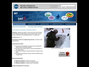
Students interpret data on snow cover and analyze trend patterns. In this snow lesson students compare data and locate their school's GPS coordinates.
Curated OER
Adaptation and Diversity on Sheffield Island
Written for an exploration of shoreline ecosystems on Sheffield Island, this gives ecology or marine biology buffs a hands-on experience. Using GPS or visual triangulation techniques, they lay transect lines on a high and a low energy...
Curated OER
It's About Time
Students investigate how Global Positioning Systems work and how and why GPS receivers make errors. They graph data points and apply estimation and prediction to real-life GPS situations, discuss time delay, and complete a worksheet.
Curated OER
TE Lesson: Navigating at the Speed of Satellites
Students study the basic concepts of the Global Positioning System and how it increases the accuracy of navigation. They examine trilateration and how the speed of light is used to calculate distances.
Curated OER
Where is Here?
Students are shown the very basics of navigation. The concepts of relative and absolute location, latitude, longitude and cardinal directions are discussed, as well as the use and principles of a map and compass.
Curated OER
Cultural Anthropology Study Using the Fundamentals of Geography and GPS
Students, in groups, operate the GPS unit, plotting each head stone with accompanying description. Two other students to log in data that corresponds to the given points. One student to note general observations
Curated OER
Where Am I?
Extensive background on marine navigation is provided for you as the teacher. Assign groups to research marine navigation techniques and construct astrolabes. Resource links are listed for extension ideas. If you are teaching an...
Curated OER
Names in the Field: A Simple GPS Field Exercise
Students explore basic methods of GPS data collection, uploading the data to a computer, and making simple maps of their data using GIS software. They create a map of the data using GIS software (or Excel)
Curated OER
From Home to School, GPS Style
Students are introduced and increase proficiency in the use of the hand held GPS system. They explore the meaning of longitude and latitude lines, then identify the parts of the map.
Curated OER
GPS Receiver Basics
Students practice using a GPS receiver. They walk in different directions and monitor their progress on maps. They enter specific locations and use information given to them to get them back to their original locations.
Curated OER
Growing Plants Using Space Technology
Pupils explain why delivering planet nutrients to crops at the correct time and amount is important. Students list possible negative effects of improper nutrient delivery. Pupils descrive two problems that farmers are now able to solve...
Curated OER
GPS Treasure Hunt
Students practice using a GPS receiver and reading directions in an on-campus field trip. Students can identify a building stone, tree, or plant at each stop depending on which area of science is being studied.
Curated OER
Hide and Seek with Geocaching
Students locate objects using a Global Positioning System. In this global geography lesson, students explore latitude and longitude using a GPS in order to locate objects.
Curated OER
And a Star to Steer Her By: A Field Trip Guide for the Planetarium Show
In this field trip study guide for the planetarium show instructional activity, students construct a model of the Earth and describe the relative positions of the continents using latitude and longitude. Students construct a star chart...
Curated OER
Finding the Way
Students identify and research navigational tools used in deep sea explorations. They are introduced to a compass, the Global Positioning System and sonar technology and then describe their uses in underwater exploration.
Curated OER
Where Am I: Navigation and Satellites
Students explore the concept of triangulation that is used in navigation satellites and global positioning systems designed by engineers. They determine ways these technologies can help people determine their position or the location of...
Curated OER
Lichens as Air Quality Indicators: A beginning lichen identification study (2003
Middle schoolers use GPS and trees to explore lichens and air quality.
Curated OER
Where Am I - Navigation and Satellites
Students explore geography by completing a navigation activity in class. In this satellite positioning instructional activity, students define terms such as orbit, satellite, GPS and triangulation. Students view diagrams of the Earth's...


