Curated OER
South Carolina Worksheet
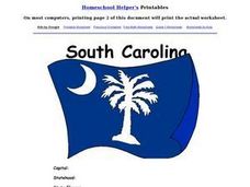
In this South Carolina worksheet, students examine a large color picture of the South Carolina state flag. After doing their own research, students fill in facts about the state: capital city, flower, tree, motto, date of statehood and...
Curated OER
Puerto Rico: The 51st State?
Students research the history of Puerto Rico, its culture, and geography. In this Puerto Rico lesson, students find Puerto Rico on a map and find specific regions or cities. Students discuss Puerto Rico's statehood and listen to salsa...
Curated OER
Match Capitals to Their States- Internet Activity
In this state capital matching worksheet, students use a given web site to match the name of each state with its capital. They use the names of the capitals that are located in a word bank at the bottom of the page when searching for...
Curated OER
American States and Their Capital- Test Your Research Skills Worksheet
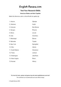
In this geography skills instructional activity, students match the American state listed on the left with its capital city listed on the right by drawing a line from one to the other.
Curated OER
California Here We Come!
A highly relevant and great cross-curricular project! In teams, your class will plot a course from the East Coast to Sacramento, California passing through all of the state capital cities along the way. As part of the journey, teams will...
Curated OER
Cartoons for the Classroom: Bipartisan Filibusters
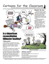
There is no doubt many changes or lack of changes are due to bipartisanism in the capital. Learners analyze a political cartoon that describes the issues surrounding changes to the current health care system, and consider whether...
Curated OER
States and Capitals, Mountains and Rivers
Students identify geographical locations in the midwestern United States. In this geography lesson, students identify 12 states and capitals and geographical features in the region by using U.S. maps. Students use blank maps to fill in...
Curated OER
The United States and Canada Review Worksheet and Study Guide
For this geography skills worksheet, students respond to 34 short answer questions about the geographic features and climates found in the United States and Canada.
Curated OER
Regions of the US: Gulf Stream, States and Their Capitals
Fifth graders identify one way of dividing the US into geographical regions and then consider alternate ways of doing the same. They locate each of the fifty states and their capitals on a map. They research the Gulf Stream region.
Curated OER
The Protestant Ethic and the Spirit of Capitalism
In this online interactive philosophy quiz worksheet, students respond to 20 multiple choice questions about Weber's The Protestant Ethic and the Spirit of Capitalism. Students may submit their answers to be scored.
Curated OER
State Facts- Internet Assignment
In this state facts Internet assignment instructional activity, students select a state to investigate using the given web site. They write the name of the state and find its capital, governor, constitution, industry, and other important...
Curated OER
US: Midwest Region
In this United States political map worksheet, students examine the state boundaries of the Midwestern Region. The map also highlights each of the state capitals denoted by stars.
Curated OER
US: Northeast Region Map
In this United States political map worksheet, students examine the state boundaries of the Northeast Region. The map also highlights each of the state capitals denoted by stars.
Curated OER
US: Northeast Region: Unlabelled
In this United States political map worksheet, students examine the Northeast Region state boundaries. The map also highlights each of the state capitals denoted by stars.
Curated OER
Geography: US States and Capitals Picture/Word #4- Trace the Words
In this geography instructional activity, 3rd graders trace sentences about the capital cities of 5 states. They write sentences about capitals about Topeka, Baton Rouge, and Annapolis.
Curated OER
Mapping the United States
For this map of the United States worksheet, learners label mountains, surrounding countries, oceans, and more. Students complete 12 tasks.
Curated OER
Geography A to Z: The Letter S
The letter S is the clue learners need to answer each of the seven geography questions on the worksheet. They answer questions about African, Canadian, Middle Eastern, and US geography using locations that begin with the letter S.
Curated OER
The Stock Market: Risks & Rewards
In order to better understand the US economy, learners read and interpret stock market price reports. They define profits and explain the role of profits in the American economic system for both firms and individual investors. Several...
Curated OER
Texas Worksheet
In this Texas worksheet, students examine a large color picture of the Texas state flag. After doing their own research, students fill in facts about the state: capital city, flower, tree, motto, date of statehood and what the state is...
Curated OER
State Poster Fair: US Geography, Social Science, Art
Students research a US state, design and construct a state 'poster' to display important facts about that particular state. They present their work to the class.
Curated OER
The 50 States
Fifth graders use maps and music to learn the 50 states. For this US Geography lesson, 5th graders map out a region of the United States and practice singing the song, The 50 States that Rhyme.
Curated OER
Wisconsin Snapshots
Fourth graders study Wisconsin's culture and heritage. They research the state's symbols and identify leaves common to the Wisconsin area. They create a leaf booklet and visit the state park. They visit local farms and create nature maps...
Curated OER
Knowledge Test #2 U.S. Capitals
In this knowledge test #2 U.S. capitals worksheet, students interactively enter the name of the capital when given the state, with immediate online feedback.
Curated OER
United States Geography: Crossword Puzzle
In this geography worksheet, students use the 14 clues in order to fill in the crossword puzzle with the appropriate United States geography answers.


