Curated OER
State Quizzes-Grades 3-6 State Quiz Elementary Education Lesson Plans
Here is an interractive, on-line lesson which allows learners to test their knowledge of the states. They have the opportunity to take quizzes on any of the 50 states. These quizzes determine the learners retention of important...
Curated OER
Our 50 States
Students identify the location of the 50 states using an interactive map. They practice geography skills by playing a fun game. Pupils become familiar with the state abbreviations for the US states. Students become familiar with the...
Curated OER
Name The States Worksheet 3
In this states worksheet, students analyze the shape of 5 US states. Students identify each state and write the name of the state and its postal abbreviation.
Freecloud Design
Stack the States™
Kids have fun learning US geography and state facts, including capitals, nicknames, major cities, and landmarks. They can choose between the game, or informational flashcards for each state.
Curated OER
USA Postal Abbreviations Map
In this United States political map instructional activity, learners examine the postal abbreviations of each of the states.
Curated OER
What's Your State Symbol?
Students explore their state symbols. In this symbolism lesson, students use a variety of resources to research the symbols that represent their state. Students discover the state flower, state flag, and state bird.
Student Handouts
Constitutional Principles
Keep track of constitutional principles with a graphic organizer. Pupils define, describe the origins of, and note down the location of the following terms: checks and balances, federalism, individual rights, limited government, popular...
Curated OER
United States Geography: Crossword Puzzle
In this geography learning exercise, students use the 14 clues in order to fill in the crossword puzzle with the appropriate United States geography answers.
Curated OER
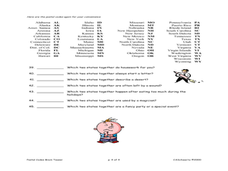
States Quizzes
In this state postal code activity, students respond to 45 fill in the blank questions that require them to use the listed state postal codes as answers.
Curated OER
Blank US Map
In this blank outline map activity, students study the physical boundaries of the 50 states that make the United States. This outline map may be used for a variety of geographic activities.
Curated OER
One Grain of Rice
Upper graders read the story One Grain of Rice, and use a Venn diagram to compare and contrast topics found in the story to current event topics today. Groups of three learners work together to create their diagram. The topics they must...
Curated OER
Name Count and Graph
Young scholars find the frequency of a name in selected states by using the Internet. They input data into a spread sheet. They create a graph that illustrates the gathered information.
Curated OER
Barack Obama Worksheet
In this President Barack Obama worksheet, students match 20 words pertaining to the life of our current President with the phrases and facts that go with them.
Curated OER
From Yosemite to Joshua Tree
Fourth graders discover diversity of plant and animal life in California's parks and compare findings to identify what makes park areas unique. Students then publish their discoveries in picture books of their own design.
Curated OER
Lewis and Clark: Reliving the Journey
Second graders explore Meriweather Lewis and iam Clark. They explore their contributions to history, and what their significance is in a timeline of Vermillion, South Dakota history.
Curated OER
B.C. or A.D.? That is the Question
Sixth graders create a time line using the conventions of B.C. and students will build an understanding of the conventions used to put the dates of historical events in order. This helps to put the historical events studied in order...
Curated OER
Latitude and Longitude
In this latitude and longitude worksheet, students complete 4 activities to demonstrate understanding. Students use a protractor to measure angles on a map of the earth. Students fill out a latitude and longitude chart after studying a...
Mocomi & Anibrain Digital Technologies
Mocomi: List of Us States and Capitals
Provides a list of 50 US states along with full names in alphabetical order with abbreviations, capitals, and respective population.
Other
United States Postal Service
As an independent agency of the government, the United States Postal Service homepage offers information on zip codes, address change, stamps, online billing, and variety of other topics.


