Curated OER
Where In The World?
Learners identify the goods and services from the United States and Mexico. Using postage stamps, they describe the various images they see and place them into categories. They use those categories to determine what is important in...
Curated OER
Stranded along the Coast
Students plot stranding sites onto a map using latitude and longitude as well as compass directions with respect to coastal features. They identify several species of marine animals that might become stranded; distinguish their...
Curated OER
Regions of the US: Gulf Stream, States and Their Capitals
Fifth graders identify one way of dividing the US into geographical regions and then consider alternate ways of doing the same. They locate each of the fifty states and their capitals on a map. They research the Gulf Stream region.
Curated OER
Ojala que viajemos a Mexico!
Students research the names and locations of Spanish speaking countries throughout the world. They use a world map to become familiar with the locations of these countries and use the Internet to conduct further research. They sing...
Curated OER
Third Grade Social Studies-Multiple Choice Activity
For this grade 3 social studies worksheet, 3rd graders complete a set of 25 questions about a variety of topics including geography, types of communities, map and questions about the environment.
Curated OER
Corn Exports Visually
Learners study imports and exports and the countries that import the most corn from the U.S. They construct mini paper corn plants and label a map with these plants to represent the amount of corn the U.S. exports to countries around the...
Curated OER
Cultural Lit. 19: Old Spanish Trail & Native Americans
Fifth graders name the American Indian people by tribe who lived in the lands which the Old Spanish Trail traversed. They investigate and describe some impacts of western expansion upon the American Indians.
Curated OER
Artifacts: Bringing the Past Back to Life -- the Mexican Case
Students examine and discuss the meanings of the various symbols in Tenochtitlan. In groups, they complete a part of the model of the city and discuss the importance of finding artifacts. Individually, they choose an a two-dimensional...
Curated OER
U.S. Place Names Show Our Diversity
Students study place names for different area in the US and determine why they were named in such a way. They examine maps to look at the religious names, "new" beginning names, and copy cat names. They complete a word search to find...
Curated OER
Aztecs Meet the Spanish
Students simulate an Independent Counsel to represent the Spanish and the Aztecs to formulate a policy for the Roman Catholic Church in 1527. They conduct research, graph the similarities and differences, create a poster, and write a...
Curated OER
The Expansion of The United States, 1846-1848
Students interpret historical maps,identify territories acquired by the United States in the 1840s. Also they identify states later formed from these territories. The primary sources for the lesson are the maps found in the lesson's...
Curated OER
Life on the Border
Students discuss different types of boundaries. They research the United States/Mexico border and answer questions about their findings. They create collages, posters, or multimedia presentations showcasing various areas of concern...
Curated OER
The First North Americans
Students identify and interpret the different North American Indian groups, by region, and the type and impact of their interaction with Europeans.
Then they complete an overview of one main Native American group during the age of...
Curated OER
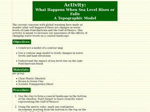
What Happens When Sea Level Rises or Falls
Students examine the impact of sea level on land formations. In this geography and map lesson, students construct a contour map model illustrating how much of the clay "coastline" is covered as water is added. Metric measurement is...
Curated OER
American Culture in a Musical Setting
Students discover the significance of similarities and contrasts of three separate cultures of the United States through music. They take out maps and trace the expedition of the Spanish along the coasts of Mexico and North and South...
Curated OER
The Four Corners Region of the United States Cultures, Ruins and Landmarks
Students who live in the inner city are introduced to the four corners region of the United States. In groups, they examine how the region differs compared to where they live and their culture. They develop maps of the area and locate...
Curated OER
Four Immigrant Groups: Their Lives and Music
Fourth graders examine the experiences of four immigrant groups. Class members brainstorm a list of misconceptions of those groups and discuss if these perceptions are still present today. Using maps, groups locate the countries of...
Curated OER
You Scratch my Back, I'll Scratch Yours
Students explore the concept of interdependence. In this integrated interdependence lesson, students interpret graphs and charts that require them to analyze the relationship between Mexico and the United States. Students also...
Curated OER
Geography of the United States
Students examine the population growth of the United States. In this Geography lesson, students construct a map of the fifty states. Students create a graph of the population of the USA.
Curated OER
Communications: To the Rescue!
Students role-play as soldiers rescuing lost mountain climbers. Working in teams, they interpret maps to locate the climbers and use flashlights to send and receive coded messages about the rescue. Their goal is to complete the task in...
Bismarck Public Schools
Chapter 9 Review WKST
Here is a traditional multiple-choice, true/false, and fill-in-the-blank assessment on the presidency of James Monroe in the United States. It was designed to supplement a particular textbook chapter, but could be used to assess learning...
Curated OER
Mississippi Under British Rule
Students construct appropriate maps to depict the following information: changes in European territorial claims as a result of the French and Indian War; boundaries of British East and West Florida; significant rivers and settlements of...
Curated OER
The Great American Desert
In this American deserts worksheet, students study the images and read the passages to learn about the 6 divisions in the American landscape: the Eastern lowlands, the Flood Plain, the Great Plains, the Rocky Mountains, and the Pacific...
Curated OER
An Excursion to Cities of Mysterious Pasts
Students use the encyclopedia sources on the computer or in the library to research the historic sites and history of Mexico City. They make notes of what they find to be the most interesting for their visit. They make a large map of...


