Other
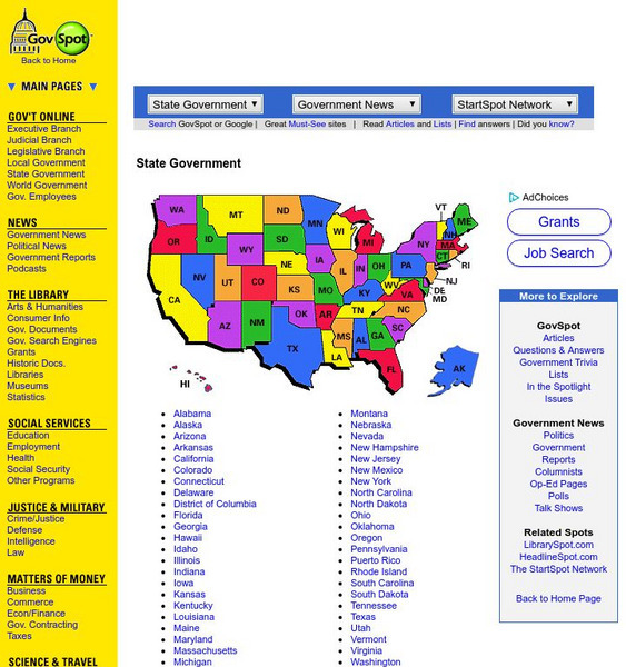
Govspot.com State Government
Govspot.com lists information for each state government's structure and elective and appointive offices.
CNN
Cnn Money: Debt Ceiling
This slideshow explains what the debt ceiling is and how it impacts the government of the United States.
Sophia Learning
Sophia: Principles of u.s. Government
Tutorial presents an introduction to the principles of the United States democratic government highlighting the differences and similarities between Roman and U.S. governments.
Other
Us Government: Fed Stats
This site shows charts, graphs, and information from more than 70 agencies in the United States Federal Government that produce statistics of interest to the public.
Virginia History Series
Virginia History Series: Virginia Becomes a State [Pdf]
Virginia played a pivotal role in the Revolutionary War and the creation of our new government. This slideshow uses pictures, graphs, and a detailed timeline showing the major events in Virginia from 1760-1800.
Curated OER
Etc: Maps Etc: United States and Confederate States, 1861
A map of the United States and Confederate States in 1861. The map is color-coded to show Free Union States, Slave Union States, Confederate States seceding before April 15, 1861, Confederate States seceding after April 15, 1861,...
Curated OER
Etc: United States During the Civil War, 1861 1865
A map of the United Stated during the American Civil War (1861-1865) showing State and territory boundaries, with dates of statehood for the territories from 1796 to 1861. The map is color-coded to show the Union States, Confederate...
Curated OER
Etc: Maps Etc: United States at the Outbreak of the Civil War, 1861
A map of the United States and territories in 1861 at the outbreak of the Civil War. The map is color-coded to show the Union Free States, the Confederate States seceded before April 15, 1861, the Confederate States seceded after April...
Other
New Hampshire State Library: World War Ii Posters
This site contains various posters the US Government used during World War II to raise nationalism and increase the armed forces.
Curated OER
California State Parks: Your Voice in Government
The California State Parks present an excellent unit to better understand how the United States government works. Through up to five lessons and a videoconference students will take a closer look into how our state representivies...
National Geographic
National Geographic: The Electoral College
Discover how the United States elects its president by using an Electoral College. A map shows how the Electoral College's 538 members are distributed throughout all fifty states and the District of Columbia.
North Atlantic Treaty Organization
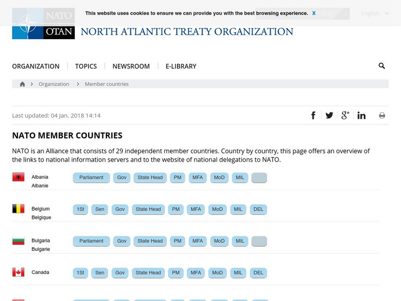
Nato: 19 Member Countries
Provides a list of all of the NATO countries along with links to their government sites. Users can find a vast amount of information about each of the member countries. A great resource for researching and learning about NATO or...
Curated OER
Wikipedia: Natl Historic Landmarks in Al: Government Street Presbyterian Church
This church was built in 1836 and is one of the oldest and least-altered Greek Revival church buildings in the United States. The architectural design is by James Gallier, James Dakin, and Charles Dakin.
Curated OER
Educational Technology Clearinghouse: Maps Etc: Flood Stations, 1916
A map from 1916 of the United States showing the cities where the government maintained flood stations at the time. "Reservoirs to hold back flood waters have been proposed, but their construction would be very expensive. The Weather...
Library of Congress
Loc: u.s. Presidents, First Ladies, Vice Presidents: Selected Images
This chronological archive presents photographs of American presidents. Also includes images of first ladies and vice presidents.
Other
Us District Courts
This is a comprehensive government site that links you to all of the district courts in the United States. It is easy to navigate and find necessary information. The large map helps you locate the district of your choice.
Curated OER
Etc: Maps Etc: Route of the Panama Isthmian Canal, 1904
A map from 1904 of the Panama Canal showing terrain relief of the isthmus, noting the 'Canal always follows the line of the Railroad’ from Colon to the city of Panama. "For generations the Panama Canal had been the dream of man and for...
Curated OER
Educational Technology Clearinghouse: Clip Art Etc: George B. Mc Clellan
George Brinton McClellan was born at Philadelphia, December 3, 1826. He was for two years a student in the University of Virginia, but in 1842 he became a cadet at West Point, where he was the youngest in his class. He made his mark,...
Curated OER
Educational Technology Clearinghouse: Clip Art Etc: John Ericcson
John Ericsson was born in Sweden, July 31, 1803. He early showed great inventive skill and was employed as an engineer in the Swedish service. He resigned in 1826 and went to England to introduce an engine he had invented. In 1829 he won...
Curated OER
Air Pollution
This article discusses how the United States is to blame for much of the world's pollution, along with some possible steps that could be taken by the government to reduce this.
Curated OER
Map: Imperialism and the Balance of Power
World maps of the Colonial Empires of 1914 as well as their revenues during that time period. There are also maps depicting urban growth, type of government, wars and atrocities, and living conditions of the world in 1900.
Curated OER
Map: Imperialism and the Balance of Power
World maps of the Colonial Empires of 1914 as well as their revenues during that time period. There are also maps depicting urban growth, type of government, wars and atrocities, and living conditions of the world in 1900.
Curated OER
Educational Technology Clearinghouse: Clip Art Etc: Charles Scott Todd
Charles Scott Todd (January 22, 1791 - May 17, 1871) was a United States army officer and government official. He was a subaltern and judge-advocate of General James Winchester's division in the War of 1812. In 1813, he was made a...
Curated OER
Etc: Oregon Trail and Other Routes, 1832 1842
A map of western North America between the opening of the Oregon Trail in 1832 to 1842, prior to the establishment of the Provisional Government of Oregon by American settlers in 1843. The map shows the boundary of the Oregon Country,...


![Virginia History Series: Virginia Becomes a State [Pdf] PPT Virginia History Series: Virginia Becomes a State [Pdf] PPT](https://d15y2dacu3jp90.cloudfront.net/images/attachment_defaults/resource/large/FPO-knovation.png)


