Curated OER
Learning the 50 States
Young scholars become familiar with all 50 states over the course of ten days.
Houghton Mifflin Harcourt
One Land, Many Trails: Challenge Activities (Theme 5)
Bring history to life through literature. The first in a series of three challenge activities designed to accompany Theme 5: One Land, Many Trails does just that through unique projects connected to historical fiction and nonfiction...
Houghton Mifflin Harcourt
One Land, Many Trails: Extra Support Lessons (Theme 5)
Grammar, vocabulary, and comprehension strategies are all part of the journey toward understanding a text. The last in a series of three extra support lessons designed to accompany Theme 5: One Land, Many Trails provides a wealth of...
Curated OER
US Energy Geography
The maps display the statistics for energy consumption and power production, state by state. They are tremendous visual aids for your natural resources unit. Consider having your class compare energy consumption versus production, or...
Texas Education Agency (TEA)
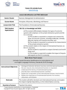
Foundation of International Business
Scholars work in teams to research the geography, economic conditions, and cultural factors associated with conducting business in another country. They create a PowerPoint to show what they've learned, and then design a brochure with...
Anti-Defamation League
"What is it Like to be an Outsider?”: Building Empathy for the Experiences of Immigrants
This lesson highlights the struggles of immigrants and the importance of showing empathy. Beginning with a read-aloud of a book in another language and a poem, scholars take part in a thoughtful discussion. Then, the class examines a...
Curated OER
Arbor Day Across the United States
Students perform research about hardiness zones used to guide planting. They read a hardiness zone color-key map and create their own color-key maps to show when different states celebrate Arbor Day.
Curated OER
United States & Canada: How Are We The Same? How Are We Different?
Students compare and contrast similarities and differences between Canada and the US. In this geography lesson plan, students read various articles and identify similarities and differences in economies, cultures, geography,...
Curated OER
The Geography of Europe
Students examine maps of Europe. In this geography skills lesson, students interpret several maps to determine the boundaries of the European Union and respond to assessment questions about the maps.
Curated OER
Nevada, A to Z
Fourth graders explore U.S. Geography by reading a timeline. In this Nevada history lesson plan, 4th graders identify the geographic location of Nevada and discuss the history. Students read the book S is for Silver: A Nevada Alphabet...
Curated OER
Las Vegas: We Are Just Like You
Students practice making multimedia documentary films by investigating cities of America. For this U.S. geography lesson, students examine Las Vegas and compare the state of Nevada to 15 other states and discuss their main...
Curated OER
Know Your Area
Young scholars investigate transit by analyzing their school surroundings. In this local geography lesson, students identify their school in relation to the rest of their state, country and globe. Young scholars discuss their personal...
Curated OER
Living Swamps, Bayous and Forests
Third graders explore interesting environments by exploring Louisiana. In this wetland lesson, 3rd graders utilize the web to research the State of Louisiana, the bayous in the area, and the Gulf of Mexico. Students write a journal entry...
Curated OER
Expanding the Mission: Historical Parks
Students explore U.S. geography by viewing a documentary in class. In this national parks lesson, students view video clips of individual national parks and locate them using Google Earth software. Students create a persuasive...
Curated OER
Let's Discover Texas!
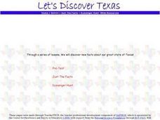
Students begin the lesson by taking a pre-test on their prior knowledge of the state of Texas. In groups, they participate in various activities to examine the geography, history, climate and vegetation of the state and record their...
Curated OER
Mapping West Virginia
Fourth graders explore West Virginia. In this Unites States geography lesson, 4th graders discuss the type of land and the cities in West Virginia. Students create two overlays, with transparencies, that show the natural land and the...
Curated OER
How did Geography Affect the Economy of the Colonies
Eighth graders examine the impact of geography on a region. In this geography lesson, 8th graders study the themes of geography. Students write an open response to a question.
Curated OER
Geomnemonics: Facilitating the Teaching of Social Studies Content with Geography Skills
Students explore how to draw a world map by hand and how to locate countries.
Curated OER
The Crash Scene
Fifth graders explore geography by participating in a mapping activity. In this engineering instructional activity, 5th graders identify the differences between latitude and longitude and practice locating precise points on a globe or...
Curated OER
Train Of States
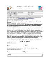
Fourth graders create a class book with information about each of the United States. After students draw a state name out of a hat, they use various resources to fill in a facts chart about their state. Students draw the state flag and...
Curated OER
Great Explorers
Students research an explorer and present a multimedia presentation on the explorer. In this United States explorers lesson, students watch a video about Lewis and Clark. Students use Google Earth to study their journey and keep a KWL...
Curated OER
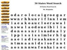
50 States Word Search
In this fifty states worksheet, students identify and locate all fifty states of the United States of America. There are 50 states located in the word search.
Education World
Edible Resource Maps!
Young scholars discuss resource maps and examine examples from library resources. Working in groups, they create edible resource maps by drawing examples, such as popcorn on the border of Iowa and Nebraska. Then they use cookies in the...
Curated OER
American Symbols and Figures
Students examine a variety of symbols important in American culture. They investigate the history of the Great Seal of the United States and the painting "The Spirit of 1776". They create an original seal and identify important monuments.
Other popular searches
- United States Maps
- United States Maps Regions
- Northeast United States Maps
- 50 United States Maps
- Create United States Maps
- Western United States Maps
- Custom United States Maps
- Outline Maps United States
- Blank United States Maps
- United States Landforms Maps
- United States Geography Maps
- United States Political Maps


