Curated OER
Geography of China (Tibet): Dalai Lama Day Three of Five
Sixth graders research another culture. In this geography and culture lesson, 6th graders read about the geography of Tibet, compare the United States and Tibet, use various resources to research information about Tibet and discuss...
Curated OER
Community Treasures (Rivers and Trees): An Integrated Curriculum Unit
Third graders demonstrate an understanding of geography and its effects on lifestyles and culture. Then they apply basic economic terms and principles
and identify the United States government and history. Students also identify and...
Curated OER
Afghanistan Today: Civil War and Human Rights
High schoolers examine the relationship between the United States and the Soviet Union during the Cold War. They analyze the role of religion and cultural identity in shaping governments. They also examine the United States foreign...
Curated OER
US Geography, The Blues
This instructional activity enables teachers to use blues styles and performers to think about various geographical regions of the United States. By studying different blues styles from the Mississippi Delta, Texas, and the Piedmont...
Curated OER
U.S. Geography for Children
In this U.S. map activity worksheet, students observe maps of the continental United States, Hawaii, and Alaska, locate and label landforms and bodies of water, and create symbols for natural resources and places of interest. Students...
Curated OER
Postmark U.S.A.
Students identify and collect postmarks from across the United States. They develop a list of ways to collect postmarks, display the postmarks on a large U.S. map, and find the exact location using MapQuest.
Curated OER
They Were Born Where?
Students assess where the presidents of the United States were born and analyze the role of geography in determining the outcome of presidential elections. They create graphs visualizing the birth and home states of the presidents along...
Curated OER
U.S. Archaeological Sites: Geography Practice
In this archaeological sites worksheet, students read about sites in the Unites States and use a map to complete a set of 7 short answer questions.
Curated OER
State Capitals Quiz- Social Studies Geography Lesson Plan Grades 3-6
Students take an online multiple choice quiz on the state capitals. There are fifty multiple choice questions. After the quiz is over, students can print out the results.
Curated OER
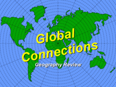
Global Connections Geography Review
In this beginning world geography PowerPoint, students answer basic questions about continents and oceans, as well as land and water that surround or can be found in the United States. Correct responses earn a mark on the...
Theodore Roosevelt Association
Roosevelt's Legacy: Conservation
The legacy of Theodore Roosevelt carries through modern American politics, economics, foreign policy, and society. But his proudest and most profound efforts were in the world of conservation, and in preserving the natural beauty of...
Curated OER
Ancient Greece and Ancient Rome Unit Plan
Students make two T charts, one for Sparta and one for Athens, showing pros and cons for living in either city-state. They use the physical information from the map and the cultural captions given for Athens and Sparts to come to their...
National Endowment for the Humanities
“The Great Migration” by Minnie Bruce Pratt
Minnie Bruce Pratt's poem, "The Great Migration," offers young scholars an opportunity to reflect on how where we come from influences who we are. Groups conduct a close reading of the poem, recording observations about the poem's...
Mr. Nussbaum
Abraham Lincoln Reading Comprehension—The Presidential Years (Part 1)
Hail to the Chief! Your class learns about Abraham Lincoln winning presidency and choosing cabinet advisors through a reading passage and paired multiple choice questions. The resource offers great practice for state tests and...
Ms. Catsos
Ancient Rome Map Worksheet
It wasn't just the great leaders of ancient Rome that shaped their civilization—the geography of the region played a major role as well. After first identifying major land masses, bodies of water, and city states on a map of Europe,...
Curated OER
Puerto Rico: The 51st State?
Students examine the political status of Puerto Rico. In this global studies lesson, students explore Puerto Rico and consider the feelings of Puerto Ricans regarding their unique political status.
Curated OER
Geography Journey
Fourth graders examine the geographic features that define places and regions and answer questions about the state of California. They discuss the components of a map legend and answer worksheet questions using a map of California as a...
Curated OER
Geography and Topography, History and Architecture
For this social studies lesson plan, students answer short answer questions about the geography, topography, history, and architecture of the east part of the United States. Students complete 24 questions.
Curated OER
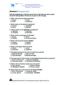
Worksheet 1: Geography Quiz
Students take a geography quiz and circle the multiple choice answer that answers each question correctly. The quiz is quite-challenging, and an atlas may be required to help the students. An answer sheet is provided.
Curated OER
The Geography of Russia
In this geography of Russia learning exercise, students read a 4 page article about the geography of Russia and complete short answer questions and assignments based on the article. Students complete 6 assignments.
Curated OER
U.S. Geography for Children: State Capitals
In this United States map skills worksheet, learners locate and label specified states and their capitals, and create icons and a map key to show something for each state that is famous. Students answer 5 questions.
Curated OER
U.S. Geography for Children: The Northeast
In this map skills of the northeastern United States worksheet, students observe an outline map, locate and label the states, and designated landforms and bodies of water; and create symbols and a map key for sources of economy and other...
Curated OER
U.S. Puzzle Map Bulletin Board
Students create cutouts of each state. They research different states noting their similarities and differences. They describe each state's location in relation to the state's surrounding them.
Curated OER
USA: Physical Map
In this United States physical map worksheet, students investigate the major landforms and bodies of water located throughout the country.
Other popular searches
- United States Maps
- United States Maps Regions
- Northeast United States Maps
- 50 United States Maps
- Create United States Maps
- Western United States Maps
- Custom United States Maps
- Outline Maps United States
- Blank United States Maps
- United States Landforms Maps
- United States Geography Maps
- United States Political Maps


