Curated OER
U.S. Political Map
For this political map worksheet, students use the map of the United States and the 7 cities to measure the straight-line distance between the cities. Students add the total number of miles traveled and write their answers in the spaces.
Curated OER
The Branding of America (And Your State)
Young scholars investigate about the origins of some major U.S. brands. They explore local products that stimulate the economy. Students create a map showing where those products originate. Young scholars discover the products that their...
Curated OER
Capitals, Oceans, And Border States
Students investigate geography by completing games with classmates. In this United States of America instructional activity, students examine a map of North America and identify the borders of Mexico and Canada as well as the Pacific and...
Curated OER
Maps Can Help Us
First graders explore the geography of Montana by analyzing geographic maps of the area. In this Native American reservation lesson, 1st graders discuss the similarities and differences between reservations in the state of Montana....
Curated OER
USA States and Capitals
Fifth graders explore U.S. geography by completing a map identification activity. In this states and capitals instructional activity, 5th graders examine a map of all 50 U.S. states and identify them as well as their capital cities....
Curated OER
U.S. Geography: The Northeast
Students investigate U.S. Geography by creating a map in class. In this natural resource lesson, students create a map of the United States and research the Northeast based on their resources and recyclable materials. Students...
Curated OER
Map Directions and the United States
Third graders search TDC database for images of a compass rose, a miles marker, and a US map. They identify cardinal and intermediate directions to help identify their state and other states on a US map.
Curated OER
Arkansas History Lesson Plan: Identifying Arkansas on a Map
Students investigate their hometown of Arkansas. In this U.S. Geography lesson, students identify Arkansas on a map and distinguish it form the other states. Students investigate the history, state line, and personal...
Curated OER
Where is Kansas?
Students explore U.S. Geography by analyzing a map. For this state vs. country lesson, students utilize a U.S. map and locate the state of Kansas before researching the history and customs of the state. Students collaborate as a class to...
Curated OER
A Treaty Tail: U.S. - Indian Treaty Councils in the Northwest
Students view a painting as a document to find out about the Indian Treaty Councils. In this artist's perspective instructional activity, students study the conflicts as shown in various pictures. Students answer questions...
Curated OER
Our Land Lesson 2: Song Mapping
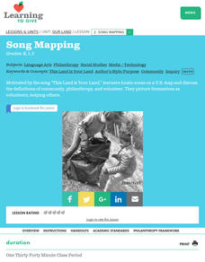
Students study the meaning of philanthropy as giving of time. talent, and treasures. They sing This Land Is Your Land while locating five of the places on a map of the United States showing that relief office are everywhere. They decide...
Curated OER
States And Shapes
Students work together and investigate the shapes of 50 states. They identify the states that they find hardest to recognize. The group then list the states in order from most difficult to just difficult to recognize and create a...
Curated OER
"History of My Family"
Young scholars explore world geography by participating in a family history project. In this U.S.S.R. instructional activity, students read assigned text regarding the Stalinist era of Russia and the intolerance that thrived there. Young...
Curated OER
Texas, Our Texas
Students explore U.S. geography by completing a coloring activity in class. In this Texas history lesson, students utilize the web to locate Texas on a map of the U.S. Students view a PowerPoint presentation which showcases the state...
Curated OER
Song Mapping
Young scholars explore locations on the United States map. In this map skills lesson, students recite the song This Land Is Your Land and locate various places listed in the song on the map.
Curated OER
States with Attitude, Latitude and Longitude Dude
Sixth graders identify states whose boundaries are formed by lines of latitude and longitude or natural borders such as rivers. They trace a map of the U.S., and fill in borders, rivers and lines of latitude and longitude.
Curated OER
Expanding the Mission: Historical Parks
Students explore U.S. geography by viewing a documentary in class. In this national parks lesson, students view video clips of individual national parks and locate them using Google Earth software. Students create a persuasive...
Curated OER
Landmarks of the Underground Railroad
Students explore Civil Rights by reading several books in class. In this Underground Railroad lesson, students discuss The Story of Henry Box Brown and identify the location and functionality of the Underground Railroad. Students answer...
Curated OER
Flower Power
An engaging, multi-session art and science lesson awaits your class. Within this lesson, you'll find everything you need to implement the plan. They go on a nature walk around their school, and must identify many living and non-living...
Curated OER
Popcorn Geography
Students use kernels to create a "Top Corn-Producing States" map or graph. They read and round off numbers. Students identify on a U.S. outline map the location of corn-growing states. They create a visual (map or graph) illustration...
Curated OER
Mapmaker, Make Me a Map!
Learners are introduced to the state quarter program and examine the Colorado state quarter. They locate Colorado on a map and create a map with a key. They discuss the state motto and examine pictures of the state's geographical features.
Curated OER
Trading Traditions: Based on the American Samoa Quarter Reverse
Young scholars investigate U.S. Currency by researching American Samoa. In this monetary unit lesson plan, students define the reverse and obverse of a coin while completing a currency related worksheet. Young scholars...
Curated OER
The Desert Alphabet Book
Young scholars explore world geography by researching a science book with their classmates. In this desert identification lesson, students utilize a U.S. map to locate the geographical locations of deserts. Young scholars create an oral...
Curated OER
The Battle of Lexington
Students discover the Missouri River and its importance during the Civil War. In this U.S. history lesson plan, students examine a map of the great Battle of Lexington, and discuss why the Missouri River was a key element to the...


