Curated OER
Salmon Stories
Work on author's purpose with this lesson, which focuses on sequence of events and audience as well. Middle and high schoolers describe the 50 State Quarters Program for background information. After discussing the images on the...
Curated OER
Spy the Flycatcher
Explore the symbols and special features of Oklahoma. By focusing on Oklahoma's state bird, the flycatcher, learners identify similes, write metaphors, and answer questions about this famous state symbol.
Curated OER
Survey of the Louisiana Purchase in 1815
Students explore the survey of the Louisiana Purchase by creating their own surveying and mapping techniques such as natural maps, pace maps, and orienting. Other students then try to follow the maps.
Curated OER
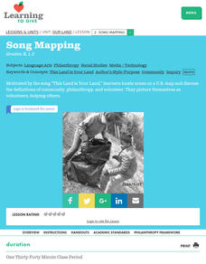
Our Land Lesson 2: Song Mapping
Students study the meaning of philanthropy as giving of time. talent, and treasures. They sing This Land Is Your Land while locating five of the places on a map of the United States showing that relief office are everywhere. They decide...
Curated OER
About the U.S.A.
Students research the United States and discover its different climate zones, geographical features, animal life, and various cultures. Students complete a research chart using books, encyclopedias and the internet and present their...
Curated OER
U.S. geography for Children: New York
In this geography worksheet, 5th graders study the state of New York. Students follow the given directions to complete 5 tasks on the state map that is given.
Curated OER
States And Shapes
Students work together and investigate the shapes of 50 states. They identify the states that they find hardest to recognize. The group then list the states in order from most difficult to just difficult to recognize and create a...
Curated OER
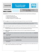
The Weather Page-Comparing Data
Students examine weather patterns in the United States. In this weather lesson, students use a United States map to identify high and low temperatures in two states. Students compare the data and record their findings onto a chart.
Curated OER
Reshaping the Nation
Young scholars learn why the census makes a difference. In this U.S. Census lesson plan, students learn how to read and use a cartogram while they explore new ways to represent data.
Curated OER
"History of My Family"
Young scholars explore world geography by participating in a family history project. In this U.S.S.R. instructional activity, students read assigned text regarding the Stalinist era of Russia and the intolerance that thrived there. Young...
Curated OER
Denali Park Topographic Maps
Students construct a topographic map of the Denali National Park. They identify different elevations and record historic landmarks in student science journals.
Curated OER
National Parks
Students conduct research on the U.S. National Parks. They conduct Internet research, analyze maps, and create and solve riddles that present specific clues pertaining to a selected national park and it's location.
Curated OER
Necessity is the Mother of Invention
Students research the Industrial Revolution. In this Industrial Revolution lesson plan, students research on the Internet, with books, magazines, fill out worksheets, and more to learn about inventions that were made out of necessity or...
Curated OER
Mapping Your State's Role in the Vietnam War
Students recognize reasons to celebrate Memorial Day. Students create a map of victims of the VIetnam War. Using the internet, students research information about soldiers from their state who were killd in action in Vietnam. Students...
Curated OER
Map-A-Buddy
Middle schoolers investigate the concept of tracking and spatial movements of animals in relation to the environment in which they live. They participate in an interactive activity by tracking one another over a pre-defined region,...
Curated OER
Facts, Fictions and Perceptions of Regions
Learners examine the different characteristics of the regions of the United States. They discuss places they have visited in the U.S., and in small groups conduct research on a selected region of the U.S. Each group labels a map of...
Curated OER
Texas, Our Texas
Students explore U.S. geography by completing a coloring activity in class. In this Texas history lesson, students utilize the web to locate Texas on a map of the U.S. Students view a PowerPoint presentation which showcases the state...
Curated OER
Song Mapping
Young scholars explore locations on the United States map. In this map skills lesson, students recite the song This Land Is Your Land and locate various places listed in the song on the map.
Curated OER
Mystery State #26
In this mystery state learning exercise, students answer five clues to identify the state in question. They then locate that state on a map.
Curated OER
Mystery State #10
In this mystery state worksheet, students answer five clues to identify the state in question. They then locate that state on a map.
Curated OER
MAKING CONNECTIONS WITH MAPS
Students define choropleth map. They construct a choropleth map. They interpret a choropleth map. They present geographic information.
Curated OER
USA State Tag / Mississippi River Shuffle
Students are given the opportunity to play a tag game while studing geographical sites in the U.S.A. (relative to the Mississippi River or to other geographic features you may choose).
Curated OER
Colonial Vacation Planner
Looking for a good lesson plan on the Colonial Period for your upper-elementary class? Then, this lesson plan is for you! They use website designs, U.S. travel publications, and maps to plan a family vacation to states which were part of...
Curated OER
Traveling Cat Flown Home to Family
Students locate Wisconsin and Belgium on a world map, then read a news article about a cat that stowed away on ship from the U.S. to Europe. In this current events instructional activity, the teacher introduces the article with map and...
