Curated OER
Naming the States of the U.S
Fifth graders study the 50 states on a map. In this social studies lesson, 5th graders identify the names of the states and location. Additionally, students work in small groups to name and locate as many states as they can on a blank...
Curated OER
The Branding of America (And Your State)
Young scholars investigate about the origins of some major U.S. brands. They explore local products that stimulate the economy. Students create a map showing where those products originate. Young scholars discover the products that their...
Curated OER
Journey Across the USA with Oliver K. Woodman
Challenge your class with this lesson focusing on the fifty states. Learners use ArcMap to show the route the main character in the story Journey of Oliver K. Woodman took across the United States. Then, they write journal...
Library of Congress
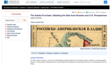
The Alaska Purchase: Debating the Sale from Russian and U.S. Perspectives
Seward's Folly or brilliant strategic move? Class members investigate primary source documents from each country to determine the rationales behind the sale and purchase of Alaska, and then stage a debate.
Curated OER
Capitals, Oceans, And Border States
Students investigate geography by completing games with classmates. In this United States of America instructional activity, students examine a map of North America and identify the borders of Mexico and Canada as well as the Pacific and...
Curated OER
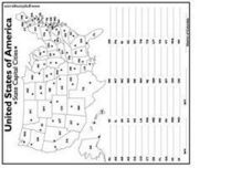
United States Capital Cities
In this identifying the United States Capital cities instructional activity, students use a United States map and a list of state abbreviations to write each state' s and the District of Columbia's capital city. Students write 51 answers.
Curated OER
Size It Up: Map Skills
Compare information from a US population cartogram and a standard US map. Learners draw conclusions about population density by analyzing census data a population distribution. They discover that census data is used to apportion seats in...
Curated OER
Mapping America
While learning about the Louisiana Purchase, pupils practice map skills. This motivating lesson has them answer questions about the Louisiana Territory and the United States. It provides a quick and easy way review of skills and the...
Curated OER
Food on the Map
Students work together to examine the tastiest towns in the United States. After discovering the names of the equipment, they identify the seven continents. They take a survey and locate the cities and states of the foods mentioned.
Curated OER
A State By Any Other Name
Learning about the fifty states can be motivating. After listening to books, pupils discuss and learn about the nicknames of various states. This is an interesting way to review the locations and characteristics of the states.
Curated OER
Maps
Maps, globes, and computer software aid young explorers as they locate state capitols, major cities, geographic features, and attractions for states they are researching. They then use desktop publishing software to create a map to share...
Curated OER
Volcanic Activity in the U.S.
Students locate and map ten volcanoes in United States, create chart comparing volcanoes by last eruption, type of volcano, location, and interesting fact, and create Powerpoint slide show describing basic
information about volcanoes and...
Curated OER
Maps Can Help Us
First graders explore the geography of Montana by analyzing geographic maps of the area. In this Native American reservation lesson, 1st graders discuss the similarities and differences between reservations in the state of Montana....
Curated OER
Mapping the Most Common U.S. City Names
Students discuss the most common U.S. place names. They map the locations of U.S. cities with the most common names and use an atlas, or an online map tool such as MapQuest or Yahoo Maps.
Curated OER
USA States and Capitals
Fifth graders explore U.S. geography by completing a map identification activity. In this states and capitals instructional activity, 5th graders examine a map of all 50 U.S. states and identify them as well as their capital cities....
Curated OER
US: Western Region Map
In this U. S. Western Region outline map worksheet, students examine boundaries of each of the states and the placement of the capital cities. This map is not labeled.
Curated OER
U.S. Geography for Children: Michigan
In this Michigan map activities worksheet, students observe an outline map of the state of Michigan, locate and label specific places and areas, and create a map key. Students complete 5 activities.
Curated OER
U.S. Geography: California
For this map skills about the state of California worksheet, learners locate and label specific places and areas and create a map key and symbolize the economy and areas of personal interest. Students answer 5 questions.
Curated OER
U.S. Geography: The Northeast
Students investigate U.S. Geography by creating a map in class. In this natural resource lesson, students create a map of the United States and research the Northeast based on their resources and recyclable materials. Students...
Curated OER
South Carolina State Map
In this map of South Carolina learning exercise, students color and label major cities and physical features in South Carolina. There is also a map showing the location of the state in the U.S.
Curated OER
Culture Regions of the U.S.
Learners identify the location of different cultural groups within the United States (agricultural, retirement, urban, etc.) They map these areas and analyze the correlation between the landscape of a given region and the type of...
Curated OER
U.S. History: de Soto's Alternate Route
Eighth graders examine various maps associated with Hernando de Soto's expedition. By comparing their textbook maps with newer maps, they answer a battery of focus questions. Using Microsoft Word, 8th graders answer the questions...
Curated OER
Build a U.S. Strategy for Responding to the Crisis in Sudan
Students work together in groups to discover the situation in Sudan. They discuss what problems arise from helping a foreign country. They answer questions and watch a video as well.
Curated OER
Teaching Six Big Ideas in the Constitution
Students debate the constitutional principles of the United States. For this U.S. government lesson, students examine the meaning of the text of the U.S. Constitution and analyze other primary documents of the era. Students prepare for...


