Curated OER
Mystery State #8
For this mystery state worksheet, students answer five clues to identify the state in question. They then locate that state on a map.
Curated OER
Mystery State #47
In this mystery state worksheet, learners answer five clues to identify the state in question. They then locate that state on a map.
Curated OER
People and Parks in the U.S.A.
Fifth graders explore the National Parks in the United States. After locating specified states, 5th graders predict which states have the most National Parks. Given the population of each state, students determine the average acre per...
Curated OER
Establishing Borders: U.S. Expansion
Learners interpret historical maps and locate territories annexed by the United States in the 1840. In groups, they research the war with Mexico over Texas from both perspectives and answer on a worksheet about expansion.
Curated OER
Attu Battlefield: U.S. Army and Navy Airfields on Attu
Students use maps, readings, drawings and photos to research the World War II Battle of Attu. They explain the importance of the battle, discuss the valor and loyalty of both American and Japanese troops and analyze sources of historical...
Curated OER
Chinese, Japanese, & Korean Immigration to the U. S.
Students study immigration of people from Southeast Asian countries to the United States. Pupils create maps and geographically illustrate the immigration. Using the internet, students research an assigned topic. They write an essay...
Curated OER
Comparing Time Periods in U.S. History: The Ashford Project
Fifth graders use a "fact book" comparing periods in American history then students create a picture to illustrate their assigned periods. # # students use their pictures and concept maps to write expository paragraphs about their...
Curated OER
How Acid Rain is Measured and Monitored in the U.S.
Explain how acid rain is measured. They discover how acid rain is monitored in the United States. They compare locally measured pH or rain with that of Great Smoky mountains. They perform Ph tests on rainfall they collect.
Houghton Mifflin Harcourt
Surprise!: Extra Support Lessons (Theme 2)
Surprise! is the theme of a unit covering such topics as consonants, blending, short vowels sounds, high frequency words, and number words. The unit's lessons also include teachable moments covering story structure, illustrations,...
US Environmental Protection Agency
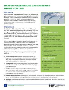
Mapping Greenhouse Gas Emissions Where You Live
After investigating the US Environmental Protection Agency's climate change website, your environmental studies students discuss greenhouse gas emissions. They use an online interactive tool to look at data from power production...
Curated OER
Minnesota-China Connections:What Time Is It?
Learners calculate the time difference between Beijing, China and their local community. They discuss how time difference affects intercultural communication.
Curated OER
The War of 1812
A good addition to a unit on the War of 1812, this slideshow details causes, specific battles, political contexts, and several campaigns of the war. Maps and pictures with broad topics allow teachers to bring their own discussion topics...
Curated OER
The Louisiana Purchase: Worksheet
Celebrate the anniversary of one of the United States' most important land acquisitions with a fun activity. The class answers five matching questions related to those involved with the Louisiana Purchase and then think about what life...
Curated OER
The Brief American Pageant: The Stormy Sixties
Intended for use with The American Pageant by David Kennedy, Lizabeth Cohen, and Mel Piehl, this slideshow includes maps and graphs that detail politics and social dynamics in 1960's America. The textbook is not necessary for...
Curated OER
Follow the Light
Young scholars investigate the role of lighthouses in navigation and practice the use of cardinal directions through reading activities, discussion, locating geographical features, and mapping lighthouses along the east coast of the...
Curated OER
People On The Move
Students describe patterns of internal migration in the United States, past and present and evaluate implications of internal migration. They examine population movement at the state and local levels.
Curated OER
Trout across America
Students research trout and salmon and create a report. In this trout and salmon lesson plan, students research where trout live in the United States, fill out a graphic organizer, and create a report on their findings.
Curated OER
Our Country's Geography
Third graders study geography. In this United States landforms lesson, 3rd graders create a map of the U.S. made out of dough. They use various edible treats to mark the country's capital, the plains, the mountains and the rivers &...
Curated OER
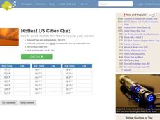
Hottest US Cities Quiz
In this online interactive geography quiz learning exercise, students respond to 20 identification questions about the hottest cities in the United States. Students have 4 minutes to finish the timed quiz.
Curated OER
End of the Line: What Happened to the Blue Ridge Railroad?
Sixth graders study the westward expansion and the role of railroad construction to the expansion. In this railroad history lesson, 6th graders complete KWL activity for the topic. Students view a PowerPoint about the growth of railroads...
Curated OER
American Symbols
Learners explore the symbols of the United States. In this U.S. history lesson, students create an American flag puzzle and research facts on the flag. Learners view a Powerpoint presentation on other symbols of America.
Curated OER
High Five Burger
Fifth graders investigate agricultural sources. In this agricultural instructional activity, 5th graders read the book Have a Hamburger and See the U.S.A. and record each component of a hamburger. Students use a map of the U.S.A. to...
Curated OER
Field Trip to Mammoth Cave
Students, when given a microscope or a camera, write two observations they have seen using technology that they did not see with just their eyes with 100% accuracy. When given a blank map, they mark the location of Mammoth Cave along...
Curated OER
Export-Import Game
Students recognize how international trade affects them as consumers and become familiar with basic agricultural crops grown in Kentucky. They identify items used in their daily lives and .heir place of origin and examine export/import...


