Curated OER
Cardinal Directions
First graders study cardinal directions on maps. In this geography lesson, 1st graders determine and show where North, South, East, and West are on various maps.
Curated OER
It's Time to Rhyme
Students listen to rhyming book, identify rhyming pairs, guess what rhyme words mean, and create list of rhyming pairs on chart paper. They then discuss Fifty States Quarters Program, identify objects on backs of state coins, and...
Curated OER
Extreme Weather and Mapping
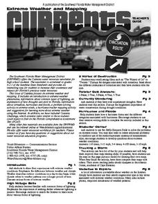
For this environment worksheet, students read an article about extreme weather conditions and mapping it out. They respond to 10 multiple choice questions about what they read. Then, students explain how droughts can occur and the...
Curated OER
Constitution Lesson Plan
Third graders identify roles of Declaration of Independence and U.S. Constitution in establishing new country, create posters with their ideas about each part of Constitution, and explain three branches of government, including their...
Curated OER
Mapping Where Animals Live
In this animal mapping instructional activity, students read a short passage about amphibians and reptiles in New York State, then use a set of maps to answer related questions.
Curated OER
To Be Or Not To Be a State? That Is the Question
Eighth graders research Puerto Rico's culture, religion, language, government, etc. and identify differences and similarities with the United States. They participate in a debate about whether or not Puerto Rico should become a state.
Curated OER
Community, State, Country
First graders identify the town, county, state, and country in which they reside and the places where people work. They draw a picture of one of the places where people work.
Curated OER
Planning A Railroad Online Lesson
Students plan a route across Donner Summit using topographical maps in order to understand the challenges involved in constructing the railroad in the Sierra Nevada Mountains. In this history lesson, students first discover how to read...
Curated OER
Know Your Area
Students investigate transit by analyzing their school surroundings. In this local geography lesson, students identify their school in relation to the rest of their state, country and globe. Students discuss their personal travel habits...
Curated OER
The Kansas State Capitol
Second graders research the Kansas state capitol building. In this historical landmark lesson, 2nd graders explore the Kansas state capitol. Over three days students explore the Governor's office, Senate and House of Representatives, and...
Curated OER
Living Swamps, Bayous and Forests
Third graders explore interesting environments by exploring Louisiana. In this wetland lesson, 3rd graders utilize the web to research the State of Louisiana, the bayous in the area, and the Gulf of Mexico. Students write a journal entry...
Curated OER
Overland Trails To The West
After observing a map of trails that settlers took in the 1800s, your class will write a journal with the perspective of a settler. In their journals, they must describe the trail they traveled, geographical features they saw, states and...
Curated OER
Tears of Joy Theatre Presents Anansi the Spider
Accompany the African folktale, Anansi the Spider, with a collection of five lessons, each equipped with supplemental activities. Lessons offer multidisciplinary reinforcement in English language arts, social studies, science,...
Advocates for Human Rights
Refugees and Asylum Seekers
To gain a deeper understanding of the plight of refugees and asylum seekers, class members read stories written from the point of view of an emigrant, map the individual's journey, and note the human rights affected by each stage of the...
Curated OER
Fort Jackson and Fort St. Phillip
Review the history of Fort Jackson and Fort St. Phillip during the American Civil War in this informative PowerPoint. Included in this presentation are interesting facts, photos, and maps to increase student understanding of these...
Curated OER
Find a Cave
Students locate their own communites and the nearest caves on a United States map. They calculate the distance to the nearest cave using rough scale.
Curated OER
Wow! You're Eating Geography
Young scholars examine patterns of food producing areas, and identify foods that are grown locally, in the U.S., and around the world. They map and graph the major food crops of their local area, the U.S., and other countries, and...
Curated OER
Where Do I Live?
Students gain a better understanding of the population of the region they live in by comparing U.S. census data on the internet.
Curated OER
Where Do People Move To Or From?
Students identify countries of origin of their ancestors, graph patterns of migration to the U.S. and Hawaii, then utilize oral history as a primary document by interviewing their ancestors or parents to explain why they moved to their...
Curated OER
Using Maps to Uncover a Soldier's Life
Students investigate maps to examine the life of a Confederate soldier based on troop movements as well as letters and diaries.
Curated OER
Alaska the Elephant
Students explore an Internet website, locating and matching the shape of an elephant's head to a state in the U.S. They complete an Alaska worksheet, identifying other geographical locations surrounding Alaska.
Curated OER
Geography and Topography, History and Architecture
For this social studies lesson plan, students answer short answer questions about the geography, topography, history, and architecture of the east part of the United States. Students complete 24 questions.
Curated OER
Establishing Borders: The Expansion of the United States 1846-48
Students investigate how the United States acquired land after the Revolutionary War ended. In this establishing borders instructional activity, students use maps to identify territories acquired by the US and the states that later...
Curated OER
The Greatest Educational Change America has Ever Seen
Students examine the history of the penny. In this Lincoln Bicentennial One Cent teachers guide, students connect the life of President Abraham Lincoln to the 1-cent coin in his honor through a variety of lessons and activities.


