PBS
19th Amendment to the U.S. Constitution - Women's Right to Vote (1920) and Resource Materials
A facsimile of the 19th Amendment, a transcript of the amendment, a photograph of a suffragist march, and a background information sheet that details the struggle to get the amendment passed comprise a packet of resource materials...
USA.gov
How The Supreme Court Works
Just how does a case come before the highest court in the land? A graphic flow chart unpacks how plaintiffs come before the Supreme Court. Graphics include background on the nine justices and just how many cases they actually hear each...
Centers for Disease Control and Prevention
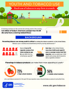
Youth and Tobacco Use
There are a number of social, emotional, and physiological reasons why teenagers start smoking, and why they continue smoking into adulthood. Help class members understand why smoking begins in youth—and how to protect themselves from...
University of Texas at Austin
Perry Castaneda Library Map Collection: Maps of u.s. National Parks
Alphabetical list of maps of United States National Parks and monuments produced by the U.S. National Park Service.
US Geological Survey
Usgs: u.s. Atlantic Continental Margin Gloria Mapping Program
This site from the U.S. Geological Survey allows you to access detailed images of the continental margin around the United States. There is additional information about the sonar methods used, and a wealth of additional sources listed.
Google Cultural Institute
Google Cultural Institute: u.s. Presidents and Inaugurations
This collection of images from Smithsonian Libraries celebrates U.S. Presidents while providing a glimpse of the presidencies and inaugurations of George Washington and Abraham Lincoln.
University of Texas at Austin
Perry Castaneda Library Map Collection: u.s. Maps
At this site find any type of map on the U.S. and any of its states here. Great site for teachers to print out maps to use in the classroom.
US Department of Agriculture
United States Department of Agriculture: State Fact Sheets
State fact sheets provide information on population, income, education, employment, federal funds, organic agriculture, farm characteristics, farm financial indicators, top commodities, and exports, for each state in the United States....
Houghton Mifflin Harcourt
Holt, Rinehart and Winston: World Atlas: United States
Features a detailed map of the United States with some basic facts. Click on each state name to get even a more detailed map and information.
University of Texas at Austin
University of Texas: Map of Early Indian Tribes in Eastern u.s.
A map of the land inhabited by Indian tribes in the eastern part of the United States before European settlement. Map shows linguistic stocks as well as culture areas, major, and minor tribes.
US Department of Labor
U.s. Department of Labor: Minimum Wage Laws in the States
A look at the minimum wage laws in the 50 states.
Other
U.s. History Images: Native American Tribes
Published images from the mid-1800s to the early part of the 1900s depicting Native Americans from tribes all over the United States.
Other
Google Maps Mashups: u.s. History: u.s. Presidents and Their Spouses
A visual of where the U.S. Presidents spouses are originally from.
Sophia Learning
Sophia: Principles of u.s. Government
Tutorial presents an introduction to the principles of the United States democratic government highlighting the differences and similarities between Roman and U.S. governments.
Sophia Learning
Sophia: Remembering the u.s. Presidents
Video, with accompanying lyrics, features a quick mnemonic device for remembering the order of the U.S. presidents and how many terms each president served. Includes quick reference guide to the first ten presidents. [2:06]
US Holocaust Memorial Museum
U.s. Holocaust Memorial Museum: Nazi Olympics Berlin 1936: Jim Crow America
The U.S. Holocaust Museum presents historical information and photographs about the Jim Crow laws of the American South, which restricted the freedoms of black Americans. Focuses on the African American struggle for social equality in...
US Census Bureau
United States Census Bureau: Quick Facts: Virginia
At this site from the U.S. Census Bureau you can discover facts about Virginia from the results of the census. Quickfacts includes numbers on population, business, and geography.
NOAA
Noaa: Earth System Research Laboratory: Psd: Interactive Climate Map of u.s.
Investigate climate trends across the United States by clicking on individual states and then specific cities. Data is presented from 1961-1990.
50 States
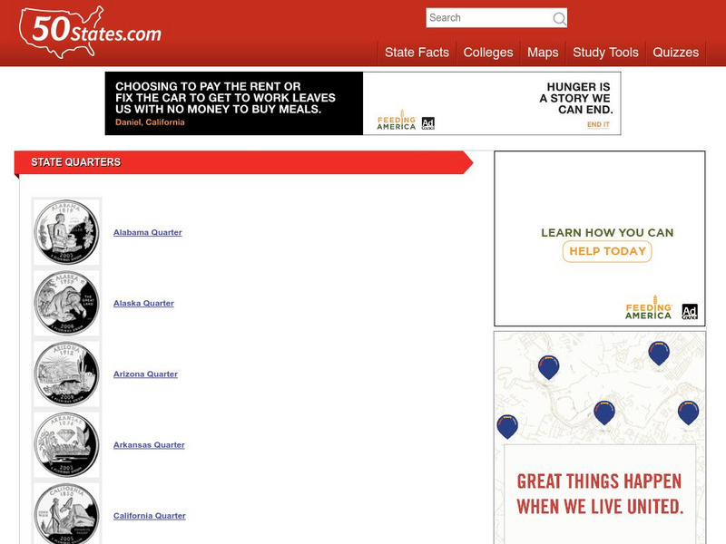
50 States: State Quarters
A list of the quarters representing each of the states. Each thumbnail links to an enlarged image with a description of the coin.
Other
U.s. Genealogy Map Project: u.s. Border/land Claims 1804 1823
A great map and a list of the acquisitions and border changes of the United States from 1804 to 1823. A concise resource showing Western expansion.
Tom Richey
Tom Richey: American Neutrality (The u.s. And the European War)
A detailed PowerPoint reviewing the neutral position the United States held at the beginning of World War II.
USA Today
Usa Today: Weather: u.s. Weather Forecasts
Weather forecasts for all 50 states, Puerto Rico, the US Virgin Islands, and the islands of American Samoa and Guam. These enable students to do comparison studies and/or receive current weather forecasts.
Tom Richey
Tom Richey: World War I for u.s. History
This slideshow will explore the reasons the United States joined into fighting during World War I. Explore the role Woodrow Wilson had during the war, the Treaty of Versailles, and the creation of the League of Nations.
Library of Congress
Loc: u.s. Presidents, First Ladies, Vice Presidents: Selected Images
This chronological archive presents photographs of American presidents. Also includes images of first ladies and vice presidents.
Other popular searches
- U.s. States and Capitals
- U.s. States and Midwest
- Learn the u.s. States
- Pdf u.s. States
- U.s. States Reports
- U.s. States Geography
- U.s. States Map
- U.s. States and Capitols
- U.s. States Projects
- U.s. States Texas
- U.s. States + Midwest
- U.s. States Midwest


