Curated OER
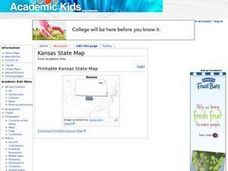
Kansas State Map
In this map of Kansas activity, students color and label major cities and physical features of this state. Students also study the location of Kansas in relation to the other states in the U.S. by studying the background map.
Curated OER
Idaho State Map
In this Idaho state map worksheet, students color and label important physical features and cities. Students also study the background map to learn the location of Idaho as related to the rest of the U.S.
Curated OER
Indiana State Map
For this Indiana state map worksheet, students color and label the important cities and physical features on this outline map. Students also learn of Indiana's location in the U.S. by studying the background map.
Curated OER
Tennessee State Map
For this Tennessee state geography worksheet, students color and label major cities and physical features on the map. Students also study a second map of the U.S. that shows the location of the state of Tennessee.
Education World
Mystery State #1
In this United States mystery learning exercise, learners determine which state is described by the 5 clues listed on the sheet and then mark it on the outline map of the United States.
Curated OER
The Philippines-U.S. Involvement
Students research and discuss the rational for U.S. involvement in the Philippines. They discuss overall foreign and domestic policies of the U.S. Then they create a timeline that highlights this impact.
Curated OER
U.S. History: 1400-1600 Matching Activity
In this U.S history worksheet, students match 2 sets of terms correlating to the 1400-s through 1600's in United States history.
Curated OER
Puerto Rico: The 51st State?
Learners research the history of Puerto Rico, its culture, and geography. In this Puerto Rico instructional activity, students find Puerto Rico on a map and find specific regions or cities. Learners discuss Puerto Rico's statehood and...
Curated OER
History of Natural Resources in the U.S.
Young scholars define conservation, exploitation and preservation, identify legislation related to conservation and environmental issues, and identify leaders and organizations that were key to the conservation and environmental movements.
Curated OER
U.S. Possessions
Ninth graders research the United States acquisition of the Philippines and their fight for independence. They locate the Philippines on a map and brainstorm how its geography has benefits. They access the Internet and complete a student...
Curated OER
U.S. Population Hits 300 Million
Young scholars read a story about the population in the United States reaching 300 million, and answer vocabulary and comprehension questions about it. In this population lesson plan, student respond to literature by answering questions,...
Curated OER
Liberia and the U.S.: Historic Ties and Policy Decisions
Learners discuss and analyze factors affecting U.S. foreign policy toward Liberia. They role-play various groups during 1900 who were concerned with the relationship between United States and Liberia as a "colony"
Curated OER
Breaking News English: U.S. Missile Shield
In this U.S. missile shield worksheet, students read the article, answer true and false questions, complete synonym matching, complete phrase matching, complete a gap fill, answer short answer questions, answer discussion questions,...
Curated OER
Science on the Skids
Students discuss the decline in the sciences in America by comparing statistics and information from the U.s. to other countries. Then they write and deliver a "State of the Sciences" address to their peers.
Curated OER
Health - Lesson Plan on Prescription Drug Prices
Students examine the issue of prescription drug prices in the United States. They discover how globalization impacts the available remedies to lower the costs to American consumers. They participate in a mock U.S. Senate Commerce Committee
Curated OER
Lesson 1: Map Data and the Census
Young scholars learn about the history of the census. In this U. S. Census lesson plan, students develop an understanding about how the United States Constitution grants and distributes power and discover how the spatial organization of...
Curated OER
A Nation Counts
Young scholars explore the functions of the U.S. Census. In this civics lesson plan, students understand the origins of the census and its role in U.S. history, recognize the political importance of apportionment based purely on...
Curated OER
United States Entry into World War I: A Documentary Chronology of World War I
Eleventh graders reconsider the events leading to U.S. entry into World War I through the lens of archival documents.
Curated OER
Who Are Our Greatest Presidents?
Students create criteria to evaluate U.S. Presidents. In this presidential legacy lesson, students determine criteria to rank presidents. Students research the presidents, then evaluate the current president and assess how they will be...
Curated OER
State Nicknames Quiz
In this online interactive geography quiz worksheet, students examine the chart that includes the names of 49 states. Students identify the nicknames of the states in 6 minutes.
Curated OER
Census and Apportionment
Students manage census data. In this U.S. Census lesson plan, students understand and describe the role census data play in apportionment decisions as they analyze the connection between apportionment and the Electoral College.
Curated OER
The Mayflower Compact
Eighth graders investigate historical documents of the United States by reading the Mayflower Compact. In this U.S. History instructional activity, 8th graders analyze the wording of the original Mayflower Compact of the first U.S....
Curated OER
"I Hear America Singing": Controversy and Music in the Mexican War
Eighth graders examine the Mexican War and its outcome through music. In this primary source analysis lesson, 8th graders analyze the lyrics of selected songs to consider the 2 perspectives regarding U.S. involvement in the war. Students...
Curated OER
Cities
Young scholars examine U.S. Census figures. In this urban centers lesson, students compare city populations across the span of 50 years. Young scholars create line graphs based on the data.
Other popular searches
- U.s. States and Capitals
- U.s. States and Midwest
- Learn the u.s. States
- Pdf u.s. States
- U.s. States Reports
- U.s. States Geography
- U.s. States Map
- U.s. States and Capitols
- U.s. States Projects
- U.s. States Texas
- U.s. States + Midwest
- U.s. States Midwest


