Curated OER
Where Do I Live?
Learners gain a better understanding of the population of the region they live in by comparing U.S. census data on the internet.
Curated OER
Mapping the Census
Students learn why the census makes a difference. In this U.S. Census lesson plan, students learn the key elements of cartography, examine the difference between data and their representation, and create a map using census data.
Curated OER
Latinos in the United States of America
Students explore a website about Latinos in the U.S., and answer worksheet questions about information on the website. They create a puppet show, organize a press conference, or create a brochure regarding Latinos living in the U.S.
Curated OER
U.S. Population Hits 300 Million
Students read a story about the population in the United States reaching 300 million, and answer vocabulary and comprehension questions about it. In this population lesson plan, student respond to literature by answering questions,...
Curated OER
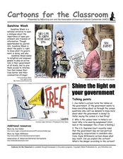
Cartoons for the Classroom: Shine the Light on Your Government
What don't we know about our government? Explore the concept of transparency and freedom of information throught this analysis handout, in which scholars examine 2 political cartoons. Background information provides context, explaining...
Curated OER
A look at our larger population
Student team together to tell the story of the U.S.'s rapid population growth. High schoolers research census changes, focusing on changes in the size of the community and the school. Students tell the story by writing articles and...
Curated OER
The Demographics of Immigration: Using United States Census Data
Students work together to analyze United States Census data on immigration. They compare and contrast the data and determine how immigration numbers have changed over time. They calculate percentages and make their own conclusions...
Curated OER
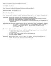
Constitution/Impeachment/Reconstruction
Eleventh graders analyze a chart comparing U.S. census data from 1850, 1880, 1900, and 1920. They read a handout summarizing immigration legislation from 1882-1996 and create a graph charting how open / closed U.S. immigration is over time.
Curated OER
Race and Ethnicity in the United States
Students explore race and ethnicity as it is defined by the U. S. Census Bureau. They compare data from 1900, 1950, and 2000 and identify settlement patterns and changes in population. In groups, they map these changes and discuss...
Curated OER
Numbers Tell a Story
Students connect census data to historical events. In this civics lesson plan, students understand cause and effect, and how they are reflected in census data and analyze census data for social and economic significance.
Curated OER
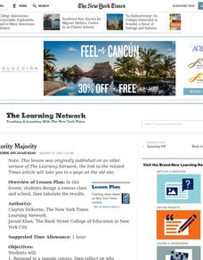
The Minority Majority
Students design a census class and school, then tabulate the results. They respond to a sample census, then reflect on why questions of race and national origin are different.
Curated OER
It's Census Time: Census Lesson Plans
Census lesson plans can provide an interdisciplinary look at how the data is used, and what it means for everyone.
Curated OER
Biggest Cities in Each State Quiz
In this online interactive geography quiz worksheet, students examine the chart that includes the names of 50 U.S. states. Students identify the names of the two largest cities in each state in 8 minutes.
Curated OER
Census Sensibility
Young scholars examine the importance of the census and census data collection methods. They gather statistical data, create graphs comparing state and national populations, and compose written reflections on why the census is necessary.
Curated OER
Census Countdown
Students read and discuss the census and how the census is used by the government. In this census lesson plan, students use the data collected to compare different census's and their outcomes.
Curated OER
It's About You
Young scholars explore the U.S. Census and come to understand more about it. In this census lesson, students build reading confidence, explain who is counted in the census, and recognize the connection between census information and...
Curated OER
Mapping Districts
Students use maps to learn about the U.S. Census. In this 2010 Census lesson plan, students visualize census data on maps, use map keys to read population maps, and explore the concept of population density.
Curated OER
Makiing Sense of the Census
Learners investigate trends in agriculture. In this secondary mathematics lesson, students evaluate agricultural census data from 1982 to 2202 as they compare the properties of the mean and the median. Learners explore what sorts of...
Curated OER
Native American Word Search
Learners search this puzzle for the names of 20 of the most populous Native American groups in the United States today. They find in this word search puzzle the names of 20 of the 30 most populous Indian groups, according to the 1990...
Curated OER
Modeling Population Growth
Learners create linear, exponential, and quadratic models of U.S. population data to determine which function best represents U.S. population growth. They predict future populations based on each model.
Curated OER
The Effect Of Transportation Systems On The Early Economic Development Of Indiana's Counties
Twelfth graders analyze the impact of transportation systems on the early economic development of Indiana's counties. They examine U.S. Census records, analyze data, and prepare a graphical depiction of the rates at which sample...
Curated OER
Biggest US City by Letter Quiz
In this online interactive geography quiz activity, learners respond to 26 identification questions about U.S. cities. Students have 5 minutes to complete the quiz.
Curated OER
Latinos Spice Up Melting Pot
Students investigate the history of early Hispanic workers in the U.S. They complete an online Webquest, explore various websites, read about Latinos in the U.S. today, view a mural, and answer discussion questions.
Curated OER
Where We Live
Students forecast future population growth of the U.S. Virgin Islands. In this U.S. Census lesson plan, students explain the factors that influence population density on the U.S. Virgin Islands, including geography and economic activity.
Other popular searches
- History of the u.s. Census
- The u.s. Census
- Analyzing u.s. Census Data
- U.s. Census 2010
- Map Skills About u.s. Census
- U.s. Census Bureau


