Hi, what do you want to do?
Texas A&M University
Sons of De Witt Colony Texas: Nueva Espana Nuevas Philipinas Provincia De Tejas
Read some first-person excerpts taken from Texas letters accounting events from the Mexican War for Independence from Spain.
Houghton Mifflin Harcourt
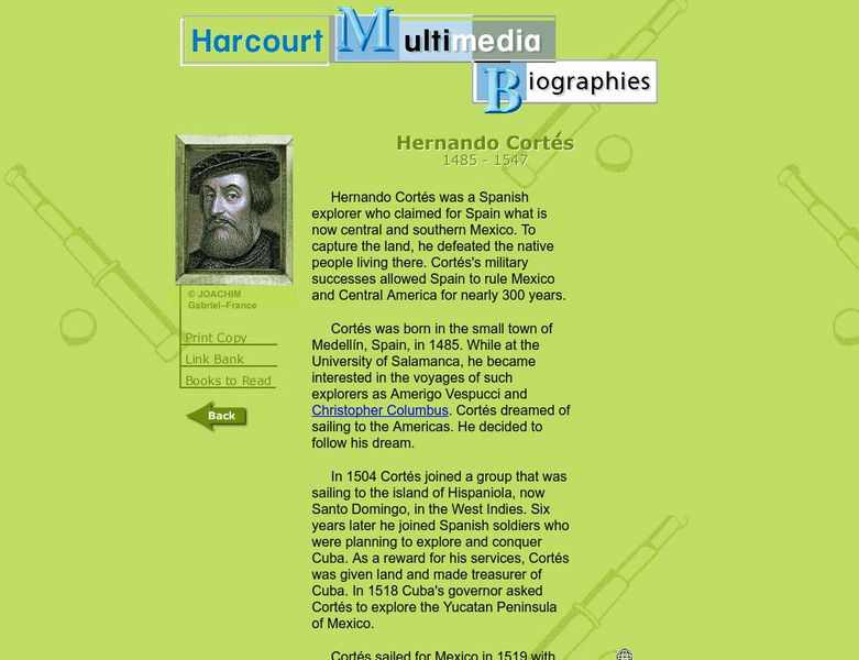
Harcourt: Biographies: Hernando Cortes 1485 1547
Furnished is a brief summary of the life and explorations of Spanish explorer, Hernando Cortes. Take a look at the photos and maps of his journey of what today is called Mexico.
National Humanities Center
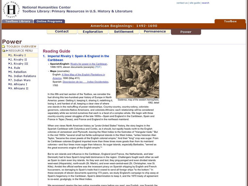
National Humanities Center: Toolbox Library: Rivalry I, American Beginnings: 1492 1690
Eleven documents and two maps detailing the almost two hundred year struggle between England and Spain for hegemony in the Caribbean.
Digital History
Digital History: Spanish Colonization
Spanish culture had a great impact on the economy, politics, and even geography of the Southwest, California, and Mexico. Read about the Spanish settlements and the structure of the social classes that left an impact the continues even...
A&E Television
History.com: 10 Things You May Not Know About Christopher Columbus
Check out 10 things you may not know about the explorer who sailed the ocean blue in 1492 for example, Columbus didn't set out to prove the earth was round.
New Advent
Catholic Encyclopedia: St. James the Greater
A long and detailed discussion about the life and ministry of James the Greater. It also includes a section on his missionary work in Spain. Please note that ?The Catholic Encyclopedia? is a historic reference source and should be viewed...
Other
Mostly fiction.com: Laura Esquivel
A review of "The Law of Love" from MostlyFiction.com and a short biography of the author, Laura Esquivel.
Curated OER
Unesco: Spain: Ibiza, Biodiversity and Culture
Ibiza provides an excellent example of the interaction between the marine and coastal ecosystems. The dense prairies of oceanic Posidonia (seagrass), an important endemic species found only in the Mediterranean basin, contain and support...
Khan Academy
Khan Academy: Parish of San Sebastian, Procession of Corpus Christi
Inca, Spanish, and Christian traditions come together in this 17th-century painting of a religious procession in Cuzco. "Parish of San Sebastian" is part of a series of eighteen canvases. View pictures and read descriptions of this...
Mariners' Museum and Park
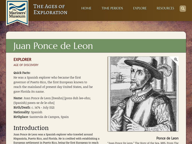
Mariners' Museum: Juan Ponce De Leon
Discover details of Ponce de Leon's expeditions in search of land for Spain in the new world. Follow the Spanish explorer's trips to present day Puerto Rico, St. Augustine, and Dry Tortugas, see a map of his journey, images featuring...
ClassFlow
Class Flow: Christopher Columbus
[Free Registration/Login Required] Students recognize why we celebrate Columbus Day as related to the story of Christopher Columbus. Students explore the route taken from Spain to the Americas and how long this voyage took by using a...
Other
Press Display Real Newspapers on Your Pc
PressDisplay offers image captures of entire newspapers from 40 different countries. Select a country, then a newspaper, and view the entire contents of that newspaper online.
Mex Connect
Mexconnect: Mexico's Colonial Era
The situation in Mexico in the 16th century, after the conquest. This brief site discusses Hernan Cortes, and the territorial expansion that characterized this time in Mexico's history.
University of Groningen
American History: Outlines: Louisiana and Britain
One of Jefferson's acts doubled the area of the country. At the end of the Seven Years' War, France had ceded to Spain the territory west of the Mississippi River, with the port of New Orleans near its mouth -- a port indispensable for...
University of Michigan
University of Michigan: Jew's Harp (Or Jaw's Harp)
Nice article for general historical information about the Jaw Harp. Also includes a basic description of the physical components of the instrument.
Other
Early 16th European History
This site breaks down the history of Europe by year between 1525-1558. It discusses the political maneuverings of the period, the social conditions, and the conflicts that arose with religious and political disputes.
Curated OER
San Geronimo De Los Taos Mission, New Mexico
A Spanish Franciscan and a French Jesuit report on the reciprocal relationship between natives and Catholic missionaries as Europeans settled New France and New Spain.
PublicBookshelf Corporation
Our Country, Vol. I: Panfilo De Narvaez
From a history book published in the late 19th century, this account of the exploits of Panfilo de Narvaez in the new world relies primarily on an account by Alvar Nunez Cabeza de Vaca, upon his return to Spain.
Curated OER
Unesco: Spain: Vizcaya Bridge
Vizcaya Bridge straddles the mouth of the Ibaizabal estuary, west of Bilbao. It was designed by the Basque architect Alberto de Palacio and completed in 1893. The 45-m-high bridge with its span of 160 m, merges 19th-century ironworking...
Curated OER
Unesco: Spain: Historic Centre of Cordoba
Cordoba's period of greatest glory began in the 8th century after the Moorish conquest, when some 300 mosques and innumerable palaces and public buildings were built to rival the splendours of Constantinople, Damascus and Baghdad. In the...
Curated OER
Unesco: Spain: San Millan Yuso and Suso Monasteries
The monastic community founded by St Millan in the mid-6th century became a place of pilgrimage. A fine Romanesque church built in honour of the holy man still stands at the site of Suso. It was here that the first literature was...
Curated OER
Etc: Maps Etc: Comparative Areas of the United States and Other Countries, 1872
A map from 1872 of the United States used to illustrate the comparative area sizes of the states to other countries in the world. The map shows state and territory boundaries at the time (Dakota, Montana, Washington, Idaho, Wyoming,...
Curated OER
Educational Technology Clearinghouse: Maps Etc: Drawing the United States, 1872
A map skills exercise from 1872 showing the drawing of the United States with proportional measurements. The map shows state and territory boundaries at the time (Dakota, Montana, Washington, Idaho, Wyoming, Utah, Oklahoma, New Mexico,...
Curated OER
Educational Technology Clearinghouse: Maps Etc: The Early United States, 1790
A map of the United States in 1790 showing the territorial claims of the states at the time, and the British and Spanish possessions and territory disputes. The map shows the frontier lines or extent of settlement from the coast of Maine...


