Google Cultural Institute
Google Cultural Institute: The Siege of Leningrad
A pictorial account of the Siege of Leningrad by the German Army during World War II.
International Institute of Social History
International Institute of Social History: Art to the People Gerd Arntz
From the exhibit at the International Institute of Social History, "Art to the People", the work of the German communist artist Gerd Arntz is examined with descriptions and images.
Google Cultural Institute
Google Cultural Institute: 50 Years of the Elysee Treaty 50 Years of the Fgyo
50 years of the Elysee Treaty and the Franco-German Youth Office are portrayed in this photographic exhibit.
Google Cultural Institute
Google Cultural Institute: "The Eternal Jew"
Photographic exhibit tells the story of Hitler's regime's humiliation of Jews and events leading to Kristallnacht, often referred to as the beginning of the Holocaust.
Library of Congress
Loc: Battle of the Bulge
HQ Twelfth Army Group situation maps of the Battle of the Bulge.
Latimer Clarke Corporation
Physical Map of German Speaking Countries
Map of Germany, Austria, Liechtenstein and Switzerland showing topographical features of the German-speaking countries and their neighbors.
Other
Propaganda Postcards of the Great War: Centrals: Heads of State
Presents some biographical information on the leaders of the Central Powers during WWI - Wilhelm II of the German Empire, Franz Josef I of the Austro-Hungarian Empire, Mehmed Rechad V of the Ottoman Empire (Turkey), and Ferdinand I of...
Metropolitan Museum of Art
Metropolitan Museum of Art: Portrait of a German Officer, Marsden Hartley
From the collection of the Metropolitan Museum of Art in New York City, here is the image "Portrait of a German Officer", a painting by German modern artist Marsden Hartley.
Google Cultural Institute
Google Cultural Institute: "Faith in the Human Spirit Is Not Lost"
Pictorial exhibit commemorates the 50th anniversary of the Righteous Program founded by Yad Vashem to honor rescuers who protected Jews from death and deportation during the Holocaust.
Curated OER
Etc: Formation of the German Empire, 1806 1871
A map showing the formation of the German Empire between 1806 and 1871. This map shows the territory of Prussia after the war with Napoleon in 1806, the territory added to Prussia by the Congress of Vienna in 1815, Schleswig and Holstein...
Other
Columbus Museum of Art: Curator's View: Nolde's "Sunflowers in the Windstorm"
From the Curator's View series at the Columbua Museum of Art, this is the piece profile on the Emil Nolde paiting 'Sunflowers in the Windstorm'.
BBC
Bbc News: The "Miracle: Of Dunkirk
Read about how ordinary citizens, in addition to the Royal Navy, came to the rescue of almost 300,000 troops trapped on the coast of France by the advance of the Germans. The miracle of Dunkirk was just that. Hyperlinks to interviews and...
Other
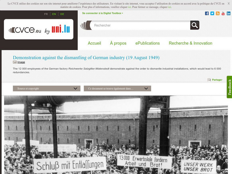
Cvce: Demonstration Against the Dismantling of Industry
This image and short description illustrate the German peoples' reactions to the dismantling of their industries by the Soviet Union during the Cold War.
Ancestry
Europe After the Congress of Vienna, 1815
Map of Europe after the Congress of Vienna of 1815, showing the gains of Prussia, Russia, Sardinia, and Austria, as well as the boundaries of the German Confederation.
Mariners' Museum and Park
Mariners' Museum: Battle of the Atlantic: A Virtual Exhibit
An online exhibit detailing Word War II's Battle of the Atlantic.
Tom Richey
Tom Richey: German Unification
Recognize the activities and political views that impacted the process of German unification. Utilize this comprehensive PowerPoint presentation illustrating the unification.
Other
Propaganda Postcards of the Great War: Centrals Patriotic: Warloans Germany
Several examples of propaganda promoting the purchase of war loans in Germany during World War I. Captioned thumbnail images can be enlarged for viewing by clicking on them.
World War 1
Worldwar1.com: Trenches on the Web: Photo Archive: The Ypres Salient, 1917
Photos to click on to see images of World War I trenches: "An Australian trench," "British infantry knee deep in mud," "An abandoned German trench at Messines Ridge".
World War 1
Worldwar1.com: Trenches on the Web: Posters From the Great War
Original posters from the leading countries involved in World War I.
BBC
Bbc History: Animated Map: The Italian Campaign
This animated map gives a good visual of the Italian Campaign which began in Sicily in 1943. Each map has a description of the action, a key is provided, and just the map animation can be replayed, or view the entire site again.
Curated OER
Etc: Maps Etc: German Territories in Africa, 1915
These three maps show the German Territories in Africa circa 1915. They include Togo, Cameroon, German Southwest Africa (Namibia), and German East Africa (Tanzania). Maps indicate the general relief of each territory, major rivers, and...
Curated OER
Educational Technology Clearinghouse: Maps Etc: German Empire, 1914
A map of the German Empire in 1914, showing cities, ports, and towns, railroads, canal routes, and rivers. This map includes inserts of the Hamburg and the Berlin vicinity, and a reference key to the German States, and principal cities...
Curated OER
Educational Technology Clearinghouse: Maps Etc: German Empire, 1906
A map of the German Empire in 1906, showing major cities, towns, and ports, railroads, and rivers.
Curated OER
Educational Technology Clearinghouse: Maps Etc: German Empire, 1885
A map of the German Empire in 1885, showing cities, ports, towns, railroads, and rivers. The map is color-coded to show the individual states of the German Empire at the time.


