Curated OER
Traveling Through Literature
Integrate geography with literature in this interdisciplinary lesson. Begin by reading a poem such as The Time We Climbed Snake Mountain by Leslie Marmon Silko. On a large map, place push pins in the cities or states mentioned. An...
Curated OER
Traveling aroud Our Town
Learners are asked to describe to a partner how he or she walks to school or the bus stop. They are shown on the overhead an one-inch grid paper, and at the intersection of two lines on the grid paper, students are shown a house and...
Curated OER
Mush! Tracking Travelers on the Trail
Students get to know Alaska and the Iditarod route that is run by dogs as they track the mushers' progress on a map that they create specifically for the race. They learn about latitude, longitude, plotting on a map, checkpoints, and...
Curated OER
Colonial Vacation Planner
Looking for a good lesson plan on the Colonial Period for your upper-elementary class? Then, this lesson plan is for you! They use website designs, U.S. travel publications, and maps to plan a family vacation to states which were part of...
Curated OER
City, County, Community
Students explore issues and situations that make for a city and its local environments. In this local government lesson, students design maps, define issues and create brochures that illustrate their understandings of these concepts and...
Curated OER
Project Whistlestop:Missouri Vacation Learning Unit
Fourth graders reserach the state of Missouri. In this Missouri History lesson, 4th graders plan a vacation to a region of Missouri. Students work in collaborative groups to determine all aspects of the trip. Students use math...
Curated OER
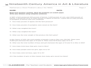
Mathematics Word Problems About the 1800s
In this history and math learning exercise, learners solve 20 problems pertaining to life in America in the 1800s. Students read four paragraphs and solve the five problems using that information. Basic math operations are used.
Curated OER
Congressional Travel
Students determine the distances traveled by the members of the legislative branch of the US Government. In this travel distance lesson, students locate Washington, DC on a globe using the longitude and latitude of the city. They...
Project SMART
Travel the World Via the "Net"
Students work together to create a travel brochure of a foreign country of their choice. They use the Internet to research their information. They create graphics showing interesting locations. They write in their journals at the end of...
Curated OER
Michigan Virtual Field Trip
Students analyze data from a virtual field trip to Michigan. They conduct Internet research on mileage and travel time between cities, calculate and compare fuel costs, and research and calculate lodging, activities, and meal costs.
Curated OER
California Here We Come!
A highly relevant and great cross-curricular project! In teams, your class will plot a course from the East Coast to Sacramento, California passing through all of the state capital cities along the way. As part of the journey, teams...
Curated OER
The Ultimate Road Trip
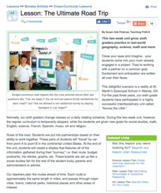
Sixth graders experience and practice real-world geography, science and math as they imagine planning out the ultimate road trip. They set goals and maintain a daily budget as they are given a set of rules as they plan their road trip...
Curated OER
History of Flight Timeline Activity
Scholars are introduced to the significant events that led to the development of today's modern forms of air travel. They create a timeline to identify the vital events that are related to man's flight. In addition, they research various...
Curated OER
How Far Is It?
Students use a map key to estimate the distance from Salt Lake City, Utah, to ten other cities. Then they use an online distance calculator to see how close their estimates come!
Curated OER
Map Your Favorite Sports Team's Next Road Trip
Students track a sports team across the country. They use a map scale to calculate the number of miles traveled by their sports team on a trip, conduct Internet research, and calculate how much it would cost them to go along on the trip.
Curated OER
Integrating Gandhian Principles of Communal Unity in Mathematics
Fourth through sixth graders incorporate Gandhian principles into Math curriculum. They explore Gandhi's teachings on communal unity and economic equality. This has quite a bit of information about Gandhi and his observations and...
Curated OER
A More Perfect Union: The Story of Our Constitution
Sit back, relax, and transport to 1787! This lesson on the Constitution begins with guided imagery of the Constitutional Convention. The class reads A More Perfect Union: The Story of Our Constitution in an...
Curated OER
Traveling the USA
Pupils simulate the role of travel agents addressing the needs of a foreign family visiting a state in the US. They prepare a presentation and informational sales pitch of a proposed travel itinerary.
Curated OER
The Euro: Classroom Exercises – Exchange Students Going to Europe
Young scholars explore ever-changing exchange rates. In this euro/dollar exchange rate lesson plan, students plan a trip to Europe and calculate their costs in euros and dollars.
Curated OER
Rivers, Maps, and Math
Students use maps to locate and label the major rivers of North and South America. Using the internet, they identify forests, grasslands, mountain ranges and other landforms on the continents as well. They compare and contrast the...
Curated OER
Alaska Virtual Field Trip
Students participate in an on-line virtual field trip to the state of Alaska. In this U.S. Geography instructional activity, students research several Internet sites dealing with travel to Alaska and activities to participate in....
University of New Mexico
Let's Travel
Fourth graders work in groups to research various locations across the United States. They present their findings to the class, participate in a travel fair, make phone calls to tourist agencies and write letters to state tourism...
Geophysical Institute
Latitude and Longitude with Google Earth
Travel the world from the comfort of your classroom with a lesson that features Google Earth. High schoolers follow a series of steps to locate places all over the earth with sets of coordinates. Additionally, they measure the distance...
New Bedford Whaling Museum
A New Bedford Voyage!
A thorough set of activities, articles, and reference material can enlighten your class about the history of whaling in New England. Kids travel back to a time when whale products were valuable and hunting whales was a way to help the...


