Curated OER
Faith-Based Initiatives: Separation of Church and State
Students examine the role of religion in everyday life. In this religion and ethics lesson, students investigate the use of government funds to support faith-based initiatives. The lesson calls for students to conduct research, watch...
Curated OER
Temperature Change and the States of Matter
Tenth graders observe the processes of evaporation, condensation, melting, freezing, boiling, and sublimation. They do a quantitative investigation of the freezing of water, to explore explanations that involve particles.
Curated OER
Changing States: Does it Matter
Students participate in experiments to visualize the differences between chemical and physical changes. They attempt to detect the five characteristics of a chemical change.
Curated OER
States of Matter and Chemical/Physical Changes Stations
Students break into four groups, starting at different stations. Each station should take about 10 minutes depending on prior knowledge of the topic. They then rotate when everyone is finished to the next station and discuss answers of...
Curated OER
Where is Coal Located in The United States?
A brief overview of the location of coal reserves in the United States can be helpful in a unit about fossil fuels. You can assign students each a different coal-containing state and have them research the local impact of mining the...
Curated OER
Review of the United States of America
Young scholars research and compile information for each US state. They write a paragraph on one of the topics found within the database comparing at least 2 states. They create a database with the information they collected about each...
Curated OER
Comparing Michigan to Other States
Fourth graders work in groups of 2 or 3 and choose a state to compare with Michigan. They use the Internet to locate information on other states allowing students time to research how Michigan compare to their state and incorporate their...
Curated OER
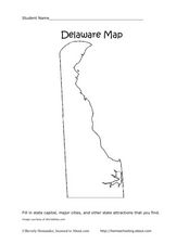
Delaware Map
In this state maps learning exercise, students identify the state of Delaware, and fill in the state capital, major cities, and other attractions in the state.
Curated OER
Colorado Map
In this state maps worksheet, students identify the state of Colorado, and fill in the state capital, major cities, and other attractions for the state.
Curated OER
North Carolina Map
In this state maps worksheet, students identify the state map of North Carolina. Students fill in the state capital, the major cities, and other state attractions.
Curated OER
New Mexico Map
In this state maps activity, students identify the state of New Mexico. Students fill in the state capital, major cities, and other state attractions.
Curated OER
The Water Cycle: States of Water
Elementary schoolers explore states of matter by concentrating on the ways in which water moves between its solid, liquid, and gaseous states in a variety of Earth environments. Learners interpret these movements through dance. The...
Curated OER
USA State Tag / Mississippi River Shuffle
Students reinforce the geographic location of the states of the U.S.A.
Curated OER
State Issues: The Native People of Hawaii
High schoolers research issues about their state and community. They work in groups to create a multi-media presentation highlighting the issues.
Curated OER
Design a State Seal
Fourth graders examine the meanings of symbols on the Ohio state Seal. They create their own personal seals which include three items about themselves. They write explanations about their seals.
Curated OER
Connecticut Map
In this state maps worksheet, students identify the state of Connecticut, and fill in the state capital, major cities, and other major attractions.
Curated OER
Montana Map
In this state maps worksheet, students identify the state map of Montana. Students fill in the capital city, the major cities, and other state attractions.
Curated OER
South Dakota Map
In this South Dakota map worksheet, students fill in the state capital, major cities and other state attractions in an outline map of South Dakota.
Curated OER
Vermont Map
In this state maps activity, students identify the map of Vermont. Students fill in the state capital, the major cities, and other state attractions.
Curated OER
Tennessee Map
In this Tennessee outline map, students examine the political boundaries of the state. Students mark the state capital, major cities, and other state attractions.
Curated OER
Kentucky History
Most students at some point in their schooling have to complete a state report. This presentation focuses on Kentucky. It could be used as an exploration of this state, or as a template for students' own state reports.
Curated OER
The City-States of Greece
A background on ancient Greece and its city-states is the focus of this presentation. With facts about Greek geography, politics, and culture, these slides would be a good way to strengthen a lecture on ancient Greece or world cultures.
Curated OER
Demonstrating an Understanding the Evolution of Democracy in the United States
High schoolers explore how democracy in the United States changed and evolved from its birth to the present. They participate in a mock testing environment. Students write a multi-tasked essay on American government and politics.
Curated OER
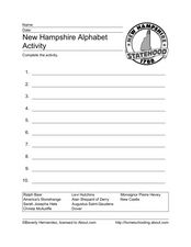
New Hampshire Alphabet Activity
In this state facts instructional activity, students read the 10 words associated with the state of New Hampshire. Students alphabetize the words.
Other popular searches
- United States History
- States of Matter
- United States
- U.s. States
- United States Maps
- Fifty States
- Constitution United States
- 50 States
- United States Government
- United States Immigration
- United States Regions
- United States Armed Forces


