Curated OER
Filling Up Florida
Students study factors controlling Florida's population growth and related environmental impacts. They research natural community types and construct maps (including a large-sized map of Florida) to be used for a simulation activity.
Curated OER
The Exploration and Settlement of North America
Students locate place in Canada and explore highlights of early of early American exploration and settlement. In this North American history lesson, students locate provinces, major cities, and physical features of Canada....
Curated OER
Our Country's Landforms
Learners investigate the many different landforms that are found throughout the United States. They use the internet and other resources to gather information. The information is used to prepare a multimedia slideshow and to create a...
Curated OER
Integration of Education
Students explore the history of Civil Rights and how the struggle for Civil Rights and the Second Reconstruction, transformed society and politics in the United States in the 1950s. Then they identify why American Schools are integrated...
Curated OER
Dead Sea Investigation: Middle East and African Connections
Students demonstrate comprehension of the physical characteristics of the Dead Sea region and its connection to the Red Sea and the African Great Rift Valley. They are given students the opportunity to understand the role of plate...
Curated OER
Mapping the 'Utah War'
Eleventh graders examine the contributions of Native American Indians, explorers, and Utah's pioneers.
Curated OER
This Land is Your Land? This Land is My Land!
Students research the various territory acquisitions in United States history and create an annotated map that tells the history of U.S. expansion. Working in small groups, students outline the land acquisitions and purchases made by...
Curated OER
The Wild Wild Mid-West
Eleventh graders examine reasons for Louisiana Purchase and identify those who played key roles in it, create map of Louisiana Purchase and states that are part of it, and analyze overall importance of Louisiana Purchase.
Curated OER
Finding the Story Setting
Second graders discuss important things to know when reading stories, identify setting in variety of stories, create story map to record information as they are reading, state setting in their own words, discuss whether they thought...
Curated OER
Texas
Students draw the outline of the Lone Star State, label the state signs (bird, flower, tree), and sing the state song.
Curated OER
Every Picture Tells a Story
Pupils examine the ways in which a work of art represents the culture or lifestyle of people living in a state. They analyze the back of the Iowa quarter and discuss how art reflects the time period in which it was created.
Curated OER
Book: Latinos Today: Facts and Figures
Students, after reading Chapter 1 in the book, "Latinos Today: Facts and Figures," identify and characterize the four main ethnic/racial groups in America. They calculate and design a bar graph showing their populations by their...
Curated OER
Birds on Wade Islands
In this birds on Wade Islands instructional activity, students read a 1 page passage about the state of the birds on Wade Islands and answer 1 short answer questions about it. Students answer "What actions should the wildlife agencies...
Curated OER
The Global Village and Trade
High schoolers analyze maps of trade patterns between the United States and other nations and identify factors that may influence the production of goods.
Curated OER
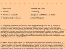
Number the Stars
Students read Number the Stars. In this social studies lesson, students read the story and use a map of western Europe and identify the countries involved in the war. Students locate the cities of Denmark that are discussed in the story.
Curated OER
Plotting Earthquakes
Students, after plotting earthquake locations on the map, should correctly; identify the pattern of earthquake locations and identify the ring of fire.
Curated OER
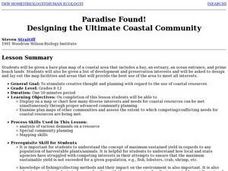
Creating a Coastal Area
Students design and lay out a map of a coastal area that includes a bay, an estuary, an ocean entrance, and prime beach lands. They write a plan outlining solutions to the economic problems of their community and present their map and...
Curated OER
Discovering Your Community
Learners focus on the origins of the families that make up their community by exploring their family's origins through themselves, parents, and grandparents. Students create a map marked with family origins for the class.
Curated OER
Community Cartography
Students use an inflatable globe which they wrap in plastic wrap. They use a permanent marker and outline the continents, and label major oceans and trace the equator. Students bring heir globes and use their projection for a discussion...
Curated OER
Study of New York City
Fourth graders read A Cricket in Times Square and examine the essence of living in New York City. They examine subway maps and other resources concerning NYC and then complete several writing activities about the city. They also create...
Curated OER
Geography
Second graders explore the major rivers of Arkansas. They locate the major rivers in Arkansas on a state map. Students discuss how water is used in the region and the state of Arkansas.
Curated OER
The Life and Death of the Byzantine Empire
Ninth graders understand the state of the world around the year 1000 AD as it pertains to the Byzantine Empire. They analyze and discuss the characteristics of the Byzantine Empire.
Curated OER
From the Farm to Your Table: Where Does Our Food Come From?
Students discover where the food they eat comes from. Using maps, they identify the agricultural areas of the United States and the products that are grown in each area. Using the internet, they research how food gets to America from...
Curated OER
Process This
Students chart the steps, including the problem-solving tangent, and discuss the idea of procedures serving to give us a "road map" or guide to help tackle tasks with preparation and forethought.
