Curated OER
USA States Abbreviations
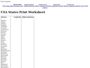
In this recognizing the fifty states learning exercise, students read a list of abbreviations and complete the double T-Chart's columns of state names and their capitals. Students write 100 answers.
Curated OER
Name the States Worksheet 2
For this name the states worksheet, students examine 6 state map outlines and identify each of them by writing the state names and postal abbreviations.
Curated OER
Name the States Worksheet 5
In this name the states worksheet, students examine 6 state map outlines and identify each of them by writing the state names and postal abbreviations.
Curated OER
Name the States Worksheet 4
In this name the states worksheet, students examine 6 state map outlines and identify each of them by writing the state names and postal abbreviations.
Curated OER
Name the States Worksheet 1
In this name the states worksheet, students examine 6 state map outlines and identify each of them by writing the state names and postal abbreviations.
Curated OER
Searching the States (or Provinces) Scavenger Hunt
Students examine information on a particular state or province. Groups of students use the internet to locate facts about an assigned state. They research information such as capital, state song, and major crops. students report their...
Curated OER
Do You Know Your 50 States?
Learners use the names and abbreviations of the 50 states to label a blank map of the United States.
Curated OER
USA States, Capitals, and Abbreviations
In this recognizing the fifty states worksheet, students read a list of the names of the states and complete a Double T Chart by filling in the capitals and abbreviations columns. Students write 100 answers.
Curated OER
Name The States Worksheet 3
In this states worksheet, students analyze the shape of 5 US states. Students identify each state and write the name of the state and its postal abbreviation.
Curated OER
States Quizzes
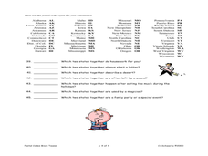
In this state postal code activity, students respond to 45 fill in the blank questions that require them to use the listed state postal codes as answers.
Curated OER
What's My Capital?
Students participate in a game about state capitals. They use two piles of cards, one with the capital name and the other with the state name and they match them. They can work together or alone in this lesson.
Curated OER
Washington: Crossword Puzzle
In this United States history worksheet, students use the 15 clues in order to fill in the crossword puzzle with the appropriate answers pertaining to Washington.
Curated OER
ZIP Code Math
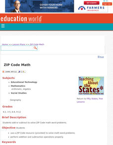
Students add or subtract to solve ZIP Code Math word problems. A ZIP Code Math work sheet is included. This lesson combines math with geography quite nicely.
Curated OER
Name Count and Graph
Young scholars find the frequency of a name in selected states by using the Internet. They input data into a spread sheet. They create a graph that illustrates the gathered information.
Curated OER
Barack Obama: Crossword Puzzle
In this United States history worksheet, students use the 15 clues in order to fill in the crossword puzzle with the appropriate answers pertaining to Barack Obama.
Curated OER
Arkansas: Crossword Puzzle
In this United States history learning exercise, students use the 15 clues in order to fill in the crossword puzzle with the appropriate answers pertaining to Arkansas.
Curated OER
Arizona: Crossword Puzzle
In this United States history worksheet, learners use the 15 clues in order to fill in the crossword puzzle with the appropriate answers pertaining to Arizona.
Curated OER
Presidents of the United States
Students discuss American Presidents. They each complete research on one particular President and then, using a template, create a short biography (including a picture) about him. When all biographies are complete, they compile them into...
Curated OER
Virginia: Crossword Puzzle
In this United States history activity, students use the 15 clues in order to fill in the crossword puzzle with the appropriate answers pertaining to Virginia.
Curated OER
Blank US Map
In this blank outline map activity, students study the physical boundaries of the 50 states that make the United States. This outline map may be used for a variety of geographic activities.
Curated OER
North America Puzzle Answer Sheet
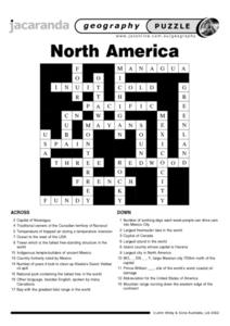
In this geography instructional activity, students name the capitals of various countries found in North America. They also identify the various weather patterns across the continent and specific bodies of water. There are 21...
Curated OER
From Yosemite to Joshua Tree
Fourth graders discover diversity of plant and animal life in California's parks and compare findings to identify what makes park areas unique. Students then publish their discoveries in picture books of their own design.
Curated OER
Latitude and Longitude
In this latitude and longitude worksheet, students complete 4 activities to demonstrate understanding. Students use a protractor to measure angles on a map of the earth. Students fill out a latitude and longitude chart after studying a...
ClassFlow
Class Flow: Labeling United States
[Free Registration/Login Required] This flipchart allows the students to use a 50 states map to move the states into their correct position on the map and identify states by their abbreviations. The flipchart is designed to help students...


