Curated OER
Global Hunger and Malnutrition
Is there a difference between hunger and malnutrtion? Is this a problem only in third world countries? How does hunger and malnutrition affect the community? Why do these problems exist when the world produces enough food to feed...
Curated OER
Old Stone House Lesson Plan
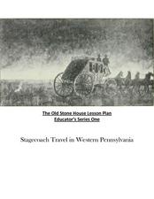
From stagecoach to railroad tracks, your class will discover how advancements in travel in the United States during the nineteenth century played an integral role in the industrialization and development of American society. The main...
Peace Corps
Community
What is a community? Find out with a lesson that sheds light onto the different types of communities—school, local, and global. Scholars read informational text detailing the life of a young girl from Cape Verde and take part in a...
Curated OER
Michigan History Through HyperStudio
Students explore the history of their local community. They visit historical landmarks in the city of Marshall. Students create a HyperStudio project about local Michigan history.
Curated OER
COLD SEA WATERS
Students examine how old sea waters affected the local and state area during the summer of 1998. Studying a detailed web-site helps students examine sea temperatures.
Curated OER
Geographics in Arkansas
Third graders discuss where Arkansas is located on the United States map. They use geographic tools to participate in activities.
Curated OER
Wisconsin Snapshots
Fourth graders study Wisconsin's culture and heritage. They research the state's symbols and identify leaves common to the Wisconsin area. They create a leaf booklet and visit the state park. They visit local farms and create nature maps...
Curated OER
BOUND TO BE NEW HAMPSHIRE
Students identify neighborhood, town, and state boundaries. They distinguish between natural and man-made boundaries. They identify major state geological features and explain how NH boundaries have changed over time.
Curated OER
Road Trip
Students explore a state, create a travel plan for visiting that state, write postcards from an imaginary trip there, and research selected points of interest in that state.
Curated OER
Knowing Where You Are
Students work together to research the names of places in their state. They divide up their state so that each group can research a different section and complete a chart of the different names. They create a key for the map to explain...
Curated OER
Fish Around the World
Students use a globe to answer questions such as which continent they live in and the country in which they live. They identify at least two bodies of water near their state and two foreign countries. In groups, they complete a...
Curated OER
Inches Away
Students are introduced to maps, scale representations, ratios and cartography. They plot the itinerary for their family's dream vacation or a trip across the United States. Using maps, they determine the short route and second longer...
Curated OER
Where's the Barbecue?
Learners identify the major landforms, regions and rivers on a map of South Carolina. They compare the locations of the major Native American groups in the state as well. They chart where barbecue restaurants are located and write...
Curated OER
Graphin' And Glyphin' Utah Weather
Fourth graders investigate the concepts of looking at sets of data. The focus of the study is upon the local weather of Utah. They study the weather found in the city and in the country and make comparisons based upon geographical location.
Curated OER
Wright Brothers Centennial: North Carolina, Creation and Development of the State
Eighth graders examine technological advances and how they influenced the quality of life in North Carolina. Using maps, they locate the city of Kitty Hawk and discuss why it was chosen for the first flight. They read primary source...
Curated OER
Finding Your Spot in the World
Students practice locating places on a Thomas Brothers map. For this map skills lesson, students locate places on the map of where their ancestors are from and then practice finding various community places on a map. Students graph the...
Curated OER
Rice Farming History
Second graders map the progress of rice farming by using a map of the United States. In this rice farming lesson plan, 2nd graders draw a line on the map from where rice farming started to the progression of its growth.
Curated OER
River Study
Students explore a stream in their area and show the class the topographic map of the stream. They locate the topographic map and name the streams, lakes and ponds in their watershed. They write a paragraph about their stream and...
Curated OER
Comparing School Bus Stats
Engage in a lesson plan that is about the use of statistics to examine the number of school buses used in particular states. They perform the research and record the data on the appropriate type of graph. Then they solve related word...
Curated OER
Local Area - What Is a Region?
Students examine the physical characteristics of the Connecticut River Valley. They view and analyze maps, identify common physical characteristics, and color in the Connecticut River on a map of New Hampshire and Vermont.
Curated OER
Local Area - What Is a Region?
Students examine the physical characteristics of the Connecticut River Valley. They analyze maps and pictures, identify physical characteristics of the region, and color in the Connecticut River on a map.
Curated OER
Local Area - Is the Land Connected to Us?#144
Students examine how human influences have affected the Connecticut River Valley. They determine what a region is in relation to its human influences. They label the important human features of this region including dams, canals, and...
Curated OER
Local Customs of Southeast Asian Countries
Students examine the cultural nuances of insular countries in southeast Asia. They perform skits demonstrating local customs of the countries examined, including greetings, visiting, business, drinking, and gift giving.
Curated OER
Map on the Wall
Learners examine the Ogallala aquifer water storage facility, identify rivers that refill the aquifer, and locate major cities near by. Students make maps of the area.

