Hi, what do you want to do?
Houghton Mifflin Harcourt
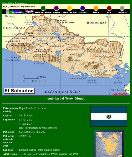
Holt, Rinehart and Winston: America Del Norte: El Salvador
This site has a map of El Salvador in Spanish, with informational data also presented in Spanish about the country. Land mass, population, life expectancy, literacy, industry, agriculture, minerals and resources are among the topics...
Houghton Mifflin Harcourt
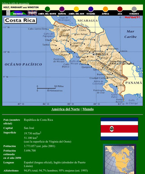
Holt, Rinehart and Winston: America Del Norte: Costa Rica
This site has a map of Costa Rica in Spanish, with informational data also presented in Spanish about the country. Land mass, population, life expectancy, literacy, industry, agriculture, minerals, and resources are among the topics...
Houghton Mifflin Harcourt
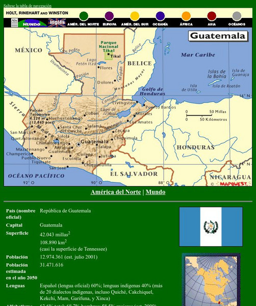
Holt, Rinehart and Winston: America Del Norte: Guatemala
This site has a map of Guatemala in Spanish, with informational data also presented in Spanish about the country. Land mass, population, life expectancy, literacy, industry, agriculture, minerals, and resources are among the topics...
Houghton Mifflin Harcourt
Holt, Rinehart and Winston: America Del Norte: Honduras
This site has a map of Honduras in Spanish, with informational data also presented in Spanish about the country. Land mass, population, life expectancy, literacy, industry, agriculture, minerals and resources are among the topics...
Houghton Mifflin Harcourt
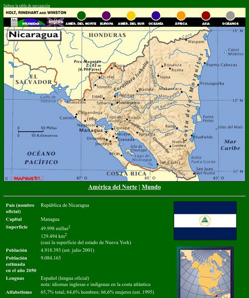
Holt, Rinehart and Winston: America Del Norte: Nicaragua
This site has a map of Nicaragua in Spanish, with informational data also presented in Spanish about the country. Land mass, population, life expectancy, literacy, industry, agriculture, minerals, and resources are among the topics...
Houghton Mifflin Harcourt
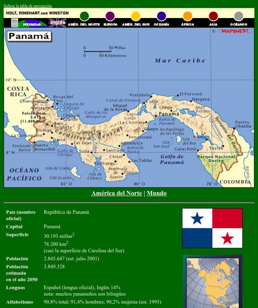
Holt, Rinehart and Winston: America Del Norte: Panama
This site has a map of Panama in Spanish, with informational data also presented in Spanish about the country. Land mass, population, life expectancy, literacy, industry, agriculture, minerals and resources are among the topics...
Houghton Mifflin Harcourt
Holt, Rinehart and Winston: Caribe: Cuba
This site has a map of Cuba in Spanish, with informational data also presented in Spanish about the country. Land mass, population, life expectancy, literacy, industry, agriculture, minerals, and resources are among the topics addressed....
Houghton Mifflin Harcourt
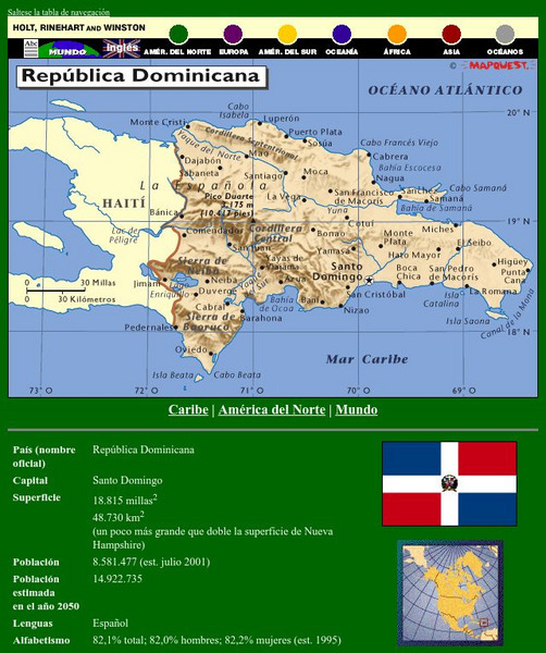
Holt, Rinehart and Winston: Caribe: Republica Dominicana
This site has a map of the Dominican Republic in Spanish, with informational data also presented in Spanish about the country. Land mass, population, life expectancy, literacy, industry, agriculture, minerals, and resources are among the...
Houghton Mifflin Harcourt
Holt, Rinehart and Winston: America Del Sur: Argentina
This site has a map of Argentina in Spanish, with informational data also presented in Spanish about the country. Land mass, population, life expectancy, literacy, industry, agriculture, minerals, and resources are among the topics...
Houghton Mifflin Harcourt
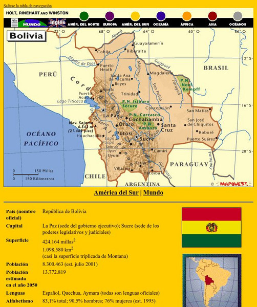
Holt, Rinehart and Winston: America Del Sur: Bolivia
This site has a map of Bolivia in Spanish, with informational data also presented in Spanish about the country. Land mass, population, life expectancy, literacy, industry, agriculture, minerals, and resources are among the topics...
Houghton Mifflin Harcourt
Holt, Rinehart and Winston: America Del Sur: Chile
This site has a map of Chile in Spanish, with informational data also presented in Spanish about the country. Land mass, population, life expectancy, literacy, industry, agriculture, minerals and resources are among the topics addressed....
Houghton Mifflin Harcourt
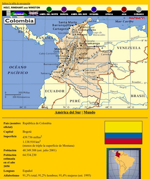
Holt, Rinehart and Winston: America Del Sur: Colombia
This site has a map of Colombia in Spanish, with informational data also presented in Spanish about the country. Land mass, population, life expectancy, literacy, industry, agriculture, minerals and resources are among the topics...
Houghton Mifflin Harcourt
Holt, Rinehart and Winston: America Del Sur: Venezuela
This site has a map of Venezuela in Spanish, with informational data also presented in Spanish about the country. Land mass, population, life expectancy, literacy, industry, agriculture, minerals, and resources are among the topics...
Houghton Mifflin Harcourt
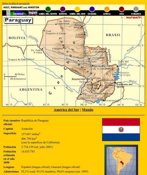
Holt, Rinehart and Winston: America Del Sur: Paraguay
This site has a map of Paraguay in Spanish, with informational data also presented in Spanish about the country. Land mass, population, life expectancy, literacy, industry, agriculture, minerals and resources are among the topics...
Houghton Mifflin Harcourt
Holt, Rinehart and Winston: America Del Sur: Peru
This site has a map of Peru in Spanish, with informational data also presented in Spanish about the country. Land mass, population, life expectancy, literacy, industry, agriculture, minerals and resources are among the topics addressed....
Houghton Mifflin Harcourt
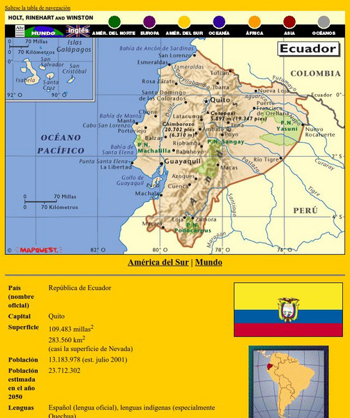
Holt, Rinehart and Winston: America Del Sur: Ecuador
This site has a map of Ecuador in Spanish, with informational data also presented in Spanish about the country. Land mass, population, life expectancy, literacy, industry, agriculture, minerals, and resources are among the topics...
Houghton Mifflin Harcourt
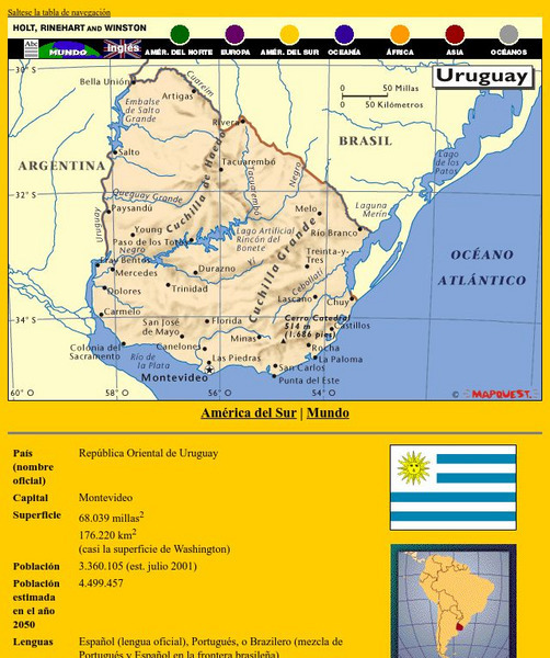
Holt, Rinehart and Winston: America Del Sur: Uruguay
This site has a map of Uruguay in Spanish, with informational data also presented in Spanish about the country. Land mass, population, life expectancy, literacy, industry, agriculture, minerals and resources are among the topics...
Houghton Mifflin Harcourt
Holt, Rinehart and Winston: Europa: Espana
This site has a map of Spain in Spanish, with informational data also presented in Spanish about the country. Land mass, population, life expectancy, literacy, industry, agriculture, minerals, and resources are among the topics...
Instituto Latinoamericano de la Comunicacion Educativa
Red Escolar: Coloreando Matematicas
In Spanish. Cartographers know that four colors are enough to illuminate their maps thus making their maps clear and easy to understand. Try to color the maps by following the two rules: 1) use the least number of colors and 2) keep in...
Other
La Prensa Web
A major paper of Panama City presents this informative guide (in Spanish) to the most important tourist spots in the country of Panama. It also includes information on folklore and outdoor activities.
Other
Si Spain: La Espana Musulmana
This resource provides a description of Spain during the Moorish presence in the country, 711-1492. This is good as an introduction to the topic, but does not go into great depth.
InterKnowledge Corp.
Geographica.com: Adventure in Argentina
This site from Geographica.com contains information on a variety of parks in Argentina. A description of each follows the name of the park.
Curated OER
Etc: Route of Lewis and Clark, 1803 1806
A map showing the route and winter camps of the Lewis and Clark explorations from St. Luis in the Louisiana Territory to Astoria on the Pacific in Oregon Country (1803-1806). The map shows natural boundaries of the British possessions...
Curated OER
Educational Technology Clearinghouse: Maps Etc: Colonial Africa, 1904
A map of Africa shortly after the Berlin Conference of 1885, which established the European colonial territory claims on the continent. These European and independent boundaries include Algeria and the Saharan Sphere of French Influence,...
Other popular searches
- Spanish Countries Projects
- Spanish Countries Capitals
- Spanish Countries Map
- Animals in Spanish Countries
- Geography Spanish Countries
- Cousine of Spanish Countries
- Cosine of Spanish Countries


