Curated OER
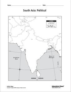
South Asia: Political Map
In this South Asia political map instructional activity, students examine the national boundaries. The map also highlights each country's capital city.
Curated OER
South Asia: Political Map
In this South Asia outline map activity, students & examine boundaries of each of the countries in the region. This map is labeled with the country and capital city names.
Curated OER
Asia and the South Pacific: Political Map
In this Asia and the South Pacific map worksheet, students examine national political boundaries and national capitals in this region of the world.
Curated OER
Southeast Asia and the South Pacific: Political
In this Southeast Asia and the South Pacific political map instructional activity, students examine boundaries of each of the countries and the placement of the capital cities. The major bodies of water are labeled.
Curated OER
Asia and the South Pacific : Political Map
In this Asia and the South Pacific map worksheet, students examine the boundaries of the nations in this region of the world. Students also note the location of capital cities as they are denoted by stars. Major bodies of water are labeled.
Curated OER
South east Asia and the South Pacific: Political: Labeled Map
In this Asia and the South Pacific map worksheet, students examine the boundaries of the nations in this region of the world. Students also note the location of capital cities as they are denoted by stars. This map is labeled.
Curated OER
Ancient Egypt
In this ancient Egypt worksheet, 6th graders use maps in chapter 5 of a Houghton Mifflin text to label items on an outline map and answer a set of 10 related questions.


