Curated OER
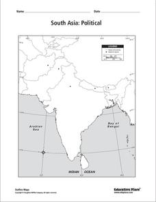
South Asia: Political Map
In this South Asia political map instructional activity, students examine the national boundaries. The map also highlights each country's capital city.
Curated OER
South Asia: Political Map
In this South Asia outline map activity, students & examine boundaries of each of the countries in the region. This map is labeled with the country and capital city names.
Curated OER
Asia and the South Pacific: Political Map
In this Asia and the South Pacific map worksheet, students examine national political boundaries and national capitals in this region of the world.
Curated OER
Southeast Asia and the South Pacific: Political
In this Southeast Asia and the South Pacific political map instructional activity, students examine boundaries of each of the countries and the placement of the capital cities. The major bodies of water are labeled.
Curated OER
Asia and the South Pacific : Political Map
In this Asia and the South Pacific map worksheet, students examine the boundaries of the nations in this region of the world. Students also note the location of capital cities as they are denoted by stars. Major bodies of water are labeled.
Curated OER
South east Asia and the South Pacific: Political: Labeled Map
In this Asia and the South Pacific map worksheet, students examine the boundaries of the nations in this region of the world. Students also note the location of capital cities as they are denoted by stars. This map is labeled.
Curated OER
What Was South Carolina's Role in the Spanish American War?
Seventh graders investigate the role of South Carolina in the Spanish American War. In this imperialism lesson, 7th graders analyze primary documents and photographs, in collaborative groups, to determine how the state was involved in...
Curated OER
Equator, North Pole, and South Pole
Students identify the Equator, North Pole, and South Pole on the globe. In this map skills lesson, students use a globe marker to locate specific locations on the globe. Students find where they live in relation to the Equator.
AGSSS
World Regions
Help your learners to visualize where historical events have taken place around the globe with a map that details the major regions of the seven continents.
World Maps Online
Introduction to the World Map
Students identify the differences between maps and globes. For this map skills instructional activity, students are shown a globe and a map and recognize the differences. Students use post-it notes to locate several locations on the...
Curated OER
Asia Crossword
In this geography worksheet, students complete a crossword puzzle on the continent of Asia. They answer 21 questions related to the type of government systems found, capital cities, deepest lake, and lowest population density.
Curated OER
Exploring an Atlas
Learners explore global geography by participating in an atlas activity. In this countries of the world instructional activity, students collaborate in small groups and analyze an atlas while researching continents, countries and...
Curated OER
Exploring Nations
Students, in groups, research countries in East and Southeast Asia. The group designs an oral presentation and PowerPoint slideshow to showcase research on landforms, political and economic issues, global interaction and special-purpose...
Curated OER
Introduction to the World Globe
Students examine a globe and the world map to see what constitutes the differences. In this world map introductory lesson, students discuss what they see when they view the globe. Students then, look at a world map and compare the...
Curated OER
Ancient Egypt
In this ancient Egypt worksheet, 6th graders use maps in chapter 5 of a Houghton Mifflin text to label items on an outline map and answer a set of 10 related questions.
Curated OER
African Safari
Seventh graders examine different countries in Africa to research. They choose one to concentrate their research on using the five themes of geography. They design a multimedia presentation that will make up the African safari.
Curated OER
The Age of Exploration
High schoolers apply computer skills to gain further insight into early exploration. They analyze the role of each explorer and evaluate their importance. Students comprehend the Chronology of Discovery and Trade of early explorers. ...
Curated OER
Negotiate Peace for India and Pakistan
Students prepare for a fake peace talk between India and Pakistan.
Curated OER
Understanding Modern Vietnam Through the Five Themes of Geography
Young scholars explore Vietnam and prepare a studenT book about Vietnam using the five themes of Geography. These books be used to teach a younger classroom about Vietnam, as part of a service-learning project in our school.
University of Texas at Austin
Perry Castaneda Library Map Collection: Sri Lanka Maps
This resource provides several country, city, historical and thematic maps detailing the country of Sri Lanka. PDF (requires Adobe Reader)
BBC
Bbc: News: Country Profile: Maldives
BBC News offers a general overview of the South Asia islands of Maldives. Focus is on history, country facts, political leaders, and news media. Provides access to a timeline of key events, recent news articles, and related internet...
BBC
Bbc: News: Country Profile: Sri Lanka
BBC News features a general overview of the South Asia island of Sri Lanka. Focus is on history, country facts, political leaders, and news media. Provides access to a timeline of key events, recent news articles, and related internet...
BBC
Bbc: News: Country Profile: India
BBC News offers a general overview of the populous South Asian country of India. Focus is on history, country facts, political leaders, and news media. Provides access to a timeline of key events, recent news articles, and related...
BBC
Bbc: News: Country Profile: Bhutan
BBC News features a general overview of the tiny South Asian kingdom of Bhutan. Focus is on history, country facts, political leaders, and news media. Provides access to a timeline of key events, recent news articles, and related...


