Curated OER
South American Outline Map
In this blank outline map worksheet, students study the political boundaries of the continent of North America and those of the countries located there.
Richmond Community Schools
Map Skills
Young geographers will need to use a variety of map skills to complete the tasks required on this worksheet. Examples of activities include using references to label a map of Mexico, identify Canadian territories and European...
Curated OER
South America and Central America Capitals Map Quiz
In this online interactive geography quiz worksheet, students examine the map that includes all of Central and South America's countries. Students match each of the country names to the appropriate locations on the map.
Curated OER
South America and Central America Map Quiz
In this online interactive geography quiz instructional activity, students examine the map that includes all of Central and South America's countries. Students match each of the country names to the appropriate...
Curated OER
South America Outline Map
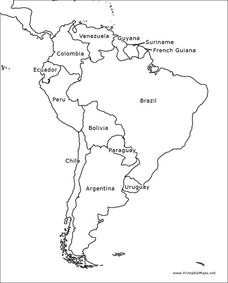
In this blank outline map worksheet, students explore the political boundaries of South America and the nations there. This map may be used in a variety of classroom activities. The map is labeled with the country names.
Curated OER
South American Capitals Quiz
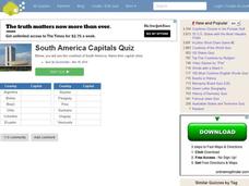
In this online interactive geography quiz worksheet, students respond to 12 identification questions about the capital cities of South America. Students have 4 minutes to complete the quiz.
Curated OER
South America Map
In this South America political map learning exercise, learners examine the country boundaries. The map also labels each of the countries and their capitals.
Curated OER
Latin America Map Quiz
For this Latin America map quiz worksheet, students label all of countries on Central and South American shown on the blank outline map.
Curated OER
South America
In this map of South America worksheet, students study the map of South America and then write the names of the 15 countries and territories on the provided lines.
Curated OER
Cocoa Around the World
In this geography worksheet, students answer 4 multiple choice questions regarding cocoa production around the world using the map and information boxes.
Curated OER
Drifting Continents
In this plate tectonics worksheet, students study the continents map and complete 8 short answer questions related to them. They predict what the Earth will look like millions from now.
Curated OER
Climate Change in Canada
In this Canada worksheet, learners read a 6 page detailed informational text about climate change in Canada. Students then complete 10 essay/short answer questions.
Curated OER
Vermont History True / False
In this Vermont history learning exercise, students read two and a half pages of information about Vermont history. After reading, students complete 10 true or false questions about what they read.
Curated OER
Social Studies Quiz B-Grade 4
In this grade 4 social studies quiz worksheet, 4th graders complete a 15 question multiple choice quiz covering a variety of grade 4 concepts.


