Curated OER
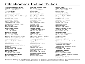
Plows on the Hunting Grounds
Students will examine and anaylze the assimilation of Native Americans in the US.
Curated OER
Coin Connections
A wonderful lesson on identifying the penny, nickel, dime, and quarter awaits your young mathematicians. They engage in a multi-session lesson which allows them to practice using the values of each coin in worksheets and activities...
Curated OER
Map Creation
Second graders identify a map, symbol, key, and compass rose. Students create and print a map for teacher evaluation using the computer. Students identify the symbols on their map and orally present them to the class.
Curated OER
Matching the Globe with the Map
Students examine how to use a globe. In this globe and map comparison instructional activity, students discuss how the globe and map are alike when looking at Africa and Antarctica. Students investigate shapes and sizes of globes versus...
Curated OER
Mapping Africa
Students identify the location of parallel and meridian coordinates. They illustrate their understanding of the physical shape of the continent of Africa through a mapping activity, then explain the processes that have influenced the...
Curated OER
Generate an Accurate Landscape Profile from a Topographic Map
Young scholars enerate an accurate landscape profile from a topographic map. They determine the correct interval needed to accurately graph the change in elevation on a single piece of graph paper.
Curated OER
MAPPING THE BLACK ATLANTIC
Pupils examine the geographic characteristics of Western and Central Africa, the impact of geography on settlement patterns, cultural traits, and trade. They compare political, social, economic, and religious systems of...
Curated OER
SpellO': An Orienteering Lesson
Students participate in hands-on activities to practice orienting maps. Given activity cards, students accurately read maps and locate specific stations. Students collect information from the maps to spell a message when the activity...
Curated OER
Elementary Mapping Activity
Young scholars build a classroom community. In this peer interaction lesson, students participate in a sociogram activity that requires them to socially interact with peers that normally they do not interact with. Young scholars write...
Curated OER
United States Map- Rivers
Students learn about rivers. In this maps lesson, students describe rivers and what human activities take place in a river. Students use a map to locate the rivers in the United States.
Curated OER
CLASSROOM MAPS
Students do a blind tour of their school by responding to verbal commands. They look and discuss various maps in the classroom. They locate the direction of the sunrise and discuss the compass directions of North, South, East, and West.
Curated OER
Map Your Local Watershed!
Students study how to map their local watershed from a topographic map. They find the watershed on an aerial photograph and use maps and aerial photos from the Web to identify the human activity within the watershed, as well as various...
Curated OER
World Map and Globe- Introduction to Symbols
Students investigate picture symbols. In this symbols lesson, students define symbols and discuss symbols that they see in everyday life. Students identify symbols on maps by using post-it notes.
Curated OER
Mini - Lesson #5: Get To Know - Mapping
Students examine and draw landscape maps. In this mapping lesson, students investigate what a landscape map is. They draw a map showing objects on a small piece of natural landscape. Students fill in a grid sheet and a worksheet to make...
Curated OER
Mapping the War
Young scholars work in pairs to draw their own maps as specified of World War II areas. When all projects have been completed let one group at a time share their assignments with the rest of the class. Compile all the maps into a...
Curated OER
United States Map
Students compare the United States on a globe and on a map. In this map instructional activity, students relate the sizes of the continents and locate the United States. Students identify the location of the continental US as well as...
Curated OER
World Map and Globe - Lesson 15 (K-3)
Students discover mountain ranges and their locations in the world. In this physical map lesson, students locate and identify major mountain ranges of the world on a large physical map.
Curated OER
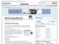
Putting It on the Map
Learners consider the purpose of various types of maps and their different uses throughout history. They create their own maps and reflect on the map-making process.
Curated OER
Mapping China
Students identify cities in China on a map. In this map skills instructional activity, students locate the continent of Asia and the country of China. Students use a blank map to label China and bordering countries.
Curated OER
Wagon's West: Life on the Trail
Young scholars investigate what life on the Oregon Trail was like. For this Westward Movement lesson, students eat foods that were eaten by settlers on the trail as they read textbook pages about the trial. Young scholars then draw an...
Curated OER
Landscape Picture Map - Lesson 7 (K-3)
Learners consider the changing landscape. For this map lesson, students examine a large landscape picture map, discuss the building they find on it, and discuss how construction changes the landscape.
Curated OER
Manifest Destiny Lesson Plan
Learners examine how Americans justified Westward Expansion. In this American history lesson, your historians will watch a Manifest Destiny Powerpoint presentation and discuss each slide then participate in a class...
Curated OER
John Smith Map Lesson Plan
Fourth graders answer questions about John Smith, and also they figure out what was necessary are needed for surviival. Students are given a replica of Smith's 1612 map, they then answer questions using the map as their resource. ...
Curated OER
3-D Topographic Maps
Young scholars create a 3-D topographic map. For this map building lesson, students use cardboard to create a topographic map of the Catskills mountain region.
