Curated OER
Good Sportsmanship Leads to Home Run
Pupils share examples of good sportsmanship, then read a news article about a team helping an injured player score a home run. The teacher introduces the article with a discussion and vocabulary activity, then students read the news...
Constitutional Rights Foundation
Refugees from the Caribbean: Cuban and Haitian “Boat People”
Should refugees fleeing poverty be allowed the same entrance into the United States as those fleeing persecution? High schoolers read about US foreign policy in the late 20th century regarding refugees from Cuba and Haiti, and engage in...
Curated OER
Who's The Boss?
Upper elementary and middle schoolers research and analyze some different types of governments. Democracies, Monarchies, and Dictatorships are some of the types that are looked at. Learners use the Internet to gather information that...
Echoes & Reflections
Rescuers and Non-Jewish Resistance
What does it mean to be a rescuer during the time of the Holocaust? Learners consider the role of those who resisted the Nazi invasions, including hiding Jewish people, throughout Europe. Activities include listening to the testimony of...
Curated OER
Traveling/Mapping
Students examine routes to gold. In this California gold rush lesson, students map land and water routes to California. Students use maps to copy the routes that they want to market to gold diggers.
Curated OER
Edible Maps
First graders, in groups, identify major geographical features of Texas. They form a topographical map of Texas using edible dough, candy, etc. They present and then eat their maps.
California Polytechnic State University
Australian Geography Unit
At the heart of this resource is a beautifully detailed PowerPoint presentation (provided in PDF form) on the overall physical geography of Australia, basic facts about the country, Aboriginal history, and Australia culture and lifestyle.
Curated OER
About Life: The Photographs of Dorothea Lange Going to the Promised Land
To better understand the migrant experience during the Great Depression, pupils analyze two primary resources: photographs by Dorothea Lange and a U.S. Map that shows the Dust Bowl. They compare and contrast Lange's images to Steinbeck's...
Curated OER
Grid Frame Mapping
Young scholars map and describe small area of the schoolyard and discuss habitats.
Latin America Network Information Center
Urbanization
Brazil's population has been changing dramatically in the last century. Study the causes of Brazilian urbanization, including industrialization and and migration, and the implications for the country of the populations'...
Curated OER
Geography/Current Events Project
Using the Balkan region as an example, fourth graders review the five themes of geography as a class. They identify the physical and human characteristics of a region before labeling the countries and landforms on a map. They then...
Geography 360°
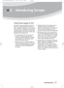
Introducing Europe
Provide your learners with a comprehensive introduction to Europe with this great set of worksheets. Map activities include matching European countries to their capitals and places on a political map, as well as...
NOAA
Into the Deep
Take young scientists into the depths of the world's ocean with the second lesson of this three-part earth science series. After first drawing pictures representing how they imagine the bottom of the ocean to appear, young scholars...
Curated OER
Instruments From Around the World
How much does the environment affect how and what man creates? Children explore the effect of the environment on primitive man as they research raw materials from a specific location. They use their findings to write a short essay about...
Boston University
Scramble for Africa
In this fantastic simulation, your young historians take on the roles of imperialistic European countries in the nineteenth century and then "scramble" to carve up the continent of Africa! This is a very hands-on activity that will help...
Alabama Department of Archives and History
Conflict in Alabama in the 1830s: Native Americans, Settlers, and Government
To better understand the Indian Removal Act of 1830, class members examine primary source documents including letters written by Alabama governors and the Cherokee chiefs. The activity is part of a unit on the expansion of the United...
Geophysical Institute
Latitude and Longitude with Google Earth
Travel the world from the comfort of your classroom with a lesson that features Google Earth. High schoolers follow a series of steps to locate places all over the earth with sets of coordinates. Additionally, they measure the distance...
Annenberg Foundation
Reconstructing a Nation
Think back to the aftermath of an family dispute. The awkwardness of having to make up, get along, and move forward can be very difficult. The tenth lesson of a 22-part series on American history examines the Reconstruction Era following...
National WWII Museum
“My Dear Little Boys…” Interpreting a letter home from the war
Letters have long been prized by historians as primary sources for what they reveal not only about events but also about the emotional responses of the writers to these events. "My Dear Little Boys," a letter written by Leonard Isacks on...
US Institute of Peace
Advanced Mediation Practice
What will become of the giraffes of Amali? Pupils participate in a large scale role-playing activity to study the art of conflict mediation. The lesson engages participants in the struggle between two countries and the animals caught...
Edgate
Native Americans of the Lewis and Clark Trail
As part of a study of the Corps of Discovery expedition, class groups research the different Native American tribes Lewis and Clark encountered on their journey and share their findings with the class.
Curated OER
Journey Across the USA with Oliver K. Woodman
Challenge your class with this lesson focusing on the fifty states. Learners use ArcMap to show the route the main character in the story Journey of Oliver K. Woodman took across the United States. Then, they write journal...
Alberta Learning
Great City-states of the Renaissance
Acting as journalists on a team to determine the most influential city-state of Renaissance Italy, your young historians will research, discuss, and compare the rise of Venice, Florence, and Genoa, and their influence in shaping a...
San Diego Community College
Step by Step Goal Setting
Help English learners reach their goals with a set of activities and worksheets. Over the course of three lessons, pupils define what a goal is and set their own academic and attendance goals for class.


