Curated OER
The Map Cartouche
Students discuss the history and purpose of cartouches. They examine examples of cartouches and design an original example with symbols of their choosing.
Curated OER
Lesson 1 Activity 2: A Place in Time
Students select place to study, note how it has changed over time, and create and illustrate a timeline.
Curated OER
A Study of Alaska
Learners explore Alaska. This lesson is gearing mostly for students who live in Alaska.
Curated OER
Orienteering Lessons - Overview
Welcome to the Orienteering lesson plans page. There is a short introduction to the topic and links to the ten lessons in this unit. There is also a linkto the unit home page. This orienteering unit is worth taking a look at.
Curated OER
Creating Mind maps
Young scholars discuss their impressions of Africa. They work in groups to create a mind map. Students are explained what a mind map is. They discuss what they think are the defining features of the continent of Africa. Young scholars...
Foreign Policy Research Institute
A Geography Lesson
Fewer and fewer people have a strong grasp of world geography, but this activity helps high schoolers understand geopolitics by creating their own original historical map. The activity requires selecting a country from the list provided,...
Curated OER
The Vietnam War: Geopolitical map and US Involvement
Students identify the important geographic and political locations on a map of Vietnam, Laos, and Cambodia. They draw and label 19 items of geographic and political importance. Students are introduced to the Vietnam War through power...
Curated OER
The Road Map & the Middle East
Will walls help? Read to learn how Prime Minister Ariel Sharon proposes to build walls around Isreal in hopes of isolation from Palestine. Complete an online Webquest, analyze maps, listen to audio clips, answer discussion questions, and...
Curated OER
Landscape Picture Map: Making a Map Grid
Students create a map grid system. In this map instructional activity, students discuss how mapmakers use a grid system to make giving directions easier. Students learn how the grid system works and create a grid system on their...
Curated OER
Arkansas is Our State: Differentiating Between a State and a Country
An ambitious geography lesson is geared toward kindergartners. They discover what the differences are between states and countries. They look at maps of Arkansas, and learn what the shapes and lines mean. Additionally, they create a...
Curated OER
California's Golden History: 1848-1880
Using a variety of online resources, learners study life and society in California during the gold rush. They use a map to identify area where gold was located, explore pre-selected websites, describe mining practices, and create an...
Curated OER
Names and Places
Students explore where jobs are done. In this careers and geography lesson, students locate places in Canada on a map and list jobs that are done in their area of Canada. Lesson includes extension and differentiation ideas.
Curated OER
Places in Arkansas: A Tour of Our Unique State
A great lesson plan focuses on important cultural and historical places in the state of Arkansas. Learners are introduced to six important places in Arkansas, then create a report on a place in Arkansas. Some excellent photographs,...
Curated OER
Beyond Demographics
Learners study the Dominican Republic through watching and discussing a video about the country and its people. They explain life in the Dominican Republic and describe the emerging picture of the Dominican Republic as viewed through...
Curated OER
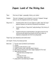
Japan: Land of the Rising Sun
Students locate Japan on a globe, name the major physical features, and describe the physical environment. They survey the differences and similarities between the life and culture of Japanese young people and American young people.
Curated OER
Hit The Trail
Young historians research one of the most colorful periods in US History: the cattle drives of the 1800's. They research the three most popular trails, and complete mapping and writing assignments about each one. The lesson has many...
Curated OER
Teaching With Documents: U.S. Constitution Workshop
What does it mean to be American? Explore the constitution and what it really means to be a citizen here. First, learners of all ages will investigate different primary source documents. Then, they establish each document's...
Curated OER
The Future of Social Studies Education
Students work in groups of four and complete a roster of their names and personal information and to complete a release form that allows their pictures to be placed online. They then engage in classroom activities while being...
Curated OER
Map Studies
Young scholars study maps and use web based activities to develop their mapping skills. In this mapping skills lesson, students use the internet to define cartography they make a list of information regarding a typical road map and...
Curated OER
Creating a Database: Africa, Technology, Social Studies
Students use technology to create a database demonstrating their knowlede (in the case) of the African Continent. This project could be applied to almost any other concept studied.
Curated OER
Governance
Third graders participate in decision-making situations. In this social studies lesson students make connections between rules and laws and the purposes for those rules and laws. Students use critical and creative thinking skills to...
Curated OER
Wales: An Interdisciplinary Unit
Students practice basic map and geographic skills as they compare Oregon to Wales. Students color map of Wales and Oregon using color codes to distinguish between land, water, and bordering nations or states, listen to stories and...
Curated OER
Map Skills
Students create two types of maps. In this map skills instructional activity, students discuss map vocabulary and view maps of Florida. Students draw a free hand map of Florida and include major cities, bodies of water and...


