Curated OER
Rapping Regions in America
Students determine what designates a place as a region. They apply their criteria for a region to the US map. They work in groups to write a rap about their region that describes its organization, type and structure.
Curated OER
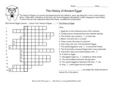
The History of Ancient Egypt
In this World History worksheet, students use the clues to identify what historians now understand about ancient Egypt and its people. They complete each of 14 clues with a word or phrase related to what they already know.
Curated OER
Regions of South America
Students explore facts about South America in the four lessons of this unit. Booklets are created from the materials produced as the class delves into the topic.
Curated OER
Unity In Diversity
Young scholars discuss the meaning of diversity in the world. They practice how to act around others and appreciate the different types of people that exist. The lesson includes a section of vocabulary and the reading of a story to...
Curated OER
Diversity Geography
Ninth graders explore the diversity of people found throughout the world. In this Geography lesson, 9th graders create a short oral report describing that area.
Curated OER
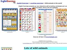
Wild Animals in the World
In this wild animals worksheet, students answer multiple choice map questions, choose the correct animal names for the pictures, and more. Students complete 4 activities.
Curated OER
Atlatl (Native Americans)
Students discover what an atlatl is and how to use it. In this Native American lesson, students discuss the history of the Native American atlatl and practice throwing with it. Students will analyze the effects of the atlatl in terms of...
Curated OER
World Map and Globe - Lesson 15 (K-3)
Students discover mountain ranges and their locations in the world. In this physical map lesson, students locate and identify major mountain ranges of the world on a large physical map.
Curated OER
National Park Project
Students develop a descriptive and informative brochure for a National Park. They focus on the history and geology of the park, environmental concerns, and visitor actions that could eliminate the environmental concerns.
Curated OER
Australia
Students participate in activities in which they discover facts about Australia. They examine its climate and history. They complete a worksheet to end the lesson.
Curated OER
Prehistory: Our Ancestors Emerge
In this prehsitory activity, learners read a 3-page article about antropological finds and then respond to 2 short answer questions based on the article.
Curated OER
Ancient Africa's Connection to Today
Fourth graders engage in a lesson in which ancient Africa's historical contributions are told though the eyes of a spider, Anansi, and his search calabash game. The game is accessed through a website which is embedded in this lesson plan.
Curated OER
Country: Austria
Students access a variety of Austria themed websites. They locate information about history, geography, climate, people and culture. They view a live webcam of different parts of Austria and read about famous personalities from Austria.
Curated OER
Community Culture Trunk
Second graders examine the similiarities and differences between the various cultures represented in their class. After being read a story about immigration, they identify things they would have to bring with them if they were moving to...
Curated OER
Geography Words, Page 1
In this geography words and maps worksheet, students examine maps of North and South America. Students respond to 12 multiple choice questions regarding the maps.
Curated OER
Getting to the Core of World and State Geography
Students create topography relief maps. In this geography skills lesson, students review geography core knowledge skills, design and make a state relief map, and compile a student atlas.
Curated OER
Africa: Political Map
Students create a political map for Africa. For this country identification lesson, students locate Africa on a globe and discuss some of its major countries and bodies of water. Students complete a political map of Africa...
Curated OER
Adinkra Printed Textiles
Students examine printed textiles that commemorate events, people, and objectives. In this Adinkra printed textile lesson, students explore Africa as they discover the patterns and techniques for creating Adinkra symbols on textile....
Curated OER
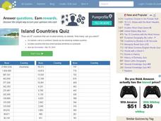
Island Countries Quiz
In this online interactive geography quiz worksheet, students respond to 48 identification questions about island nations in the world. Students have 5 minutes to complete the quiz.
Curated OER
World's Biggest Islands Quiz
In this online interactive geography quiz worksheet, students respond to 20 identification questions about the largest islands in the world. Students have 4 minutes to complete the quiz.
Curated OER
Labeling the World
Sixth graders conduct research on the countries found on the labels on their clothing. They locate the countries on a map, research the labor practices on countries that export clothing to the U.S., and create a graph using the information.
Curated OER
On the Oregon Trail
Students prepare cross-curricular lessons based on the experience of traveling the Oregon Trail.
Curated OER
FUN WITH MAPS
Second graders receive a general overview about how maps are made and used, how specific information can be derived from them, and how a student can gain personal information about their surroundings from examining them.
Curated OER
Landforms By Hand: Geography, Map Skills
Students experiment with landform vocabulary by using their own hands and a bar of soap as media.

