National Gallery of Canada
Taken Out of Perspective
Art does not always have to look perfectly realistic. Play with proportion and shape by stretching images. Pupils study works of art by Picasso, Cézanne, and Monet before selecting a photograph to adapt. They use a distorted grid to...
Curated OER
Applied Science - Science and Math Lab
Students investigate topology. In this Applied Science lesson students explore higher, more abstract mathematics using tangles. Students make topologically related shapes.
Curated OER
Distortion Unleashed
Students view examples of man-made structures and create a building that matches the style. Using the internet, they research the style of Frank Lloyd Wright and create plans for creating their own community. They use a painting of...
Curated OER
Why All Maps Lie
Eighth graders discover the fundamental advantages/disadvantages of both maps and globes. They see that maps may distort size, shape, distance and direction. They discuss the advantages and applications of 5 types of map projections and...
Curated OER
Tear the Continents
Learners tear paper into representative continent shapes and configure them with world oceans through relative location, direction and latitude and longitude starting points. They recognize the shape of the continents. Students recognize...
Curated OER
Digital Self Portraits
Pupils use digital cameras and computers to create their own self-portrait. After taking their picture, they download the image and use brush and shape tools, colors and the elements of design to create a distorted portrait of...
Curated OER
The Global Grapefruit - Maps vs Globes
Students tell how maps differ from globes, state some characteristics of 3 different types of map projections, and realize that distortions are inherent in various systems of map projections.
Curated OER
Matching the Globe with the Map
Learners examine how to use a globe. In this globe and map comparison lesson, students discuss how the globe and map are alike when looking at Africa and Antarctica. Learners investigate shapes and sizes of globes versus maps.
Curated OER
The Global Grapefruit - Representing a 3-Dimensional Globe on a 2-Dimensional Map
Students compare and contrast world maps and globes. They convert a 3-dimensional globe to a 2-dimensional map. They are introduced to the Mercator map projection. They observe map distortions of shape, area, distance, directions and angle.
Curated OER
Symmetry In Nature
Students investigate the symmetry that is found in nature. They view shapes and patterns in nature while looking at images. Students look for tessellations while obtaining photographs with a digital camera. The information is used for...
Curated OER
Sixth Graders Express Themselves
Sixth graders create examples of expressionistic paintings using pastels, black paper, and chalk in this 6th grade Art instructional activity. Emphasis is on creating an emotion for the painting using simple lines and large shapes and...
Exploratorium
Soda Can Mirrors
Here is an entertaining and illuminating lesson on morphed images. Middle schoolers make cylindrical mirrors by wrapping soda cans in reflective mylar. First, they try to determine what the images are that are embedded in the plan by...
Curated OER
Melted Paintings
Another in the amazing series of lesson plans which use unique mediums! Young scholars execute artwork on a non-traditional painting surface. They theorize what happen to their artwork if it is exposed to heat, then see what happens when...
Curated OER
Amazing Triangles
Student scientists investigate triangle structures. In this building lesson plan, students explore how to design triangle braces in the construction of structures in order to build a stronger base.
Curated OER
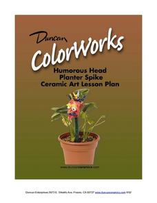
Humourous Head Planter Spike: Ceramics Lesson
What a great activity. Kids create humorous ceramic character (heads) spikes to enliven a planter. Modern art is full of expressive and exaggerated forms and your class gets to create them out of clay. This would be a lovely activity to...
PHET
The Earth as a Magnet
Everyone loves playing with magnets and iron filings. Here, young scientists first observe and then participate in an activity demonstrating magnetic fields. After completing their observations, they apply this knowledge...
Virginia Department of Education
Dilation
Open up your pupils' eyes and minds on dilations. Scholars perform dilations on a trapezoid on the coordinate plane. They compare the image to the preimage and develop generalizations about dilations.
Curated OER
Exploring Maps: Navigation
Students engage in a lesson that is concerned with the concept of navigation while research is conducted with the use of a variety of resources. The information is used to expand their perspective of the applications for navigation. The...
Curated OER
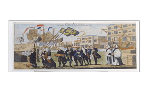
The Art of Political Cartoons in Revolutionary America
Students analyze political cartoons. In this colonial America lesson plan, students examine the provided political cartoons and respond to analytical questions about each of them.
Curated OER
Mapping the Ocean Floor
Students construct and interpret a line graph of ocean floor depth and a bar graph comparing the height/depth of several well-known natural and man-made objects and places. In addition, they calculate the depth of two points using sonar...
Curated OER
World Projections
Students identify map projections and examine polar maps. For this map skills lesson, students use a flat world map to identify various projections and calculate the distances between locations by using a map scale.
Curated OER
Using Cartograms t Learn about Latin American Demographics
Pupils make cartograms while drawing connections between physical, economic, social and cultural geography.
Curated OER
Traveling Sound
Students explore how sound waves move through liquids, solids and gases in a series of simple sound energy experiments. They describe how sound needs molecules to move and that changing the medium that it travels through changes the...


