Curated OER
Campus Greenhouse Gas Emissions Inventory
Students brainstorm the campus links to global warming. Students pick topics for individual or group research. Students develop a research plan. Students keep good records and report their progress. Students report findings both...
Curated OER
Impact Craters and Water on Mars
Students explore for water on Mars using impact crater morphology. During this lab, students: investigate how to use the equation writing and graphing capabilities in Microsoft Excel, then develop and apply an impact crater...
Curated OER
SEM/EDS Beach Sands
Students pose a question that can be answered using the SEM and sand they collected from beach profiles. Then, they use the SEM to answer their question or test their hypothesis. Students design a small testable project and demonstrate...
Curated OER
Environment and the Earth
Students were involved in environmental service learning and they gathered information from academic buildings for a database. The data allowed them to use an establish baseline data on light use, recycling, and water fixtures in five...
Curated OER
Interpreting the History, Geology, and Ecology of Monterey Bay
Students explore what they know about Monterey Bay in the special topics course and share their information with K-12 grade children at local schools by participating in the Virtual Canyon Project. Students in this service learning...
Curated OER
Waves Through Earth: Interactive Online Mac and PC
Students participate in a JAVA activity to vary the seismic P and S wave velocity through each of four concentric regions of Earth. They match "data" for travel times vs. angular distance around Earth's surface from the source to detector.
Curated OER
Rivers: Short In-class Activity
Students make observations, estimates, and interpretations. They view Images of the James River at Belle Island, Virginia, including one at flood stage, a plot of peak stream flow since 1935, and an image of potholes in the Petersburg...
Curated OER
Describe and Interpret Images: Folded Strata
High schoolers describe and interpret images. They make a simple sketch of an outcrop shown in a slide (or computer projection) then discuss possible interpretations.
Curated OER
Using GIS to Construct Water Table Maps and Flow Nets
Students examine how to use GIS software to analyze patterns of groundwater flow. Seepage lake elevation data from the Sand Hills of Nebraska is used to construct a water table map and flow net using Esri's Arc Map software.
Curated OER
Geographic Information Systems (GIS) and Water Resources
Students demonstrate how water quality and environmental health issues can be analyzed together, how hydrologic information can be built up, and how decisions can be made using GIS.
Curated OER
Chemistry - Atoms and Elements
Pupils perform varied activities as part of a layered curriculum unit: They write and perform a skit that outlines the evolution of the model of the atom. The script is submitted to the teacher for review before performance.
Curated OER
Magnetic Discovery Bottle
Students examine how to conduct simple investigations and use simple equipment to gather data. In this magnet activity students decide what types of objects are attracted to magnets.
Alabama Learning Exchange
Botany Scavenger Hunt Where's the Ginkgo?
Learners use a science journal to log plants that are native to Alabama. In this plant lesson plan, students identify characteristics, describe environments, and classify the plants that they find.
Curated OER
What is a Museum? The Musee' d'Orsay
Students read paragraphs and study pictures to learn about museums and in particular the Musee' d'Orsay. In this museum study lesson plan, students study the range of activities found in a museum and the characteristics common to all...
Curated OER
It's in the Garbage
Students analyze how studying garbage relates to methods of archaeology. They examine garbage to determine things about their culture and relate that to prehistoric peoples.
Curated OER
Fun with Phylogenetic Trees
Tenth graders differentiate angiosperms and gymnosperms. In this biology lesson, 10th graders construct a musical phylogenetic tree from information they gathered on resource websites. They present their project in class.
Curated OER
Biotic Factors
Students identify individual organism, a species, and a population within the study community. They identify biotic factors at the site and attempt to characterize the site's species diversity.
Curated OER
Post-settlement landscape evolution
Pupils use this example, a field laboratory in introductory geology becomes a test of a hypothesis: Does the model proposed by Stanley Trimble for Coon Creek, Wisconsin adequately describe the history of post-European-settlement erosion...
Curated OER
Groundwater Pump Test
Students observe groundwater flowing to a pump, changes in groundwater table as a result of pumping, and the quantity and quality of water in the groundwater system. Students must graph and interpret their data, and quantify orders of...
Curated OER
Glacial Geology in the Field
Students examine the origin of glaciers, how glacial sediments are deposited, and what sedimentary records of glaciation provide about source and process of glaciers in a field lab.
Curated OER
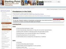
Floodplains in the Field
Students measure a topographic and geologic cross-section across a floodplain using simple surveying and auguring techniques in a field lab. Students also reconstruct the history of a river system.
Curated OER
"Adopt an Outcrop"
Students "adopts" a different outcrop or road cut, describing and interpreting both the outcrop scale features and hand specimens. They build their confidence in their ability to describe and interpret outcrop geology. Students are...
Curated OER
Sea Floor Spreading II
Students import ocean bathymetry data form either the topex web site or text files. They then graph these observations along with model predictions to assess the model's ability to sumulate the observed topographic features of the North...
Curated OER
Earth Surface Socratic Questions
Students explore the ways Earth's surface is shaped by hydrologic, climate and tectonic forces by participating in a whole class discussion. They respond to prompts that lead them to conclusions about the relationships between landforms...


